Pond to pond across Marshall Lake

Photo by Ben Padegimas. Yes, that’s me.

Marshall Lake is a small, marshy pond, really, just south of Flagstaff. Its’ reedy shores are full of birds, and the forested hills around it are full of dispersed campers.

Arizona does not have many natural lakes, but Marshall Lake is one of them. It’s really only a lake at its rare high water mark. At normal levels it is a series of connected ponds. There are times when it is completely dry.

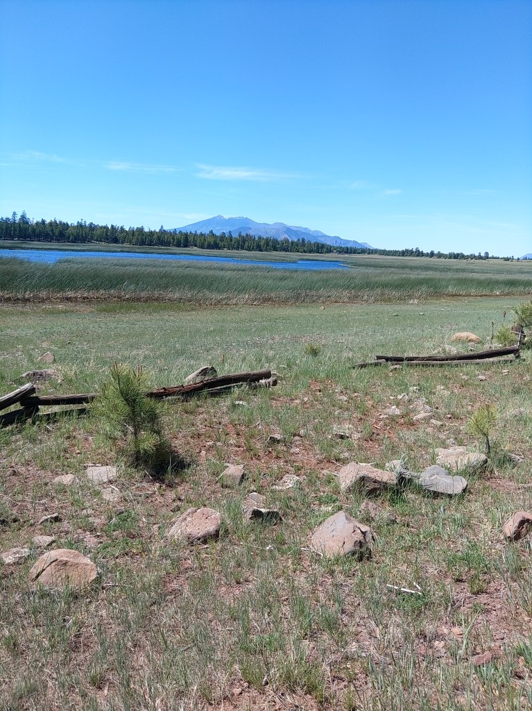
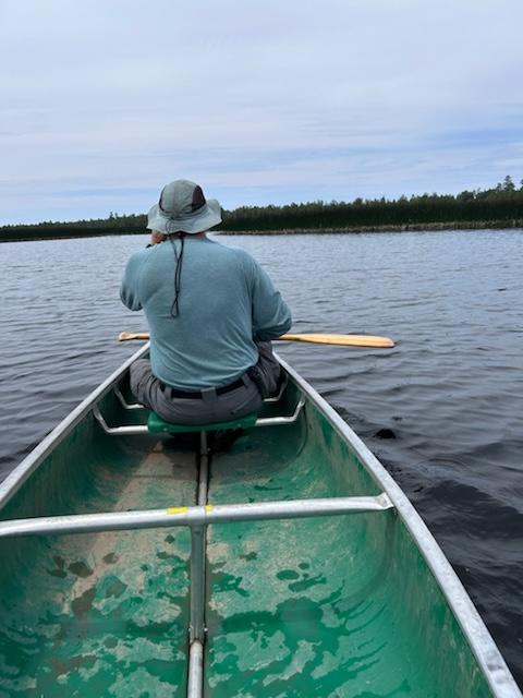
On my last visit, my son and I were able to paddle a canoe through breaks in the reeds and go from pond to pond to see the birds and hear the frogs and waver to the scattered fisherfolk. At high levels, AZ Game and Fish will stock some trout in here. Folks have also caught channel catfish, northern pike, crappie and the occasional largemouth bass.

More numerous than fisherfolk are the ducks and coots. The Coconino National Forest slipped a good line past the fedbots:

“Marshall Lake is a small marshy body of water that’s generally full of coots and other waterfowl splashing, flapping, and cooting around. It is such valuable wildlife habitat that it is managed in partnership by Ducks Unlimited and the Arizona Game and Fish Department.”

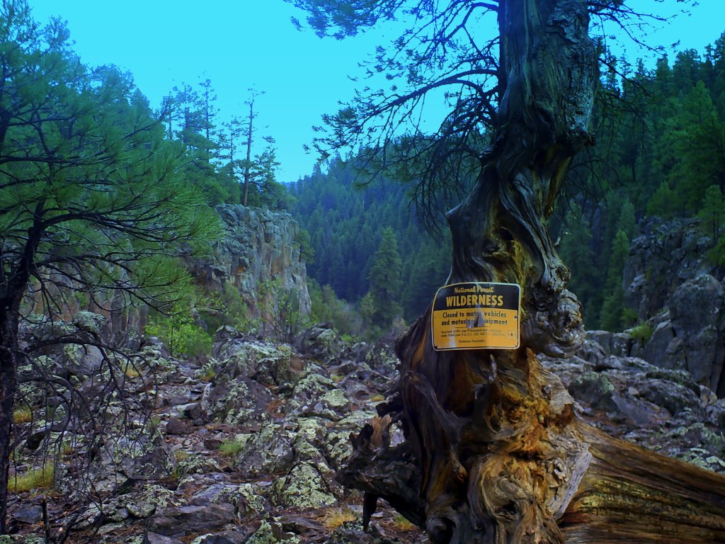
Signs and portents by the lake.

You can also see osprey and even eagles around the lake. The hills around are popular for elk and are grazing allotments for cattle.

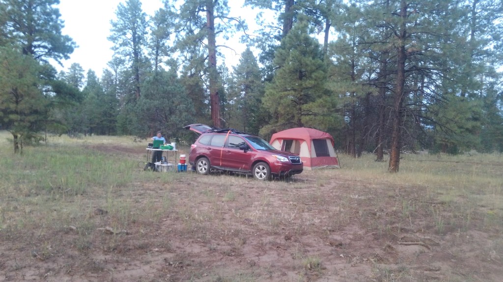
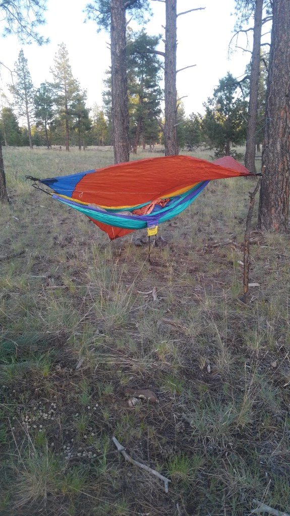
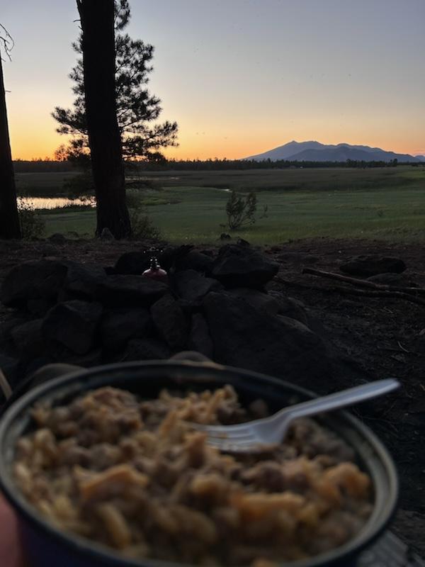
Dispersed camping means no services: no tables, no trash, no outhouses, no water. When we were there in late June, we were under a fire restriction, which covers all of these sites. Even so, the area is popular. If you aren’t up there by mid-morning Saturday on a weekend with good weather, you are likely camping somewhere else. A lot of your neighbors are clearly going to use all 14 days of the stay limit.

Photo by Ben Padegimas

Marshall Lake is seasonal, approximately May-October. Outside that window, the roads might close indefinitely due to snow.

The lake is located about 12 miles south of Flagstaff, off of lake Mary Road (aka FR3). Take that road south past the Lake Mary recreation sites to FR 128 which switchbacks up the hill before becoming graded dirt. Follow the signs.

There are no fees. There is a small parking lot next to the “boat launch”.

The observatory on the top of Anderson Mesa is not open to the public. The nearby trailhead is, and I have written about that in my book: 5 Star Hikes Sedona and Flagstaff.

There is a plan to improve the wetland conditions here, somehow. More information can be found here:

We quote from their 2013 PDF:

Current Status: The wetland is a perched clay basin with limited inflow from rain and snowmelt. As a result, Marshall Lake is sensitive to drought and is dry in many years. AGFD is conducting a water balance and feasibility assessment for habitat improvements in the Marshall Lake watershed. A restoration plan will be developed in coordination with the Coconino National Forest in 2015.

And finally, a video:

Camping in Sycamore Rim Country

The end of the road…

My go-to spot for undesignated camping in the high country (in AZ that means higher than 5000’) is the north rim of Sycamore Canyon. The Sycamore rim marks the southern boundary of the Williams district of the Kaibab National Forest. It lies essentially 30-50 miles south by southeast of Williams AZ, which is about 30 miles due east of Flagstaff along I-40. 

The rim itself does not offer spectacular scenery. It offers a consistent expanse of rock-studded plateau topped with pine and oak stands separated by occasional prairies. It is plenty pretty to be sure. The  tall green grasses and flowers, towering fragrant pinon and ponderosa pines and gnarled oaks offer habitat for everything from turkey to elk. But this is what most of the Coconino plateau looks like when it hasn’t been paved over or grazed down to high desert. 

The only noteworthy vistas are views into and across Sycamore Canyon itself. 

This is a ten year old photo doctored with ten year old free-ware. Don't judge.
One of many vistas of Sycamore Canyon

Sycamore Canyon proper is a wilderness area (mostly within the Coconino NF) where Sycamore Creek and its immediate tributaries have cut steep slots into the plateau. The canyon often rivals Oak creek Canyon (to the southeast) for scenery, but is not nearly as accessible. Getting into the canyon is best approached as  a backpacking expedition, and well beyond the scope of this article. 

Ruby and company

(Although I wrote about those trails, and others I will reference shortly in 5 Star Trails: Flagstaff and Sedona, which I plug here to avoid a lot of repetition.)

What I like about it is the relative privacy. You will consistently pass the tribal compound of RV boondockers on the main roads just south of Williams. But go further south, on the thinner forest roads, and you can spend days at a time on your own part of the prairie, seeing no other people until you have to go back into town for more ice. I have accomplished this feat more than once. 

And when it’s just me…

To get real privacy, I had to bounce down some roads with long number designations until I was out of sight of the road that is actually on the map. This is undesignated camping, meaning you make your own campsite and provide your own services. If you need a toilet and a trashcan, you are better going to Whitehorse Lake Campground, which we will also get to. 

I have camped on the northwest rim (off of FR 110) on the north center rim (off of FR56) and the northeast rim in the Coconino NF somewhere off of FR 231. The experience was all the same. Though, in full disclosure, I haven’t been on the northeast portion since I wrote the hiking guide. 

All were about 6500’, hard-dirt prairie where I only had to wear pants if I wanted to. And bees – I had plenty of bees at all three sites. 

Whitehorse Lake Campground

Credit – Kaibab NF

White Horse Lake campground is the big campground on the actual rim. It features a mix of tent and RV sites (94 total) about half of which are reservable. Most are at least within sight of the 35 acre lake. You can’t swim in the lake, but you can putter about in non-motorized boats (some rentable on site – in non Covid years) and do a bit of fishing. The lake is also popular with frogs. 

The campground is a hosted fee area. (Fees vary – check the website). I visited the place on a Wednesday in August of 2020, and it was about ⅓ occupied. You would still want a reservation or an early arrival for a weekend spot. 

Also nearby, of course, are the Sycamore Rim and Overland Trail hikes (also in my book). I had assumed I blogged about these on the old site, but it seems I did not. So that comes next time. 

Next time…