The abandoned Holbert Lookout (I think)

I can’t call it the Lost Lookout, as cool as that sounds, because you can see it from the street.

Bongo found the lookout.

As I stare at the Phoenix South Mountain Preserve, the ridgetop immediately east of Dobbins Lookout also has a stone structure upon it that I can see from my house. As a side-quest to the Holbert Trail I decided to seek it out.

To reach it, I followed the Holbert Trail south and up, past the Dobbin’s Lookout connector, and up to Buena Vista Road. I then followed the actual road east for a few hundred yards. Before you get to the junction with TV road, you will encounter a guard rail on the north side of a gentle curve across a relatively level ridgetop. This is not necessarily to keep careless drivers on the road. This is to keep curious drivers off the remnant road running north of here.

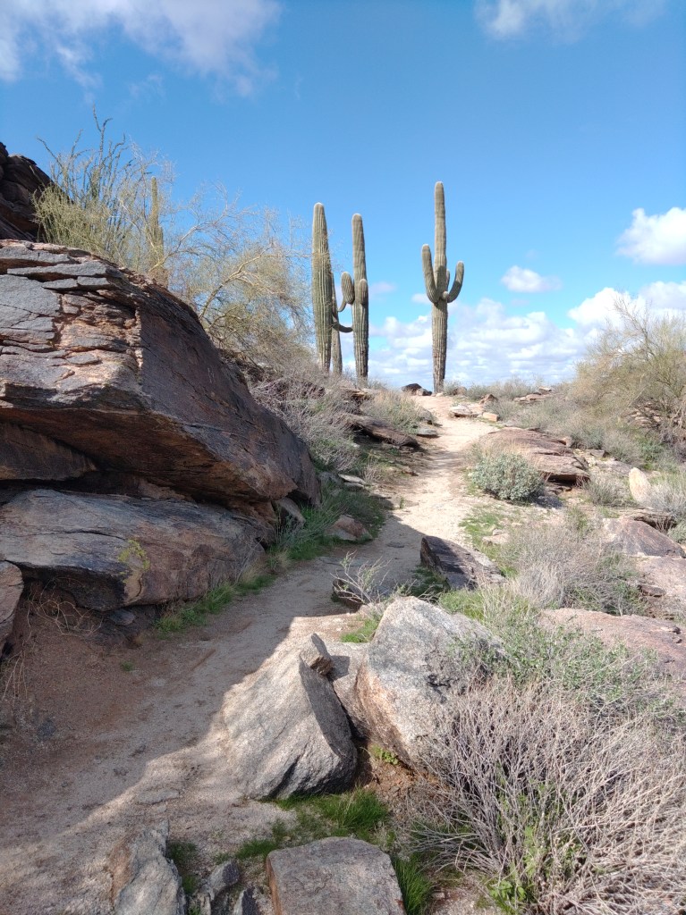
Well, I’m a pedestrian. So I went around the rail and south along what was vaguely a remnant road flanked by small palo-verde trees and young saguaros.  The oldest of the saguaros guards the destination about a half-mile from the road, but you’ll see the big double-hoodoo first.

Approach from the road.

The remnant road climbs the hill, past the hoodoo to empty into what was clearly a vehicular parking/overlook with space for maybe 10 cars.

Panoramic view

The topo map has the elevation at 2246’ above sea level.

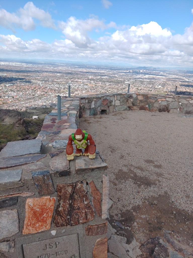
I believe, based on inferences, but not direct references, in old city planning docs, that this was called Holbert Overlook. The concrete stamp on the west side declares it was built by JSP in 1979-80 for the City of Phoenix. Its is referenced in the 1989 city master plan for the preserve.

D3 – The North Overlook area near the Summit of the Gila-Guadalupe Range. Containing Holbert and Dobbins Lookouts, with access to Buena Vista and Gila Overlooks, this sub-zone will continue to receive large numbers of visitors. Overlook sacrifice zones should be defined and edged with compatible barrier treatments.

Or abandoned and forgotten apparently.  It does not appear on the 2007 trail map, or any map afterwards.

The road, though, appears on the 1952 USGS topo map.

All searches for Holbert Lookout will produce results for the trail. The lookout was abandoned before the internet was useful, so sometime in the 1990’s. I’ll update this article if I find an answer to that.

Meanwhile, I had the place nearly to myself. The other guy was also making a video, though in Spanish. He climbed the hoodoo. I did not. But I enjoyed the view until the rest of my hike called me away.

The Holbert Trail

When you have friends or relations in from out-of-town and they say that they want to hike up South Mountain – and you are satisfied that they understand what “hike” and “up” really mean in this context – you want Holbert Trail.

It is also worth doing on its own merits.

This hike is part of my Phoenix South Mountain Preserve Collection.

One of several park things named for Charles M Holbert, the first custodian of South Mountain Preserve from 1929 to 1939. It is said that there was no place in the preserve that he had not visited.

The official trailhead of Holbert is now in the giant parking lot near the Central Avenue entrance. Where exactly, in the giant lot depends on where they are in reconstructing the group picnic site.

The two and half miles of Holbert Trail can be roughly divided into four sections. The first section starts in the giant parking lot, wandering east across the north base of the mountains, skirting a couple of retention basins. You can find some petroglyphs in the early going. This is where you take out-of-towners who clearly do not grasp “hike” or “up” in this context, and you do not want to hear them whine. Meaning this portion is super-easy, and totally skippable.

The second part can be easily reached by the 7th Street or Mineral Road trailhead. This is no longer an official trailhead on city maps, but the dead-end of Mineral Road heading east from the southern terminus of 7th Street is very much used as a trailhead. Both the footpath on the west side and the access road on the east side will lead you to signed junctions with Holbert Trail.

This is also the entrance for Mystery Castle – should that attraction ever manage to open its gates again.

Past the second water tank, Holbert starts its second section, a sustained, winding climb up and across two ridges and then up a narrowing canyon lined with blackened basalt. Every time you can bring your gaze up from the constant rock-stairs on the trail you will see the desert slopes of the mountains spreading before you. Stop and turn around and you will witness the whole of the Phoenix metro stretching off into the horizon.

So, this hike is best done on a clear day. Otherwise, you will see the bowl of haze you hiked out of, realize that you actually live in that, and struggle with sadness.  But on a clear day, this is awesome.

Poor place to plan a felony…

As this popular trail winds up the canyon, the voices of other hikers in the distance will echo around the steep walls. This is a poor place to plan a felony with your friends.

Just past what would be a waterfall, for the seven hours a year this canyon has running water, you will encounter the junction with the Dobbins Lookout Access Trail. At this point you’ve climbed 500 feet up in just over a half mile – which is why you’re feeling it.

Most locals with out-of-towners in tow take the access road to Dobbins Lookout. Yeah – don’t tell them. Hearing your friends exclaim “We could have driven up here?” is a long and traditional source of great joy.

There are also vault toilets here – one of the few available outside of the developed picnic areas.

When I did this hike for photos, I cheated. I had a friend drop me off at Dobbins, then I went up Holbert, off to a side-quest, and then down.

Upper Holbert continues past the Dobbins junction, climbing the rest of the way out of the canyon before crossing Buena Vista Road. It keeps climbing over and then on top of the actual mountain. This portion is quieter, less crowded, slightly easier and more scenic than the portions that came before, and totally worth doing. In less than a half mile from Buena Vista Road, you will reach TV Road.  Across that road – which goes to the antenna farm on the summit and the Gila Valley Lookout – is the terminus of the Holbert Trail as it T’s with the Maricopa or National Tail. You are at the 2.5 or 3 mile mark, depending on whether you went up to Dobbins, and have climbed at least 1200 feet from the trailhead to stand at 2400 feet above sea level. 

The proximity of either Dobbins or Gila Valley lookouts make this a super-easy car shuttle. You could also take the National Trail west to the Kiwanis Trail and then Los Lomitas Trail to make a full loop of it. The loop would add a couple of hours.

The up and back described could be done in four hours, five if you dawdle. I mean – I suppose. I actually cheated.