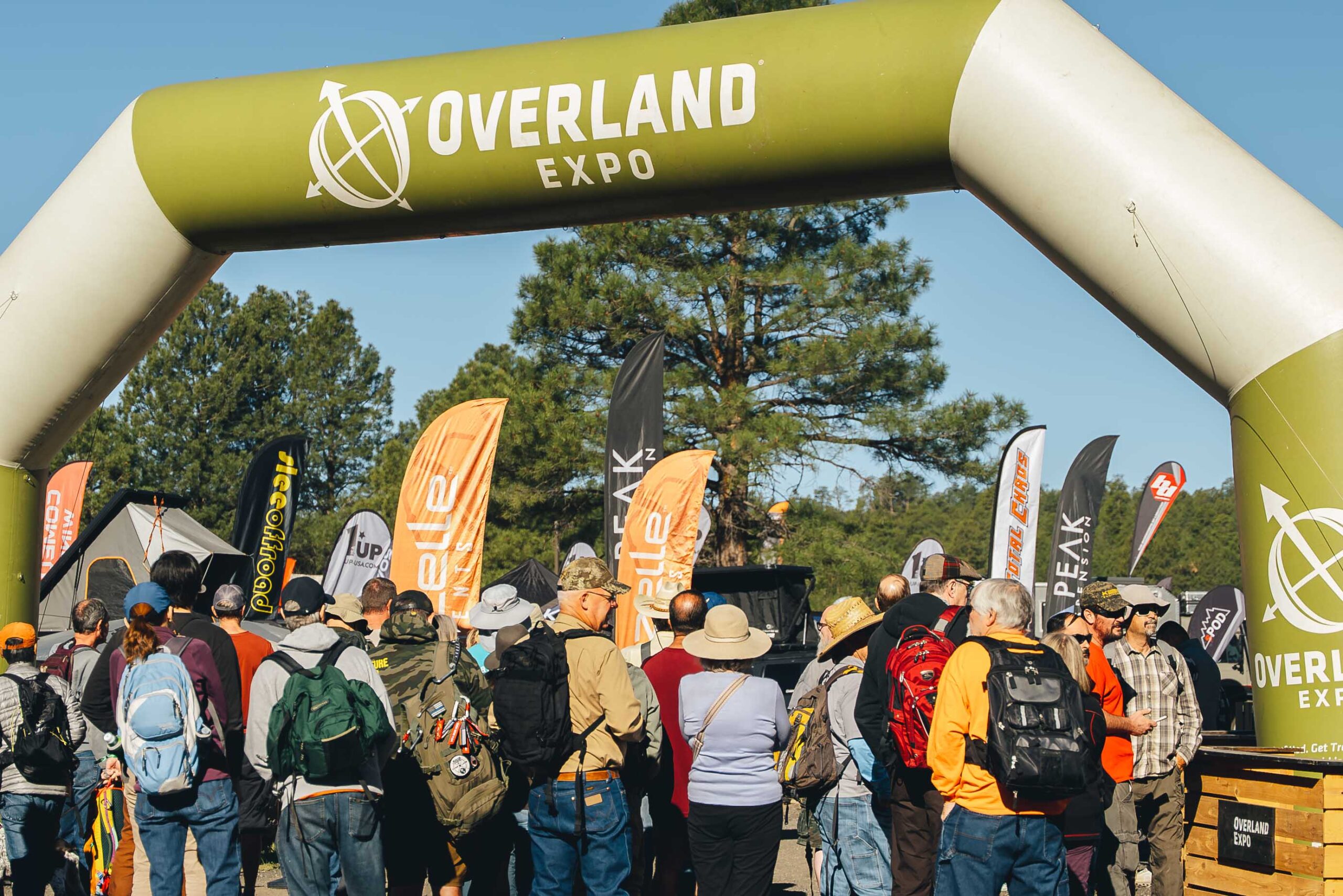
Full disclosure: I am not actually an Overlander guy and I doubt I would become one even if I had the money. It just doesn’t take that much to get off of the beaten path. However, many others see it differently, and the market that emerged from this worldview created the Overland Expo which was recently encamped in Flagstaff.
My wife and I went, and while we paid to shop, essentially, we had a discount through some means I do not recall.
Amateur but veteran tip: we parked at NAU and took the bus in, and this was little trouble. Especially compared to a previous year where we spent so long hiking in from our found parking space that we essentially missed the event.
This is not a detailed review of what is a giant outdoor mall for people who want to see the great outdoors from the window of their expensive vehicles. We found a few cool things, and I record them here for my reference, but I share also with you.
More or less smallest to largest:
The Transcool portable evaporative cooler. A lunch-boxed sized evap cooler you can run from your car battery of other portable power. Or a wall outlet, I suppose. Couldn’t vouch for its performance in the humidity but the demo was blowing cold on a dry Flagstaff afternoon. https://transcoolusa.com/
The Aquaboost power station turns salt water to electricity, perhaps to power your Transcool for up to 12 hours, per their literature. https://www.aquaboostpower.com/
Your state parks and local tribes are trying to save history – and they gave me a sticker, so I give them a plug. https://savehistory.org/
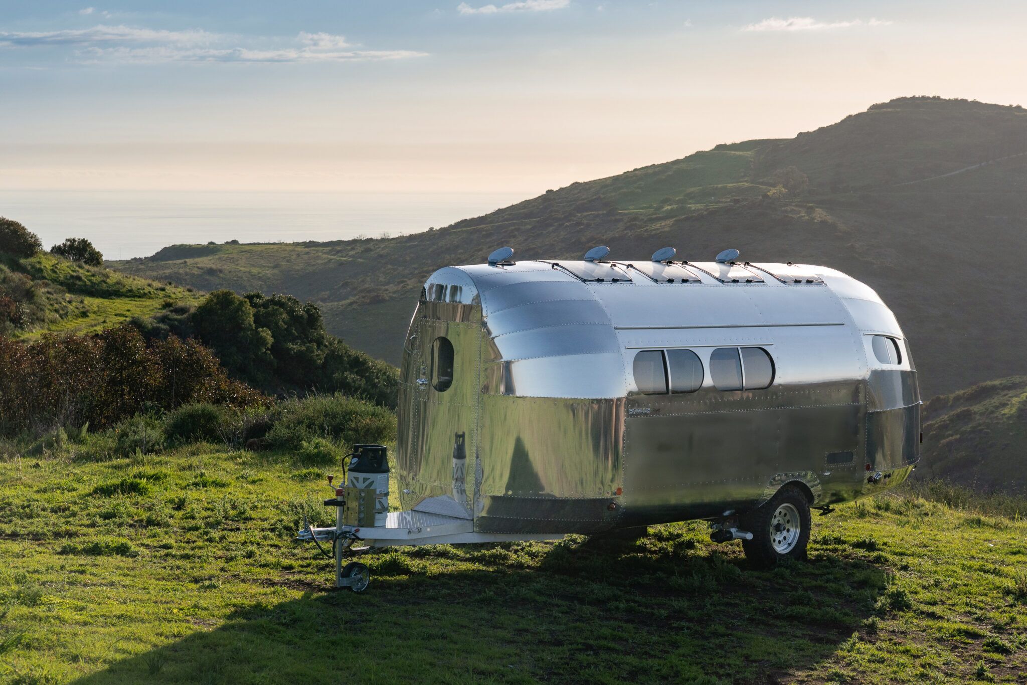
Finally, if money were no object, this would be the trailer I tow:
The Bowlus Rivet is an airplane fuselage disguised as a trailer. Our European host made us take off our shoes to walk inside the thing. Once inside we learned that while it has actually fewer amenities than trailers in its $150k price category ( you read that right) it is stupid lightweight for its size. That’s what you’re actually paying for. Sure the shower is clever, the other features are spare but well laid out, and thing outside is mirror-shiny, but what makes it worth it is the #2800 base weight. You can tow it with an SUV.
We would tow it with a cargo van – money being no object – for UnObtanium events. But we are not anywhere close to that kind of money.
Even so, it was fun to get out of the heat and daydream.
A bajada is the mound of run-off sediment skirting the edge of the mountain. It is not quite Spanish for “Alluvial Fan”, but they are functionally the same thing.
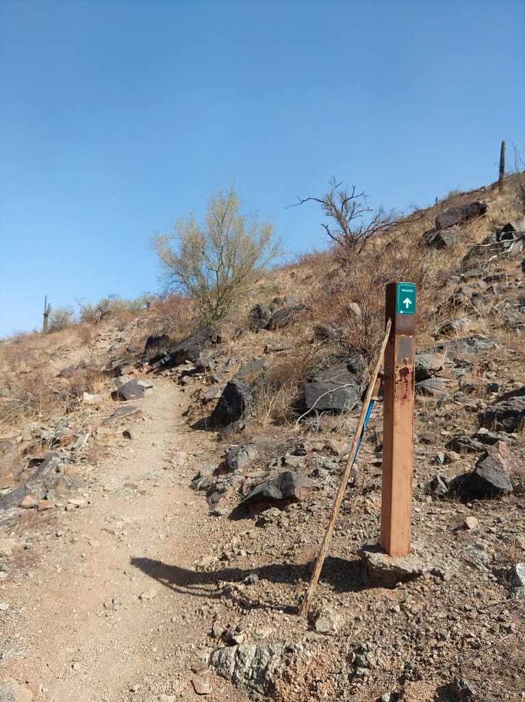
The Bajada Trail winds up and across its namesake across the San Juan Valley in the Phoenix South Mountain preserve. Or, rather, the main western portion des this. The eastern third of the trail is basically a connector trail we have written about elsewhere.
The portion we write about here connects the San Juan Bicycle Center with the San Juan Lookout, running from its junction with the Max Delta Trail (at the lot) to its’ junction with the National Trail on the west end of the park. You then follow the National Trail northwest to the lookout.
This is often done as a loop hike with the Alta Trail. If so, regardless of direction, do Alta is the harder of the two, and I always recommend doing the hard part first. If you do it as a loop, take a lunch.
I did this as a car shuttle. My plan was to park at the bike lot, and then have a friend drive me to the Curtis Saddle Trailhead. However, we lucked into one of those Brigadoon-like morning when the vehicle road to San Juan Lookout was actually open to actual vehicles. So, he dropped me off there instead.
The route is National Trail of Bajada Trail to the bike center – a route that is about 4.3 miles one way. Most people can do it in a couple of hours.
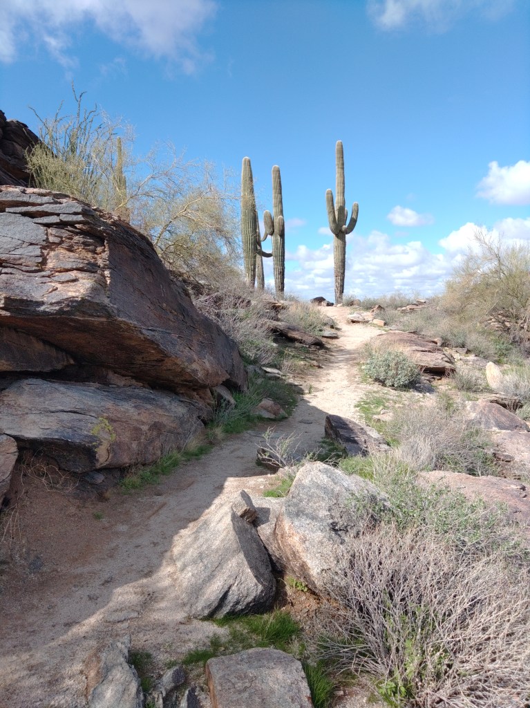
National Trail heading out from the lookout is what you picture single-track trail through the low desert to look like: Packed dirt wide enough for one pedestrian, winding through the cactus. There are not a lot of landmarks. Sure, to the west, AZ 202 crosses in front of the casino, but the trail itself has few features. The junction with the Maw Ha Tuak Perimeter Trail. A stand of teddy-bear cholla. A stand of chain fruit cholla. A stand with both of them together. A geologic marker. You cross three small washes, then a big one, and then East San Juan Road. On the far (south) side of that you come to the junction with the western terminus of the Bajada Trail.
The National Trail, also called the Maricopa Trail heads off further southwest until it turns east and charges up the main Gila Range to the top ridge. It will continue east across that ridge to the other end of the park.
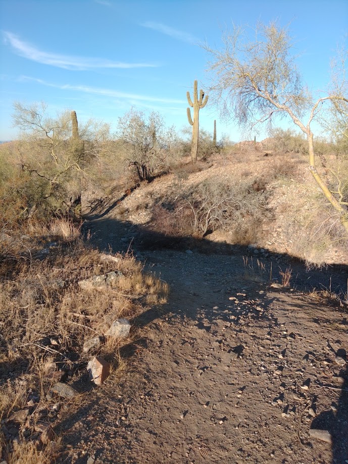
I took the Bajada Trail, of course. It promptly crossed the grey-gravel expanse of the main San Juan wash, and then began a lesser climb up the mountain, turning east kinda-sorta along the top of the bajada.
When the road is closed, and you get some distance from the freeway, this is one of the quietest sections in the park.
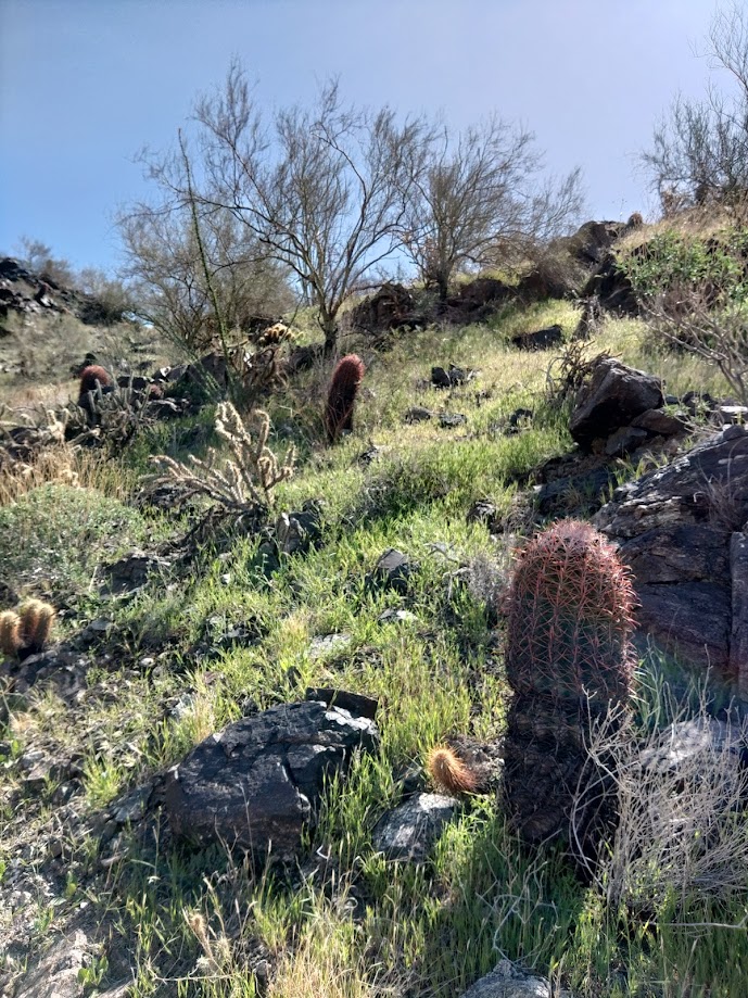
The trail will go up the berm and down the wash and up the berm for most of its remaining length (either direction). It is in excellent shape, a little rocky in places, blue and black basalt with a little gypsum for color, but you can do this in tennis shoes. The entire length is a shadeless march through stunted palo-verde trees, bone dry creosote and a scattering of cacti.
The terrain is not your problem. Like all hikes in this park, or this area, do not attempt this in summer unless you start marching in the predawn gloom. The entire hike I noted two places (both washes) with enough shade that a grown human could sit down within.
Below you (north) East San Juan Road follows the wash through the relatively quiet canyon. Towards the end, after one of the few sustained climbs, the trail with turn north and descend towards the road. Before you get there, as you start to enter the main wash, you will reach the junction with Alta Trail.
You are a half-mile from the trailhead. You can guzzle some water now.
Don’t cross the wash. Stay on Bajada as it turns east again, though and then out of the wash. Then across the desert floor a little farther to pavement.
If you look up the hill during this passage you will see mine trailings, and perhaps some social trails going up towards same. There is at least one open mine shaft still existing on those slopes, but you are on your own with that. When crawling about in mine-shafts, you are betting your life on the engineering acumen and diligence of whatever miner dug this 100+ years ago, and I cannot recommend that.
The bike lot has trashcans, but no other services. The San Juan Lookout has nothing but an old ramada and signage.
The Apache Trail has re-opened, and one hot September 2024 Sunday, my son and I found ourselves with no obligations we could not avoid. Being too hot to hike (daytime highs never sank below 95 the entirety of September in 2024) (God – I hope that’s a remarkable sentence in the future) my son suggested that I should drive.
Because the AC in my 2015 Subaru still works.
Thus, we found ourselves burning down the Superstition Freeway [US60] past Chandler and Mesa and east Mesa and Gilbert all the way to Apache Junction where you finally exit and go north on Idaho Road.
In about two miles, Idaho road forms a triangle with the Old West Highway and state route 88, otherwise known as the Apache Trail.
The park his triangle forms around is the beating heart of the great, sprawling trailer park that is Apache junction. I kid – it’s not really one super-massive trailer park. It is a cluster of large trailer parks separated by small strip malls. Keep driving.
There are several side trips accessed from this road, and we will append those links at the bottom of the article as we document them.
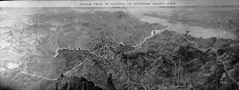
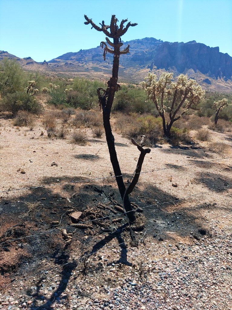
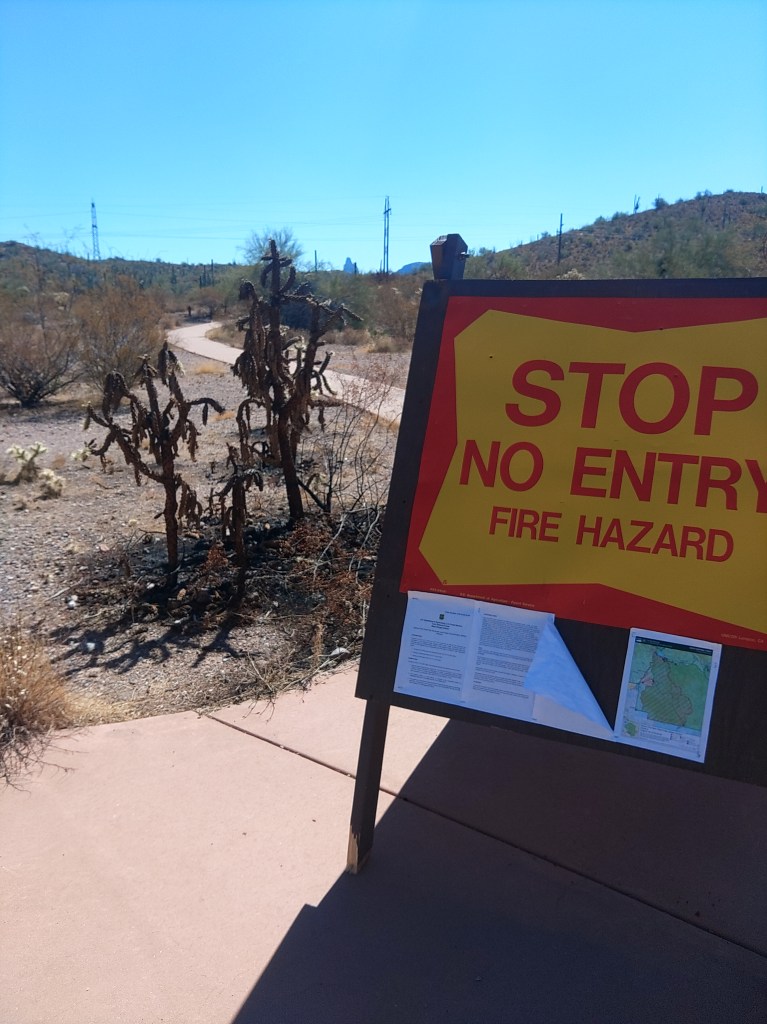
Apache Trail goes northeast, out of Apache Junction and along the edge of the Superstition Mountains – or increasingly, what is left of them. For behold, once you pass the Lost Dutchman State Park and the Goldfield “ghost town”, you enter Tonto National Forest, and more tragically, burn scar country.
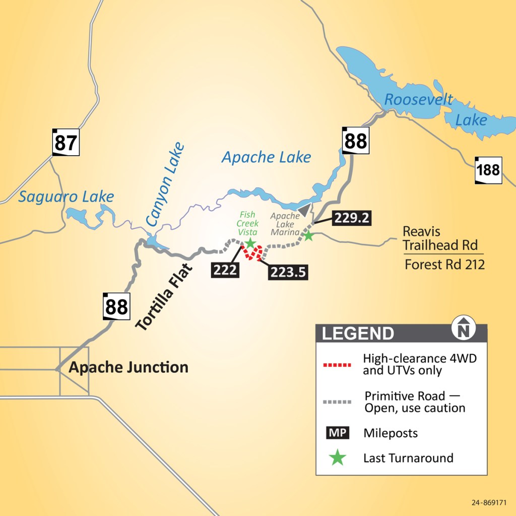
In June of 2019, the inevitable fire, called the Woodberry Fire, consumed almost 124,000 acres, much of it along this road. In September of that same year, monsoons dumped six inches of rain on the fresh fire scar and the resulting runoff damaged large portions of the road and left the stretch between Fish Creek Vista and Reavis trailhead impassable – for years.
ADOT map of the fire damage closures. You can pretend the red line is grey now.
Road maintenance, you see, unfairly heightens the tax burden of the rich. No- that’s not it. I mean, a majority of the Arizona legislature has said things like that out loud, but the other problem is that the Apache Trail, when it was open, saw less than 300 vehicles a day.
The Apache Trail has never been a thoroughfare. The northern terminus is a T with AZ188 along the south shore of Roosevelt Lake. Heading northwest will eventually get you to Payson, but AZ87 is far easier. Heading southeast will get you to Globe, but even the winding, two-lanes-through-tunnels US60 will get you there faster – usually.
Trail construction circa 1909. US archives.
Apache trail was constructed, starting in 1903, as a supply road for what would become Roosevelt Dam. It gained its name from the large portion of the labor force that was Apache – including the ones who built the road.
For the most part, AZ88 follows the same route.
The southwestern trailheads into the Superstitions were still closed from fire damage as we drove past them. They may be for a long time. Fire is not part of the life cycle of the Sonoran Desert. It takes decades to grow back to where ecologists would feel comfortable again.
The road is still paved as it turns east to skirt the shore of Canyon Lake, which like most lakes in Arizona, is actually a reservoir. Every lake I mention in this article is actually a reservoir. You will pass some day-use boating sites, the marina, and then head back up the hillside towards Tortilla Flat.
Tortilla Flat is a bar/hotel/gift shop complex. On this Sunday, it was packed with bikers, and we decided we could wait until we got to Globe to eat. Given the line outside the restaurant, we might eat sooner in Globe. Your results might vary.
The trail climbs here and on top of the ridge you will pass Fish Hill overlook, which is worth a moment to stop and stretch. And there are vault toilets if you need. A short trail goes to a concrete pad with some visibility of the Salt River Canyon below. But the trail beyond that is not technically closed, and you can follow it to a more distant rocky knob with better views.
Panorama of Fish Hill Point (and Ben)
Past Fish Hill, you enter the recently opened heart of AZ88 as the road dips and winds in and out of Fish Creek Canyon crossing a couple of single-lane bridges. There is nothing here that cannot be traversed in a passenger car, if you take your time and pay attention – which you will want to do anyway- right? That is the point of taking this route.
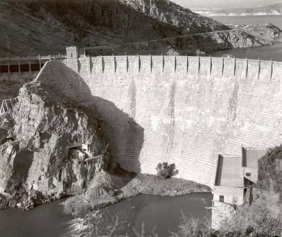
Over the ridge you pass a couple of scenic turnouts overlooking Apache Lake, and later Burnt Corral Campground. Past the campground, the road runs along the canyon wall, just above the Salt River, fat and lazy between dams until the biggest of the dams, Roosevelt, looms ahead.
At the time it was constructed, 1905-1911, Theodore Roosevelt Dam was the largest masonry dam in the world, built from stones carved out of this very canyon and held in place by cement mixed on site. A whole village was built to accommodate the workers as they built the place, called Roosevelt, of course, most of which would be submerged by the very dam its inhabitants built.
Roosevelt Dam – spanking new. USPS
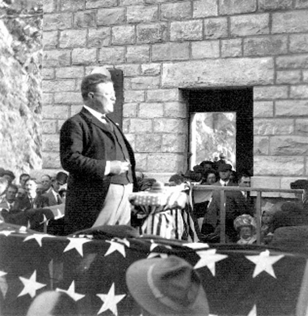
TR at the 1911 dedication. USPS.
One of the first projects of Roosevelt’s new Bureau of Reclamation, it was one of the first hydro-electric dams of any scale, and created what was, at the time, the largest artificial “lake” in the world.
That lake stretches out before you after you wind up past the dam and reach the T intersection with AZ188, which runs across the southern shores of that reservoir. You will also pass plenty of pull-outs if you want photos of the dam.
This is Roosevelt Junction and the termination of AZ88. You are still a half-hour from Globe – so this was no shortcut. But still worth it.
You get what you pay for – but you only get what you pay for.
From Big 5’s website
If Golden Bear Tents is not a house brand for Big 5 Sporting Goods, it might as well be. That is where I bought mine in person, and the only outlet that sells them new online.
Don’t mistake them for the jewelry and sportswear company, or some Canadian outfit that sells higher end tactical gear exclusively via internet or several other companies selling everything from pool cleaning to insurance.
Golden Bear makes, let’s face it, affordable tents, and that was the primary draw for me to purchase this one. The zippers on my much higher end Copper Canyon 6 had finally failed, and I needed a replacement quickly for what was left of a paycheck. That replacement ideally would have enough room for our queen-sized air mattress and enough height to dress standing up – which meant straight walls. Big 5 had this tent – which met those specs – on sale for just under $80. Sold.
The West Peak out in the wild.
This has everything you expect from a tent made in this century: fiberglass poles; detachable rainfly, dual zippers, bathtub floor, a couple of mesh pockets and a little flap for your electrical outlet. All of these features can be found on any other tent sold in any other US sporting goods store. There is zero innovation about this tent.
It actually had better ventilation than I was expecting, and did I mention that I can stand up in it? Well, I can.
The tent clips to the poles. There is only one small sleeve for the optional canopy pole. That makes set-up quick – if you have two people. If one person tries to set it up, you have to clip the middle (top) portion first, and then do the legs. I think. I’ve always had help, and even then, it helps to be tall.
Like most budget tents, the carrying bag is not generous, and you must roll it up the exact width of the pole bag and no longer, or it will not fit back inside.
I have not used it in bad weather, but I have low expectations. I clearly got what I paid for. There’s a mud flap and tie downs and such, so you could rig for storms, but I never have. This is a privacy tent for established campgrounds in good weather. The nylon is thin, the stitching is minimal, and the zipper feels less substantial than the Copper canyon zipper which took ten years to fail.
This is not an adventure tent. Happily, I do not need one. I needed a tent to sleep and change clothes in on weekend escapes and occasionally ren fairs. I expect to get a year or so of that sort of use out of it.
If that’s all you need out of a tent, this one is fine and affordable. If you plan to stay out your 14 day limit in the wilderness during monsoon season, you may wish you spent more money.
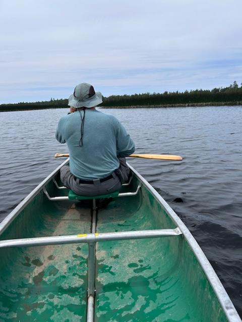
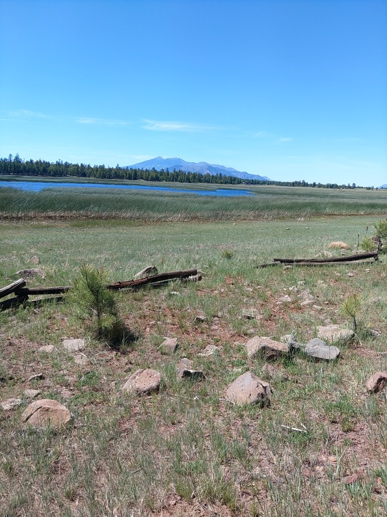
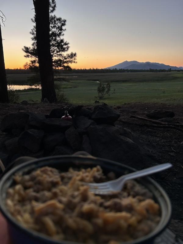
Marshall Lake is a small, marshy pond, really, just south of Flagstaff. Its’ reedy shores are full of birds, and the forested hills around it are full of dispersed campers.
Arizona does not have many natural lakes, but Marshall Lake is one of them. It’s really only a lake at its rare high water mark. At normal levels it is a series of connected ponds. There are times when it is completely dry.
On my last visit, my son and I were able to paddle a canoe through breaks in the reeds and go from pond to pond to see the birds and hear the frogs and waver to the scattered fisherfolk. At high levels, AZ Game and Fish will stock some trout in here. Folks have also caught channel catfish, northern pike, crappie and the occasional largemouth bass.
More numerous than fisherfolk are the ducks and coots. The Coconino National Forest slipped a good line past the fedbots:
“Marshall Lake is a small marshy body of water that’s generally full of coots and other waterfowl splashing, flapping, and cooting around. It is such valuable wildlife habitat that it is managed in partnership by Ducks Unlimited and the Arizona Game and Fish Department.”
Signs and portents by the lake.
You can also see osprey and even eagles around the lake. The hills around are popular for elk and are grazing allotments for cattle.
Dispersed camping means no services: no tables, no trash, no outhouses, no water. When we were there in late June, we were under a fire restriction, which covers all of these sites. Even so, the area is popular. If you aren’t up there by mid-morning Saturday on a weekend with good weather, you are likely camping somewhere else. A lot of your neighbors are clearly going to use all 14 days of the stay limit.
Photo by Ben Padegimas
Marshall Lake is seasonal, approximately May-October. Outside that window, the roads might close indefinitely due to snow.
The lake is located about 12 miles south of Flagstaff, off of lake Mary Road (aka FR3). Take that road south past the Lake Mary recreation sites to FR 128 which switchbacks up the hill before becoming graded dirt. Follow the signs.
There are no fees. There is a small parking lot next to the “boat launch”.
The observatory on the top of Anderson Mesa is not open to the public. The nearby trailhead is, and I have written about that in my book: 5 Star Hikes Sedona and Flagstaff.
There is a plan to improve the wetland conditions here, somehow. More information can be found here:
Current Status: The wetland is a perched clay basin with limited inflow from rain and snowmelt. As a result, Marshall Lake is sensitive to drought and is dry in many years. AGFD is conducting a water balance and feasibility assessment for habitat improvements in the Marshall Lake watershed. A restoration plan will be developed in coordination with the Coconino National Forest in 2015.
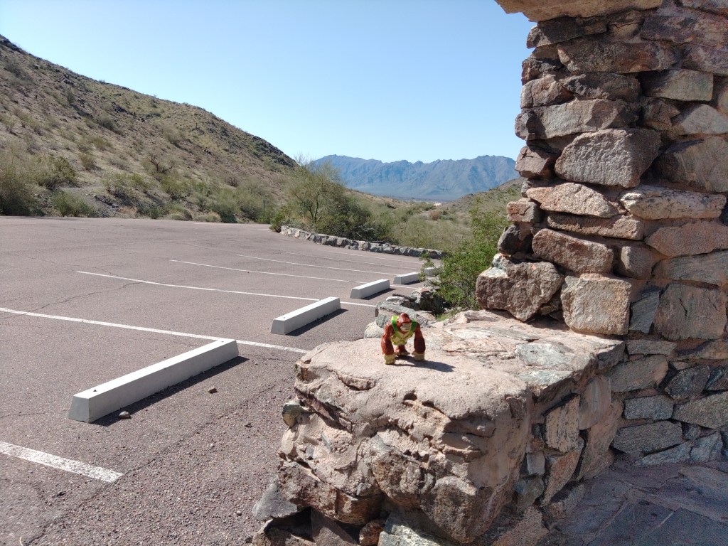
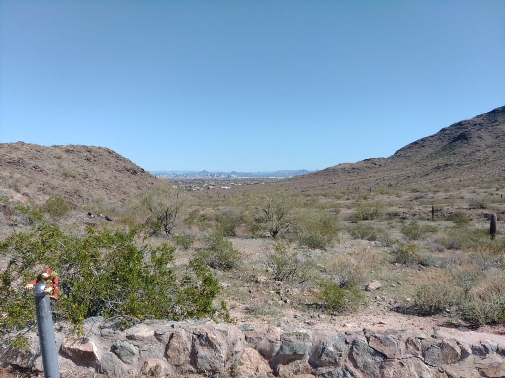
As late as 2015, this small parking lot, complete with a remnant CCC ramada, was reachable by vehicle whenever the park was open. In the day, this was primarily trailhead parking for three main trails: The National or Maricopa trail, the Bajada Trail, and the Alta Trail. To the east, you can see downtown Phoenix through the saddle, but there are honestly better views elsewhere. To the west you could see the still undeveloped farms and deserts separating the South Mountains from the Estrella range.
After sunset, that was all dark, of course, until the freeway and the casino – and still mostly dark. Anyone parked here after sundown was likely more interested in fogging up their windows than looking out of them.
The monsoon in 2015 ended that by washing out part of the access road. The city has taken that opportunity to save a bit of the ecosystem and a bit of money by keeping the road closed except for limited windows ever since.
The view to the east
The paved roadway sans cars makes it a popular destination for cyclists. It is also open to pedestrians, but the Bajada Trail goes the same place and is a nicer hike.
The Curtis Saddle Trailhead, meaning some spots you can park at the dead end of Estrella Drive, lies about a half mile west and downhill. It’s always open.
According to the Phoenix Parks:
San Juan Road: Open from 5:00 a.m. to 7:00 p.m. on the first Saturday of the month and from 10:00 a.m. to 7:00 p.m. on the first Sunday of the month.
This is the toughest trail in the Phoenix South Mountain Preserve. It is also one of the more lightly used one, as, aside from the difficulty, none of its access points are from parking lots. Originally built by CCC and convict labor in the 1930’s , it is one of the oldest existing trails in the park. And one of the best – if you’re up for it.
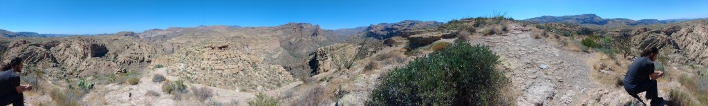
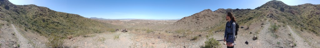
Panoramic shot on the western slopes
You can do it as a loop with the Bajada or even the National trail, and that will take all day. If you do it as a car-shuttle, no one will judge you. Either way, it is worth doing – at least once.
We (my son joined me) parked one car at the Curtis Saddle “Trailhead”. We only call it a trailhead because it is so marked upon a map. At the eastern dead-end of Estrella Drive, just east of 43rd Ave, where it turns to dirt, you can find several places to park along the barbed wire fence lining the south side of the road. There are no services.
The elevation here is about 1140 feet.
A short connector trail (called Dead Man’s trail in some sources) charges up the rock slopes, bisecting the Ma Ha Tauk Perimeter Trail (aka the East Laveen Trail) before winding south through the actual Curtis Saddle and down to the San Juan Lookout.
San Juan Lookout is one of several parking lots in the park where you are no longer allowed to realistically park. That’s another article. To our purpose it is a trail hub granting access to the National or Maricopa trail, which crosse the entire park east-west, the Bajada Trail which goes across the gentle slopes of the San Juan Valley to the east, and the Alta Trail, which also heads east – but straight up the slopes of the Ma Ha Tauk mountains.
Alta is Spanish for “high”
It has always been my preference to go up the hard way – while your feet are fresh, and then down the easy way, which is why we describe this hike west to east. The western climb has some switch-backs, but it has just as many places where you are going to be obliged to use your hands or maybe your knees to get up the rock-surface portion of the trail.
There is one particularly daunting spot, where a straight climb up scree leads you to a trail marker, taunting you. This is a trap. Look behind you. The trail actually switches sharply back to climb the slope in a more rational manner.
This old trail winds up the oldest of the two ranges that form the park. This range and the western portion of the Gila range (due south) are composed of Precambrian gneiss pushing up granite 1.7 billion years ago. It has been slowly eroding ever since. You’re helping.
Vista from a false summit
There are a couple false summits where you can pant and take pictures but the literal high point is also approximately the half-way point, around 2.5 miles, when you reach the ridge crest and can see both the north and south sides of the range. This is 2400 feet, depending upon which rock you sit on. That’s why you’re tired.
The highest point of the range, at just under 2500′ is called Maricopa peak – on some maps.
From here, the trail winds up and down the high slopes on the north side for a mile or so before cresting again. On the way, you can see the farming village of Laveen and the gated communities that increasing surround it. You can also absolutely win a game of desert cactus bingo along its slopes, passing stately saguaros, whispey ocotillos, stunted palo -verde trees, angry cholla and in the right season delicate wildflowers. If you’re lucky you’ll see some hawks. If you’re less lucky – jet planes.
The last mile and a half winds down the southeast slopes in lunatic switchbacks – a hallmark of CCC trail engineering. Towards the bottom, you might find where the original course was abandoned for a straighter line along the wash.
You will cross that wash, and the trail flattens as it approaches the San Juan Bicycle Center, where you can find the Bajada Trail and the Max Delta. The San Juan Bicycle Center is another not-really-open parking lot that we made fun of described in the Max Delta trail description. It has trashcans and places to sit, but no other services. There are other normally open parking lots just down the road.
We reached the Bicycle Center from Curtis Saddle in just over 4 hours – but I hike slow and take notes and pictures. My son could have easily shaved an hour off of that were he not waiting on me.
I can’t call it the Lost Lookout, as cool as that sounds, because you can see it from the street.
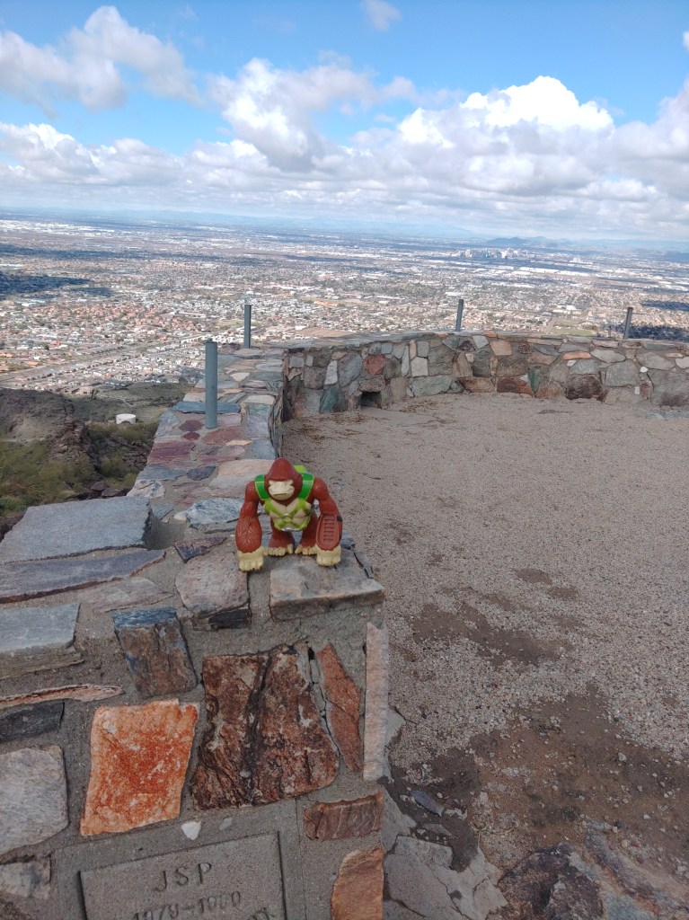
Bongo found the lookout.
As I stare at the Phoenix South Mountain Preserve, the ridgetop immediately east of Dobbins Lookout also has a stone structure upon it that I can see from my house. As a side-quest to the Holbert Trail I decided to seek it out.
To reach it, I followed the Holbert Trail south and up, past the Dobbin’s Lookout connector, and up to Buena Vista Road. I then followed the actual road east for a few hundred yards. Before you get to the junction with TV road, you will encounter a guard rail on the north side of a gentle curve across a relatively level ridgetop. This is not necessarily to keep careless drivers on the road. This is to keep curious drivers off the remnant road running north of here.
Well, I’m a pedestrian. So I went around the rail and south along what was vaguely a remnant road flanked by small palo-verde trees and young saguaros. The oldest of the saguaros guards the destination about a half-mile from the road, but you’ll see the big double-hoodoo first.
Approach from the road.
The remnant road climbs the hill, past the hoodoo to empty into what was clearly a vehicular parking/overlook with space for maybe 10 cars.
Panoramic view
The topo map has the elevation at 2246’ above sea level.
I believe, based on inferences, but not direct references, in old city planning docs, that this was called Holbert Overlook. The concrete stamp on the west side declares it was built by JSP in 1979-80 for the City of Phoenix. Its is referenced in the 1989 city master plan for the preserve.
D3 – The North Overlook area near the Summit of the Gila-Guadalupe Range. Containing Holbert and Dobbins Lookouts, with access to Buena Vista and Gila Overlooks, this sub-zone will continue to receive large numbers of visitors. Overlook sacrifice zones should be defined and edged with compatible barrier treatments.
Or abandoned and forgotten apparently. It does not appear on the 2007 trail map, or any map afterwards.
The road, though, appears on the 1952 USGS topo map.
All searches for Holbert Lookout will produce results for the trail. The lookout was abandoned before the internet was useful, so sometime in the 1990’s. I’ll update this article if I find an answer to that.
Meanwhile, I had the place nearly to myself. The other guy was also making a video, though in Spanish. He climbed the hoodoo. I did not. But I enjoyed the view until the rest of my hike called me away.
When you have friends or relations in from out-of-town and they say that they want to hike up South Mountain – and you are satisfied that they understand what “hike” and “up” really mean in this context – you want Holbert Trail.
One of several park things named for Charles M Holbert, the first custodian of South Mountain Preserve from 1929 to 1939. It is said that there was no place in the preserve that he had not visited.
The official trailhead of Holbert is now in the giant parking lot near the Central Avenue entrance. Where exactly, in the giant lot depends on where they are in reconstructing the group picnic site.
The two and half miles of Holbert Trail can be roughly divided into four sections. The first section starts in the giant parking lot, wandering east across the north base of the mountains, skirting a couple of retention basins. You can find some petroglyphs in the early going. This is where you take out-of-towners who clearly do not grasp “hike” or “up” in this context, and you do not want to hear them whine. Meaning this portion is super-easy, and totally skippable.
The second part can be easily reached by the 7th Street or Mineral Road trailhead. This is no longer an official trailhead on city maps, but the dead-end of Mineral Road heading east from the southern terminus of 7th Street is very much used as a trailhead. Both the footpath on the west side and the access road on the east side will lead you to signed junctions with Holbert Trail.
This is also the entrance for Mystery Castle – should that attraction ever manage to open its gates again.
Past the second water tank, Holbert starts its second section, a sustained, winding climb up and across two ridges and then up a narrowing canyon lined with blackened basalt. Every time you can bring your gaze up from the constant rock-stairs on the trail you will see the desert slopes of the mountains spreading before you. Stop and turn around and you will witness the whole of the Phoenix metro stretching off into the horizon.
So, this hike is best done on a clear day. Otherwise, you will see the bowl of haze you hiked out of, realize that you actually live in that, and struggle with sadness. But on a clear day, this is awesome.
Poor place to plan a felony…
As this popular trail winds up the canyon, the voices of other hikers in the distance will echo around the steep walls. This is a poor place to plan a felony with your friends.
Just past what would be a waterfall, for the seven hours a year this canyon has running water, you will encounter the junction with the Dobbins Lookout Access Trail. At this point you’ve climbed 500 feet up in just over a half mile – which is why you’re feeling it.
Most locals with out-of-towners in tow take the access road to Dobbins Lookout. Yeah – don’t tell them. Hearing your friends exclaim “We could have driven up here?” is a long and traditional source of great joy.
There are also vault toilets here – one of the few available outside of the developed picnic areas.
When I did this hike for photos, I cheated. I had a friend drop me off at Dobbins, then I went up Holbert, off to a side-quest, and then down.
Upper Holbert continues past the Dobbins junction, climbing the rest of the way out of the canyon before crossing Buena Vista Road. It keeps climbing over and then on top of the actual mountain. This portion is quieter, less crowded, slightly easier and more scenic than the portions that came before, and totally worth doing. In less than a half mile from Buena Vista Road, you will reach TV Road. Across that road – which goes to the antenna farm on the summit and the Gila Valley Lookout – is the terminus of the Holbert Trail as it T’s with the Maricopa or National Tail. You are at the 2.5 or 3 mile mark, depending on whether you went up to Dobbins, and have climbed at least 1200 feet from the trailhead to stand at 2400 feet above sea level.
The proximity of either Dobbins or Gila Valley lookouts make this a super-easy car shuttle. You could also take the National Trail west to the Kiwanis Trail and then Los Lomitas Trail to make a full loop of it. The loop would add a couple of hours.
The up and back described could be done in four hours, five if you dawdle. I mean – I suppose. I actually cheated.
Los Lomitas Trail in South Mountain Preserve is the connector trail between the middle of the developed picnic lands and the giant parking lot that separates the conference center from the group picnic grounds. It is the third and final leg of my South Mountain Infrastructure Loop.
For all that, this trail is worth doing on its own. Because this is part of the loop, we start in the middle of the park, and head towards the great lot where you likely left your car.
We start at the four-way junction: The Bajada Trail goes south, up the slope. The Ranger trail continues north, towards the Five Tables Trailhead. The Derby Trail, which is oft signed as part of Los Lomitas, goes west to eventually join the Max Delta Trail, but the part we want, the main portion of Los Lomitas, heads east, before bending north.
East now, from the junction, Los Lomitas goes over low hill and shallow wash a few times before crossing some flat desert. On the far side of that, you reach Los Lomitas Cabanas, which were fenced off when I was there, but the restroom was open. By open, I mean unlocked. The gate door is closed and latched, presumably to keep the critters out of the garbage. Latch it back up behind you.
The trail follows ridgeline NE to the Kiwanis TH (and another RR), then parallels the road a spell before dropping into a large wash near the ramada compound of the Piedras Grandes picnic grounds.
Here, you trudge through sand, as opposed to the packed dirt of the trail that came before. In mid-day, the high walls of this wash present your only hope for shade. Los Lomitas climbs out of this wash to merge with Box Canyon Trail, a horse trench bending more north now. Soon, Box Canyon/Los Lomitas parallels the Judith Tunell accessible trail as it gradually bends from north to northeast before reaching the parking lot.
Where exactly in the parking lot depends upon where they are in the endless construction. This flat expanse of asphalt hides few secrets, and rarely more than a dozen cars. You’ll be fine.