

The city of Prescott has three man-made reservoirs in or about city limits, and Willow Creek is the most accessible, and arguably the most scenic. While you can float a non-powered boat on it, and fish and bird-watch, or even peer into the excavated homes of the long-gone natives if you time it right, the attraction – at least for me -is as a hiking destination.
There are three trailheads, and I picked the only one with a parking fee – City-run Willow Lake Park on the north side.
Let’s stop here and clarify: the body of water is called Willow Lake, Willow Creek Lake, Willow Creek Basin or Willow Creek Reservoir depending on what source you look at. It is all the same body of water.
The city park is the most developed site, with the boat launch and the well-guarded aboriginal ruins. They were closed when I was there, and thus we skip right past them. The park asks for a $3 fee paid by an honor-system kiosk. Or you could park at the ball-fields of adjacent Heritage Park – as I did, and hoof in for half a mile extra.
The lake, and the 6 mile trail that wanders around its perimeter can be accessed by the Jim McCasland Willow Creek Park, which has a ball-field and a dog park, on the east shore, and some undeveloped gravel parking areas on the south shore. McCasland, for your planning convenience, also has restrooms and water fountains. The south lots have only trash cans.
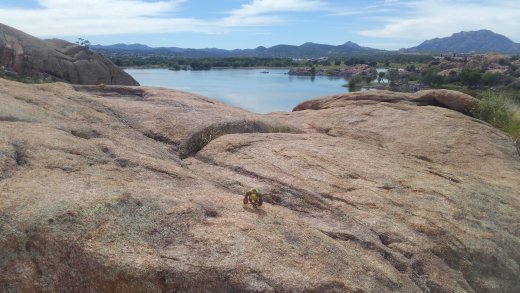
Back on the north shore, the city park is adjacent to a trailer park and a campground, and a number of social trails connect the two. I went clockwise, past all of these and into the portion of the Granite Dells, a large, relatively famous jumble of granite boulders and mounds that line the north and east shores of the lake.
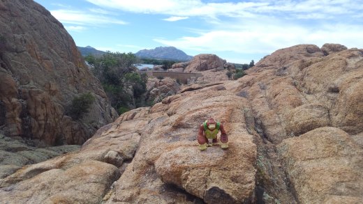
Like all trails through this terrain, the path has a lot of up and down and round and round and is often a scramble over granite marked only by spots of white paint.
In the NE corner, some side trails loop further into the Dells, but I skipped these, to budget time and energy. Originally, I was just going to go to the dam, and then turn back. Past the junction with the loop trails, heading south through the boulders, you can look for the red bridge, though if you take the offshore leg of the loop you could miss it, before you wind down into the valley behind the dam.
I have been through this valley both wet and dry. Dry is far more likely, but trails exist which will get you across when the water is spilling out from the concrete barrier.
On the south wall of this valley are the stairs, rail-road tie stairs, which will march up 200’ in elevation to the last leg of the journey south through the Dells.
Here I reasoned, correctly I still believe, that retracing the just under two-mile journey from the city park to the top of the stairs would consumed as much energy as continuing along the remaining four miles ahead of me, and I decided to press forward around the lake.
Another half mile of big boulders, including a close encounter with the edge of the lake, that required a bit of rock hopping, separated the stairs from more open terrain. You can avoid the edge of the lake via a loop I did not take.

Both will dump you into the shadeless, swamp-grass covered expanse of the south-eat edge of the lake, The map claims this part of the trail could be submerged, but this is rare. When I traveled it, it was a dry dirt track through the tall grass and swarms of insects that live there. This turns west and rises into the hard-pack of the southern shore. Power lines and an intermittent fence-line separate the trail from Willow Road to the south. Past the gravel parking areas, and across a wooden bridge, the trail wanders away from the road, and skirts some low granite formations before turning north along the east shore.
 It will dip in and around some wooded washes before reaching McCasland Park, where I found the water and restrooms nearly life-saving. Past there the trail wanders through scrub along the shore, passing Embry-Riddle University on the far side of the road, and finally back to the city park sprawling along the north shoreline.
I did the trail in about three hours. The Dells are Hard, the rest of the trail is easy, but the Dells are the worthwhile portion in my opinion. These Dells would be a premier destination for burning off the energy of junior high boys. Even as an adult, this hike remains a good way to kill a few hours if you happen to be in Prescott, in good weather, with time on your hands, and reasonably sturdy shoes.
