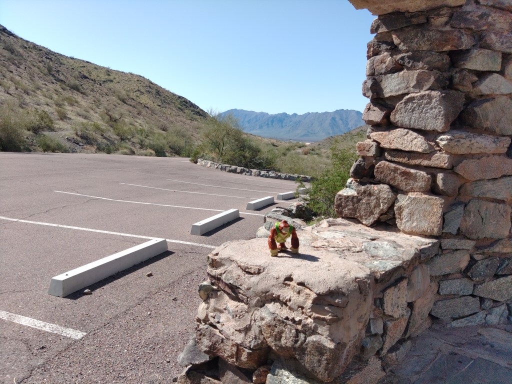
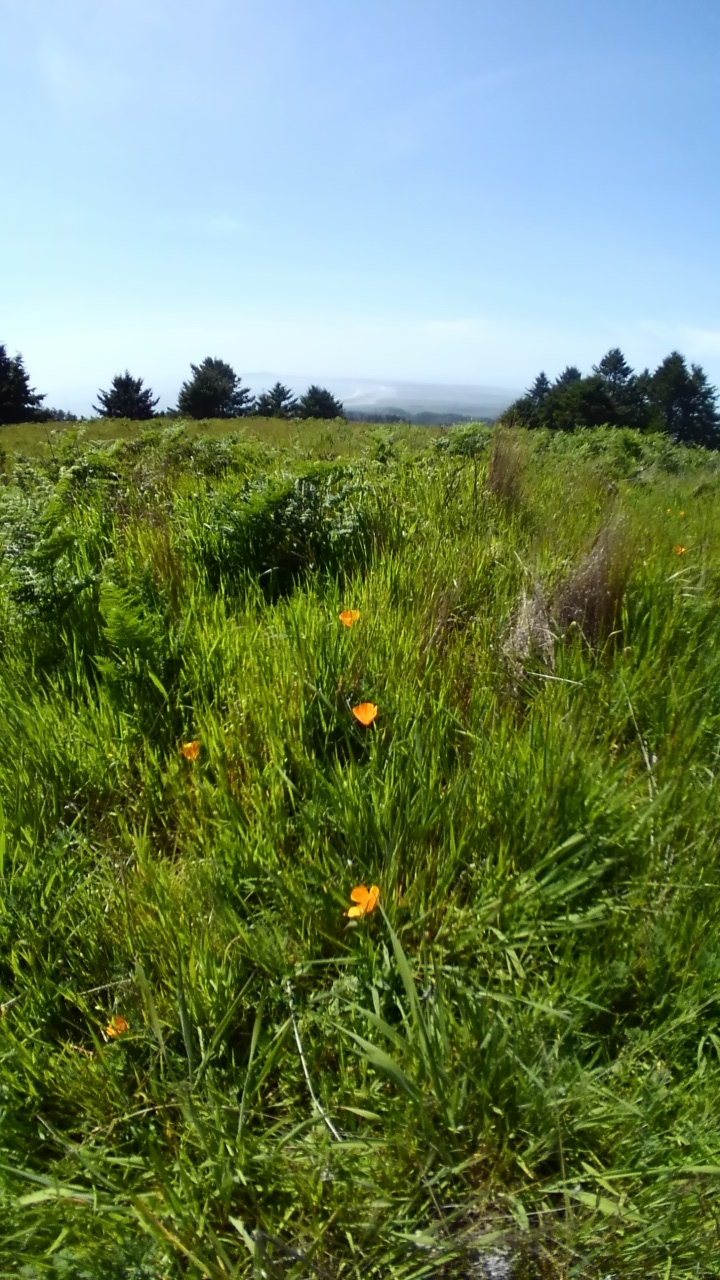
As late as 2015, this small parking lot, complete with a remnant CCC ramada, was reachable by vehicle whenever the park was open. In the day, this was primarily trailhead parking for three main trails: The National or Maricopa trail, the Bajada Trail, and the Alta Trail. To the east, you can see downtown Phoenix through the saddle, but there are honestly better views elsewhere. To the west you could see the still undeveloped farms and deserts separating the South Mountains from the Estrella range.
After sunset, that was all dark, of course, until the freeway and the casino – and still mostly dark. Anyone parked here after sundown was likely more interested in fogging up their windows than looking out of them.
The monsoon in 2015 ended that by washing out part of the access road. The city has taken that opportunity to save a bit of the ecosystem and a bit of money by keeping the road closed except for limited windows ever since.
The view to the east
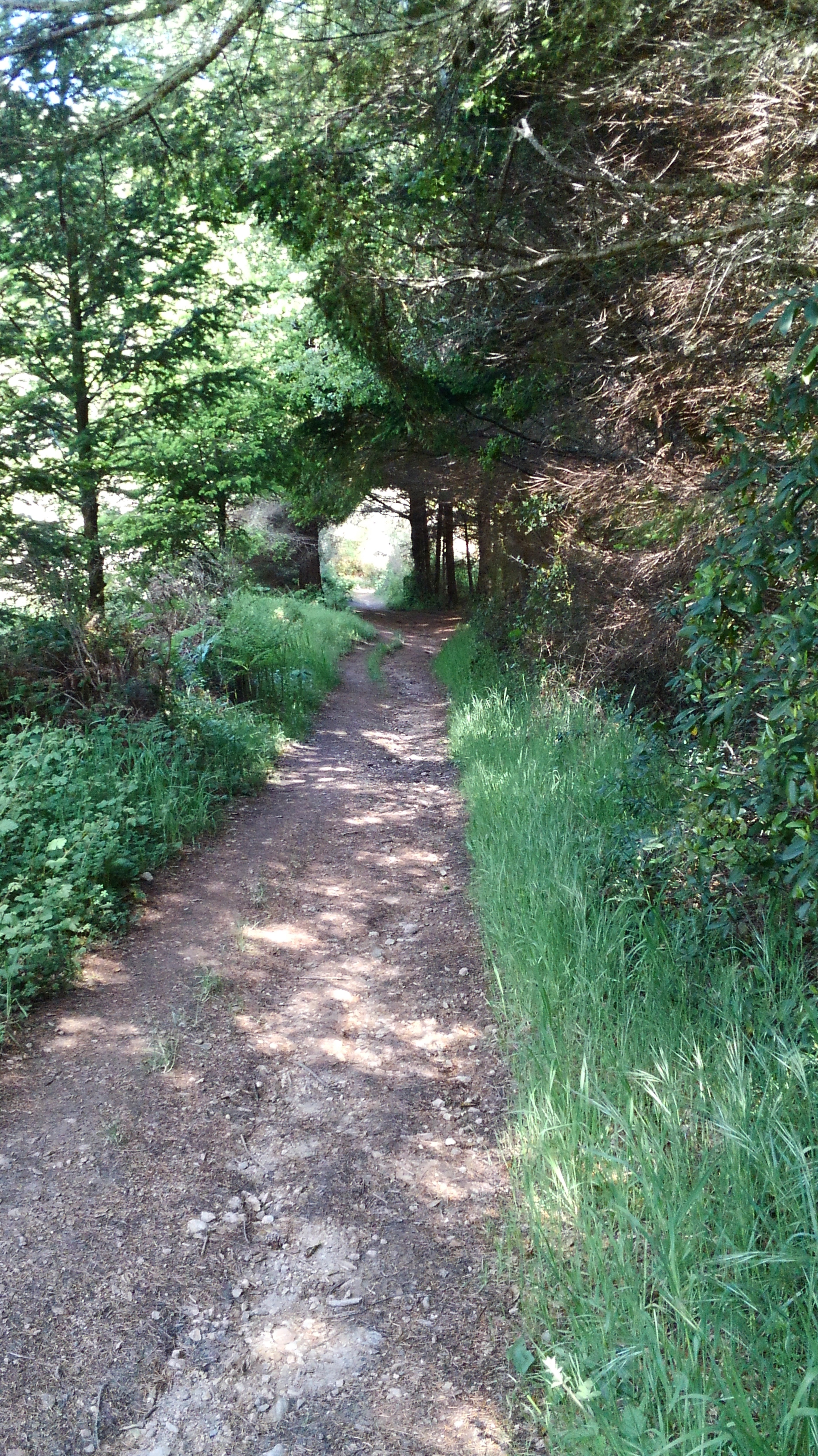
The paved roadway sans cars makes it a popular destination for cyclists. It is also open to pedestrians, but the Bajada Trail goes the same place and is a nicer hike.
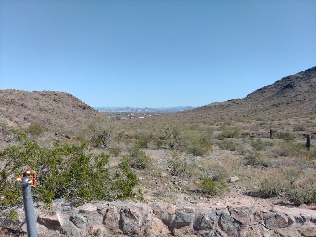
The Curtis Saddle Trailhead, meaning some spots you can park at the dead end of Estrella Drive, lies about a half mile west and downhill. It’s always open.
According to the Phoenix Parks:
San Juan Road: Open from 5:00 a.m. to 7:00 p.m. on the first Saturday of the month and from 10:00 a.m. to 7:00 p.m. on the first Sunday of the month.
Before I get into this article about the ruined houses of native Americans, let me confess, for context, that I have long been bored with the subject. As a native (meaning born in Phoenix – not Native) and thereby a product of Arizona public education through the 1970’s, I joined my classmates as we were herded by busloads through the various ruins scattered around a two hour drive from metro Phoenix.
These are not hard as day trips go, and low-hanging fruit for educators: here are their mud and stone structures or pit houses – and they all used to live here and did things – some of which we know, the rest we guess about – and then they all disappeared – before white man arrived (they always add that) – and now we can look at their old houses from a respectful distance.
Just like the last ones we visited, only they are over here, and look like this. If the nerds in class are bored with this (and I was a poster-quality nerd), all of the kids are bored with this.
Consequently, as an adult, I swore off Native American ruins as a destination.
This lasted until I had kids and started dabbling in travel writing.
Another thing these places have in common is visitor centers with maps and bathrooms.
Bongo at the Homolovi AZ state park visitor center
I arrived at the visitor center at Homolovi State Park at 4pm – an hour before they closed their gates. The ranger their took my $7 entry fee, and said I probably had time to see the main ruins: Homolovi II at the end of a road winding through the dry prairie for about two miles north of the visitor’s center.
Of the five known sites, only two are open to visitors. Homlovi II is the larger of the two. Homolovi I is close to the campground – yes people camp here – all year. It’s $20/night for most spots. The campground has restrooms, and even showers, but, like the rest of this ecozone, zero shade.
I saw RV’s scattered across it in early February. I don’t know why.
The state park is a joint effort with the Hopi Tribe, whose reservation lies about 60 miles north of here, in the middle of the sprawling Navajo reservation. Neither tribe thought this was a good idea, and the Feds didn’t care. Thick books have been written on how this happened and why its stupid. I don’t have time to get into that here – but this guy took the time, if you care.
The Hopi people of today still consider Homolovi, as well as other precolumbian sites in the southwest, to be part of their homeland. They continue to make pilgrimages to these sites, renewing the ties of the people with the land. The Hopi tell us that the broken pottery and stones are now part of the land and are the trail the Bahana will follow when he returns. Therefore, these are mute reminders that the Hopi continue to follow the true Hopi way and the instructions of Masau’u.
The website does not go on to explain who or what the Bahana is, and while we can guess by context, it does not expand on the concept of Masau’u. None of which is surprising.
The Hopi Tribe is notoriously insular. They allow visitors to their reservation, but only in the approved hotel, and you cannot wander around, and not only is photograph prohibited, but note-taking is prohibited.
I think in 7th grade a public school teacher told us that every year evangelical Christians would send Christmas gifts to the Hopi reservation, and every year the Hopis would, “toss them over the cliff”. I don’t know if that still happens, or for a fact if that ever happened, but it sounds plausible that it happened at least once. I’m pretty confident, though, that you can replace the cliff part with a dumpster of some sort.
So those guys – those guys – partnered with white man (then Governor Bruce Babbit in particular) to preserve the dwindling remains of these sites, as pot hunters were starting to come in with construction equipment.
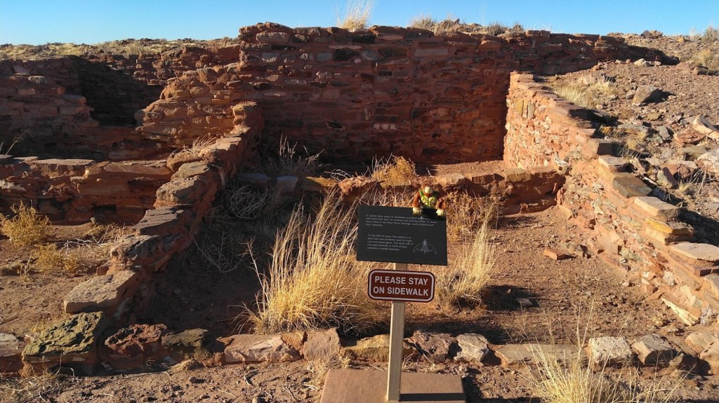
And having driven that road and walked along the couple hundred yards of sidewalk to and around Homolovi II I can report that those ruins are – unimpressive. A couple of small dwellings and one large ceremonial structure have been excavated so you can take pictures (that was part of the deal) and learn that they – favored rectangles.
Rectangles!
Full disclosure: I did not have the time to go through the interpretation displays in the visitor center – which take up slightly more space than the gift shop portion, nor did I download or otherwise listen to the interpretive audio feature.
As much as I claim disinterest, I did do some reading.
Somewhere in the 1200’s flooding along the Little Colorado (which marks, roughly, the western boundary of the park) deposited big piles of driftwood. Ancestral Hopi (I’m using a consensus term that is also easiest to spell) migrated out from the Mesas and used that driftwood for building and burning, establishing several villages along the river. They grew cotton and other crops in the alluvial soil until sustained drought in the 1300’s drove them back to the Mesas.
That same drought did in a lot of cultures around the southwest. I learned that in the 70’s.
Ancestral Hopi took the trouble to destroy their homes, particularly ceremonial sites, as they abandoned them. Vandals and looters also did their share of damage. Unlike the towering ruins at say Wupatki or Walnut Canyon, all the average eye will see is a pile of rubble of what was once a sizeable complex of structures. Except for the small portion the state park excavated so I could pose my plastic gorilla in front of them and take pictures.
The sidewalk to peace and quiet
I do not have Hopi ancestors to commune with. In fact, I have very little spiritual awareness – I don’t feel Vortexes around Sedona or any of that. I believe the spirit world is like the New Jersey mob: not a player, not a target. This buddhist has enough complications in his life.
I did feel the abiding peace that comes with those barren, rust-colored hilltops – near silent save for the wind. That may be typical of the whole region, but I paid my $7 – so I could feel this without trespassing.
Micah Loma’ovaya, an archeology student working on the site wrote this in Southwest Archeology in the Fall 2000 issue:
“Going home on the weekends allowed me to recount for my grandparents and other relatives our weekly discoveries. Many parallels between Homol’ovi and Hopi were found, and my learning expanded, not only in archaeology, but in my own culture as well. It seems that as Hopi have progressed along our cultural continuum, we have tended to lose focus of the true meanings behind our behavior. […]
“In Hopi culture, we understand that ancestral places were marked with footprints (ruins, artifacts, and burials), monuments to our prehistoric occupation, that would be attributed to us one day. Now we must participate in retracing those steps leading to Hopi society and be willing to acknowledge the fact that we have a history to share.”
Micah Loma’ovaya Archeology Southwest, Fall 2000 pg 10.
I’ll leave on that, before the ranger closes the gate.
[Micah Loma’ovaya has gone on to become an archeologist and apparently a realtor. His Linked-in bio.]
Homolovi State Park is located just north of I-40 and Winslow on AZ 87.
After finishing day-job business early in Yuma, I realized that I did not want or need to take the [yawn] I-8 to AZ85 to I-10 back towards Phoenix.
Interstate 8 replaced the old US 80 through this part of the state. US 80 replaced the Butterfield Stage Route. The actual Butterfield stage only ran a few years (1857 to 1861), but their route held onto the name. It was the wagon route from Phoenix to Yuma.
Bongo in Wellton, AZ, on old US 80.
The stage route benefitted from the work of the Mormon Battallion who beat the path from Santa Fe to San Diego, including what had long been known as the Gila Trail to Spaniards and other locals.
It’s flat desert. Follow the river as long as you can until you have to cut across to the mountain pass. Not a lot of cause for innovation.
This obvious route became part of the Dixie Overland/Lee/Bankhead/Ocean to Ocean/etc. Highway by the 1920’s, when the Feds, finally taking an interest in highway construction, decided they needed numbers. The number for this jumble of routes was initially US 80.
As Us 80 meandered across the state, if followed the old wagon route (as did the railroad line) until around what is now Gila Bend, where it bent north towards Phoenix. The original stage route bent southeast towards Tucson. Phoenix was barely a settlement in the 1850’s.
Butterfield wagon ruts are long gone, but parts of actual US 80 exist, much of it as an access road along Interstate 8. We start along there.
At Telegraph Pass, I-8 winds through the Fortuna Foothills to descend into metropolitan Yuma. These mountains are prime habitat for both Border Patrol and the Arizona Highway Patrol. Just saying. US 80, as an actual paved road you can drive, starts on the east side of this pass at the Ligurta exit.
I had lunch at some small place in Wellton where I ate my fast-food quality sandwich while trying not to listen about the Local Loud Trumpster expound on his theories to two poor women listening politely. I was happy not be included in that conversation. (I have different ideas). I was happier to leave.
Parallel to I-8, US 80 is a two lane highway with a speed limit of 65-ish. To the south, train tracks and beyond, the mighty interstate. To the north, you can see what farming in the southwest desert looked like right before the water ran out. North of that is the zombie bed of the Gila River.
We didn’t write about this little landmark, but you can read about it here.
The quest for Wellton Pond
I came across a sign saying Wellton Pond 10 mi. Had a little fishing symbol. I was ahead on time, so I took the right off of Old US 80 on Avenue 45E and headed due north for about 6 miles, crossing the Gila River bed. Following another sign, I took the right (east) on County 2nd Ave for another 5 miles until I found the pond at the junction of 2nd Street and Ave 50 East.
Wellton Pond is not on the map. Following signs as I did is about the only way to find it. It is a small hole full of water, choked by a wall of brush. I do not know who owns the property, but there were no barriers to access other than the brush. People clearly fish here. The farm field adjacent had an outhouse, for which they have my gratitude.
Once I had satisfied my curiosity with the pond (perhaps so you don’t have to) I continued east on 2nd Street until it bent south, becoming Avenue 52 E and, once back across the Gila, graded dirt until its eventual terminus with Historic US 80 just as that terminated back into Interstate 8 near the Mohawk rest area.
Bongo finds Wellton Pond so you don’t have to.
Sentinel
This is one restaurant that did not close due to COVID.
Sentinel proper is north of its exit from I-8, but the part I visited was to the south.
In truth, I wanted to see the Sentinel Plain Volcanic Field, but most of that is on the wrong side of the fence, inside the bombing range. You might be able to do this with a permit. I wasn’t that curious.
Back at the highway, though, you can see the remains of the Sentinel stage stop that once served bad food and brackish water to the brave passengers of the Butterfield Stage Line.
There is apparently more on this across the highway in Sentinel proper (which consists of like 6 buildings) but I had squandered too much time looking for a tiny pond.
US 80 north
Old US 80, as a separate highway, resumes on the east end of Gila Bend (past the Space Age Lodge), winding north along its original route west of the Gila River. Once again, you drive along the two-lane highway with the honor system as a speed limit, though pavement conditions will punish you if you try interstate speeds.
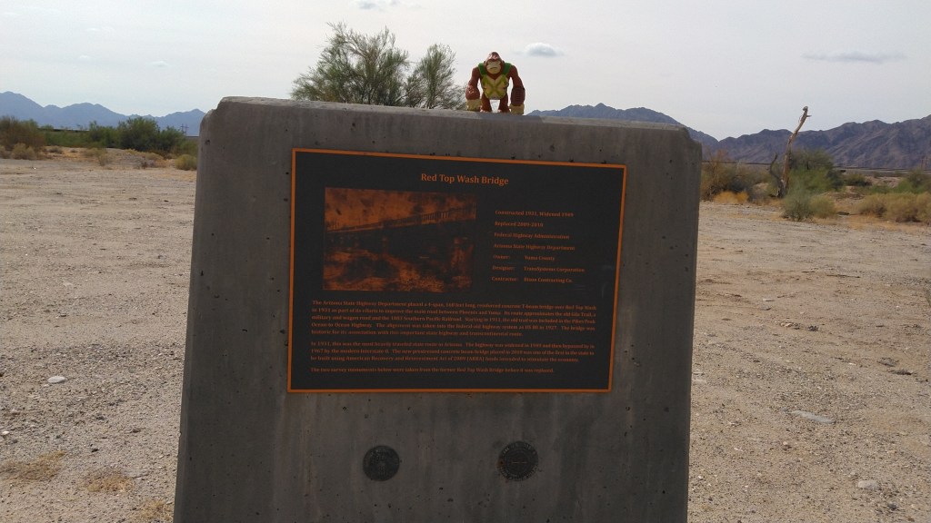
Not all the highway is original. At Rainbow Wash, I stopped to look at the bridge that once crossed the wash, back when this was a maintained coast-to-coast highway. That bridge is a hunk of concrete on one side of the wash. Beside it, the asphalt of “old” US 80 crosses the bottom of the wash, and if that’s flooded, you will have to go over to AZ 85 on the other side of the canals.
In the 1950’s, US 80 was re-routed to follow the route of what is now AZ 85, the connector highway between I-10 at Buckeye and I-8 at Gila Bend.
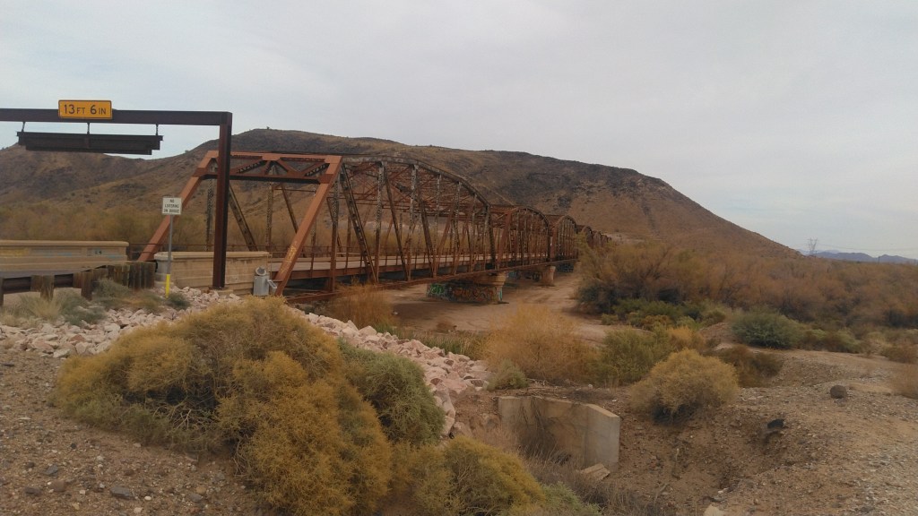
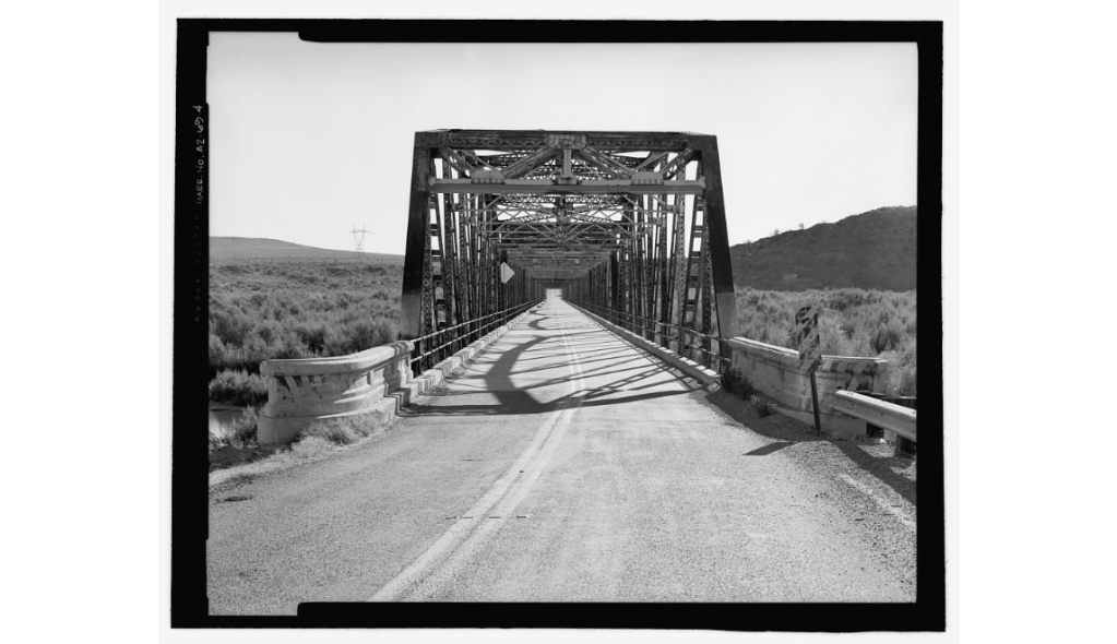
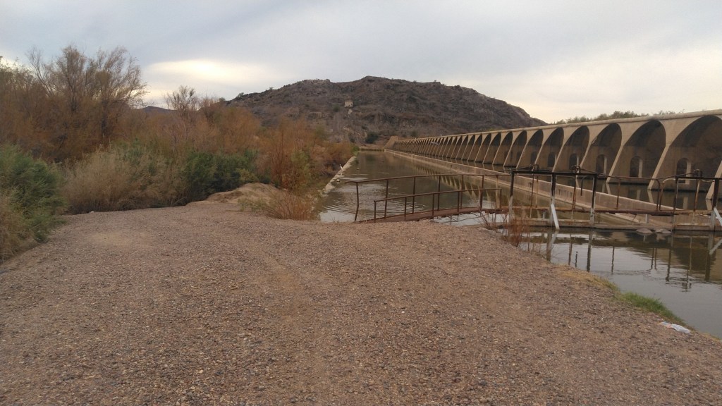
The road bends west until it crosses the Gila River (bed) at the historic Gillespie Dam Bridge.
The bridge
The Library of Congress notes:
Prior to completion of this bridge in 1927, traffic on the Pikes Peak Ocean-to-Ocean Highway at this point was often halted by flooding on the Gila River. The Gillespie Dam Bridge was this strategically important to Arizona transportation in that is finally allowed all-weather travel over this vital transcontinental route. Technologically, the bridge is noteworthy as one of the longest vehicular structures in the state. … In almost unaltered condition today, the Gillespie Dam Bridge is one of the most important examples of early bridge construction in Arizona.
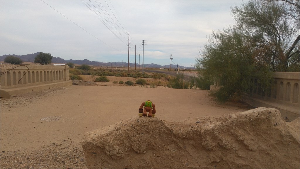
To the north, as you cross, the ruins of Gillespie dam marks the spot where the Gila river, as an actual flowing river, dies. To one side, stern fencing isolated the ports where the water flows into the machinery of irrigation. No fence stopped me from exploring the partially ruined dam on foot, among the frogs and waterfowl.
The old Highway carries on, of course, hooking around to the east through various farming hamlets until it finally intersects with its replacement, AZ85, which takes you to the coast-to-coast highhway’s ultimate replacement, the mighty I-10.
A few weeks ago, taking the back way down from Prescott, I stopped at the Granite Mountain Hotshot Memorial off of AZ89. The State Memorial Park is located on the second serpentine wind down the mountain that separates Yarnell from Congress. It is most easily approached going south. AZ89 is split here, and you would have to U-turn past the site going north to come back and reach it.
There you will find parking for about a dozen cars and “restrooms”, meaning plastic outhouses.
Or you could take a map
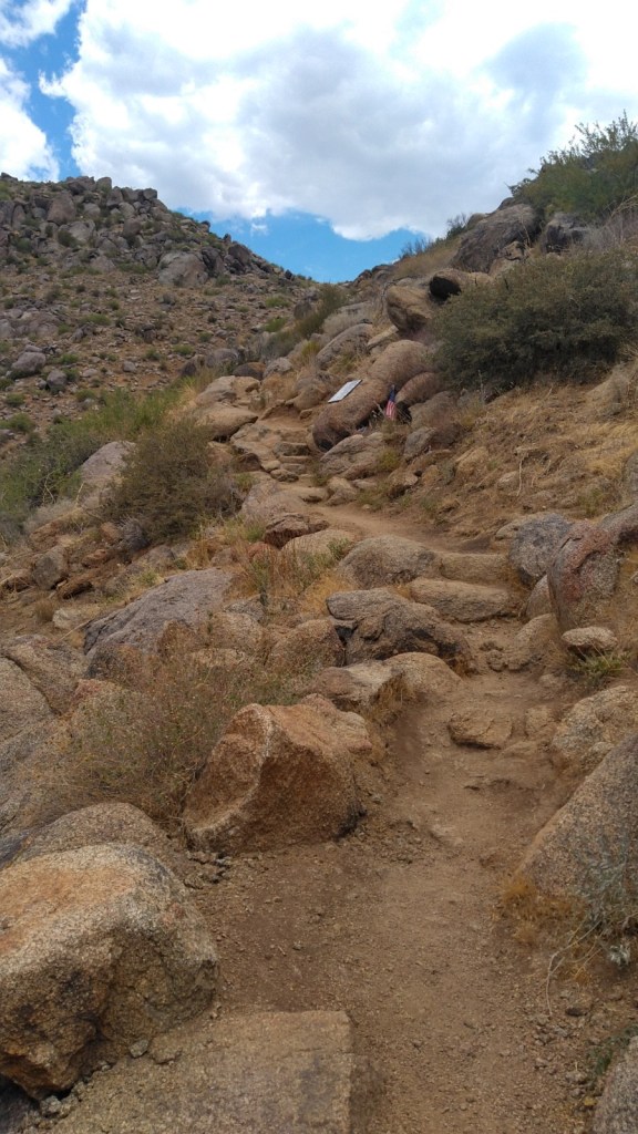
The main trail is just shy of three miles one way winding up and around the desert ridges. You can expect all the low desert hazards and all the low desert heat. The grade is gentle but constant as the packed dirt path switches back and forth across the ridge, perhaps more times than is really needed. On occasion, stone stairs will help you up or down.
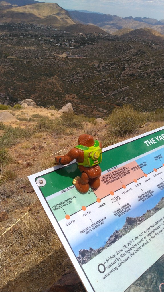
Along the way are shiny, stainless steel plaques commemorating each firefighter who died in this catastrophe, as well as plastic plaques explaining the history of desert fires in general, and the Yarnell Hill Fire in particular. There are also benches.
If you took a free map from the container at the trailhead, you can easily follow your progress up the 2.85 main trail by plaque. I’m not going to recount the well-known tale here. The park website repeats all the verbiage on the plaques.
If you need to know more right now, this article is a good over-view without being gushy local news or terse and technical fire-speak. You could also read the actual report it references. Meanwhile, we are hiking.
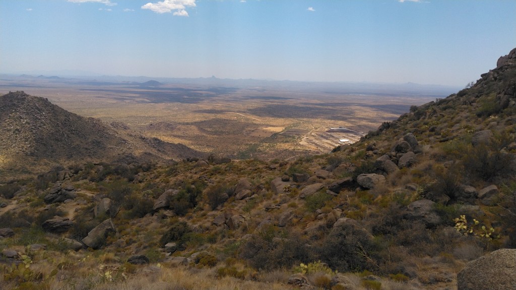
View from the trail
Were it not for its grim purpose, the Hotshot Trail, as it is designated, would actually be a pleasant climb through a fine collection of rocks and cacti. Climbing up the ridge reveals consecutively grander vistas of the valley below. On my trip lizards scampered away from my feet as hawks circled overhead. But then I came to a glaring plaque (the afternoon sun makes them signal mirrors) and joy yielded to grim purpose.
The Yarnell Hill Fire ended for a generation the debate as to whether Prescott (where the GM Hotshots were based) and surrounding communities should publicly fund wilderness firefighting. There had been loud talk of leaving all of it to the feds. After the fire, state and municipal money carved this fine, if sad trail up the ridgeline.
The Hotshot Trail ends at an Observation Deck overlooking the site where the 19 men actually burned to death. A large plastic plaque explains how that happened. There is a bench and shade and a tribute wall decorated with a multitude of firefighter patches along with other mementos.
The much steeper Journey Trail continues from this point, tracing the route the Hotshots took down the ridge to their doom. It drops about 500 feet in one mile to reach the actual memorial. I was out of water at that point, so I turned around at the observation deck.
A week later, hand to God, I stumbled upon the movie based upon this group and their sad end, Only the Brave. It is actually well done.
If you visit this site, go in the morning and don’t go in summer. The desert wants to kill you even when its not on fire – don’t make it easy.
In April of 2018 I scored a permit to camp inside the Point Reyes National Seashore just north of San Francisco. There are no drive-in campsites in Point Reyes; they are all walk-in or boat in. In the case of the Glen Campground, where I had a ($20) permit, this meant about 5 miles from the visitor center.
Just long enough to call it backpacking.
The Bear Canyon Visitor Center is everyone’s first stop, being where the permits come from, and correspondingly crowded. Get beyond it, and the little maze of day-use trails wandering around the picnic grounds, and the crowds started to thin, even on a Sunday afternoon with good weather.
I headed south(ish) along the Bear Valley trail until I realized this dirt road is everyone’s day hike. So I cut to the right, west, up the Meadow Trail. This spur trail cuts steeply uphill to the Skyline Trail, which bisects the main ridge forming the peninsula.
Pretty typical…
The heart of Point Reyes is Inverness Ridge, which has been separated from Bolinas Ridge on the coast be the San Andreas fault. To the north end of the peninsula, that fault line is submerged by Tomales Bay. To the south it runs roughly under Highway 1. Point Reyes is a couple notches of Richter Scale away from being an island.
The thick canopy of trees and brush are all part of the Phillip Burton Wilderness, which actually encompasses about a third of the total peninsula. The rest is extant private ranches and a scattering of state and local parks.
It felt strange climbing the hill, until I realized that I was still at about 700’ total elevation. The atmosphere was still thick. And humid – I soaked everything in sweat with temps in the low 80’s.
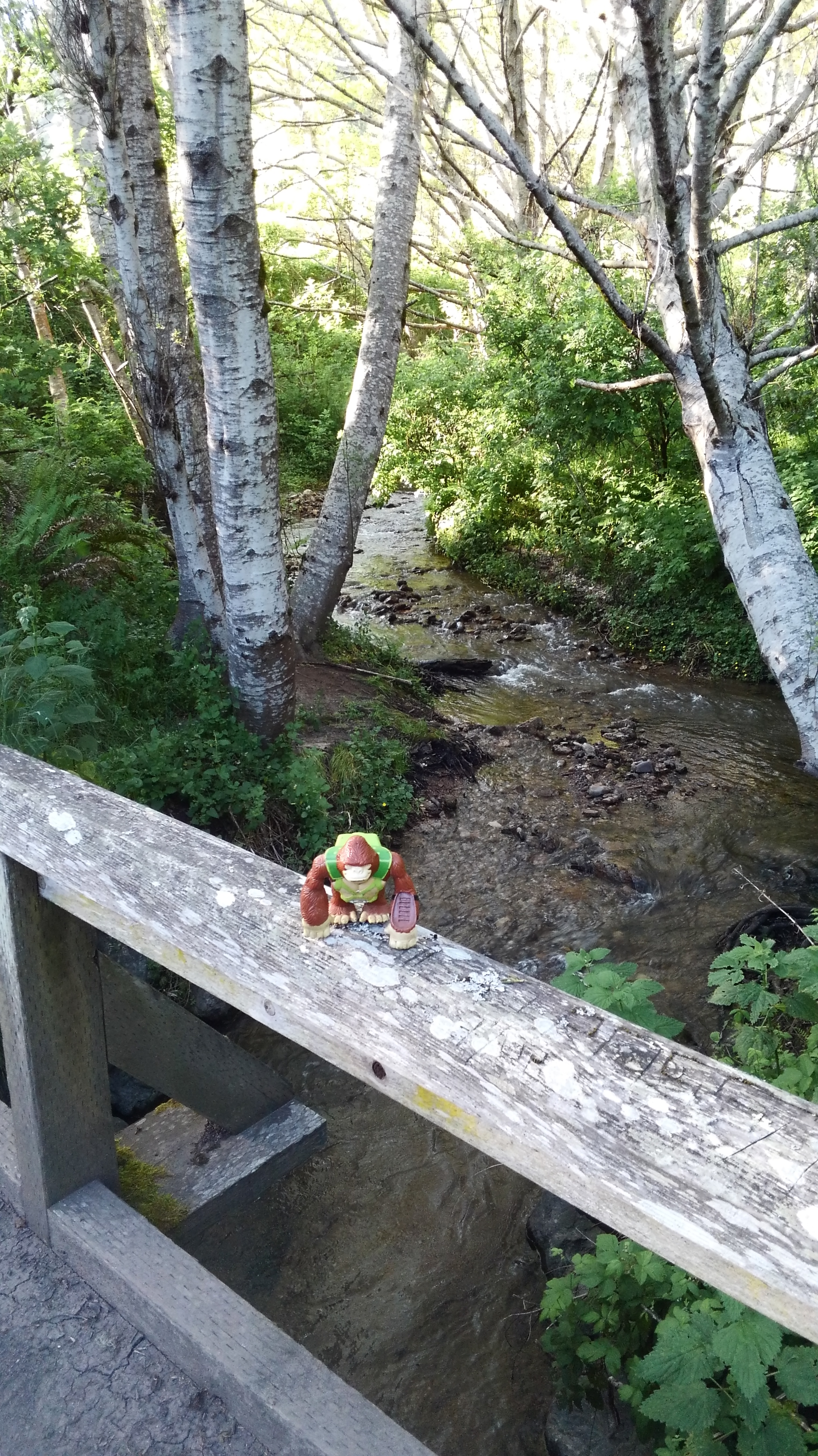
About a mile and a half past where I picked it up from the Meadow trail, Skyline winds down the west side of the ridge towards but not to the Pacific. The trees open up, and you are in for a heavy dose of sea breeze and sunlight. It cuts back inland to cross Coast Creek via a wooden bridge. I snuck off to the side here,and found a place to force my feet into the frigid creek.
The bridge across Coast Creek
I wasn’t at blisters yet, but I could feel them coming.
Work boots aren’t hiking boots. Good Advice from Direct Experience.
Happily, I was less than a mile at that point from Glen Camp, though I likely hiked 6.5 miles overall taking the scenic route.
The walk-in campsite has twelve designated sites fanning out from a vault toilet. Each campsite has a table, fire ring and an enclosure to protect your food from ambitious raccoons. There is also, unpublicized, a water spicket available for use. I had to hang my hammock over some pretty steep hillside, but otherwise had no complaints.
Glen Campground – site 12.
In April, the overnight low reached the low 40’s, maybe upper 30’s. I had to use all my layers.
In the morning, after a leisurely – for me – breakfast, I conceded to my blisters and took a more direct route to the wide and sunny Bear Valley trail. With the ridge to my west, and Divide Meadow refusing to block any morning sun to my east, and limp-marched back to the visitor center.
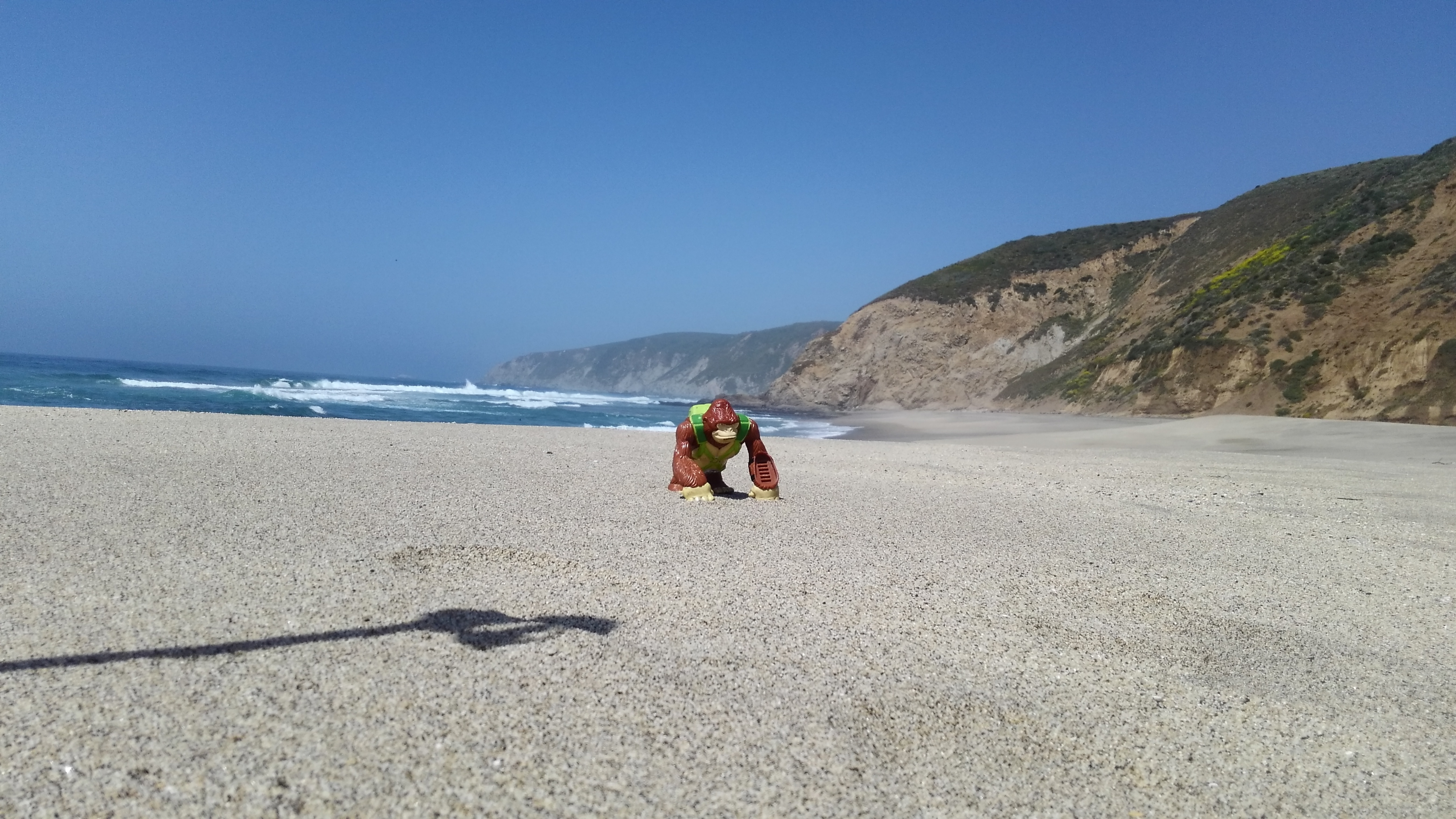
Even at that pace, I had time to drive out to McClure’s Beach towards the north tip of the Peninsula. You reach it via a narrow road winding sharply through prairie covered hills, where you are not likely to get out of 4th gear. The short trail follows a drainage to a wide beach flanked by tide pools. Worth it even with blisters.
Bongo at McClure’s Beach
Worth it more: the bar in Olema, the tiny town that guards the entrance to the park, where I had oysters and whiskey for a late-late lunch. Cannot recommend that sort of thing enough.
So, Easy, Scenic and Fun. The hard part is getting there – and totally worth it.
[This repeats information in the page of the same name, but we start somewhere, right?]
When I used to take my son hiking (he’s grown now), reliably, about a third of the way into the hike, he would ask me, “Are we lost yet?”
What I love about that question was his certainty that if we were not lost now, we would eventually become lost.
He was right more than he was wrong.
I am, among many other things, I writer about outdoor destinations and activities, particularly hiking. Part of my job, I think, is to get myself lost so you don’t have to.
This is a continuation of a blog of the same name that was once hosted by the publisher of two of my hiking guides. That blog no longer functions, for reasons they cannot explain to me, and cannot update it, or retrieve my material, or anything.
Thus, I created this site, to continue that work, without dependence on an outside party – even one that has a clear interest in maintaining a public forum for their authors.
We are going to discover hiking trails, of course, and other outdoor destinations and activities as I feel are of interest. I will also review gear from time to time, particularly gear I like. At this writing, any such gear would have been purchased by me for me. I will announce upfront if I somehow become sponsored or even comped.
Between those items, I intend to rescue some of the better material from the old blog.
The goal is new items every Thursday. Backlog on Tuesdays.
Unless I get lost.
Which happens.
Bongo
I often include Bongo in my photos. Bongo is a Fisher Price Rescue Hero originally named “Swinger”. So Bongo Swinger? Sure.
I have lost the grapnel accessory. And this is actually the second one (I lost the first one). Someday I might lose this one, which would be sad, because they don’t make them anymore.
I use him in place of a lawn gnome. You’ll see him in photos from time to time.