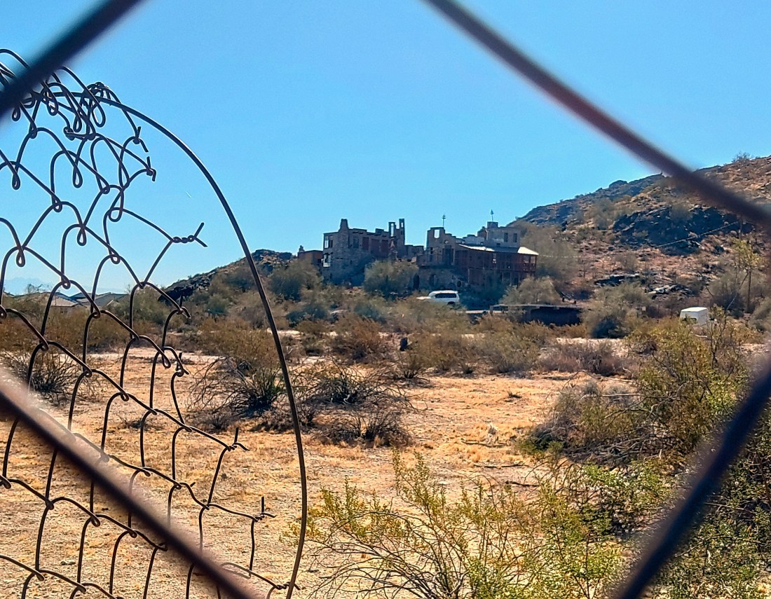
If you drive south on 7th Street until it hits South Mountain then make the left on Mineral Canyon Road, you will find Mystery Castle. Like many cities, Phoenix has a few bits of inexplicable architecture, some of which is open to the public. Mystery Castle was one of those places until the pandemic.
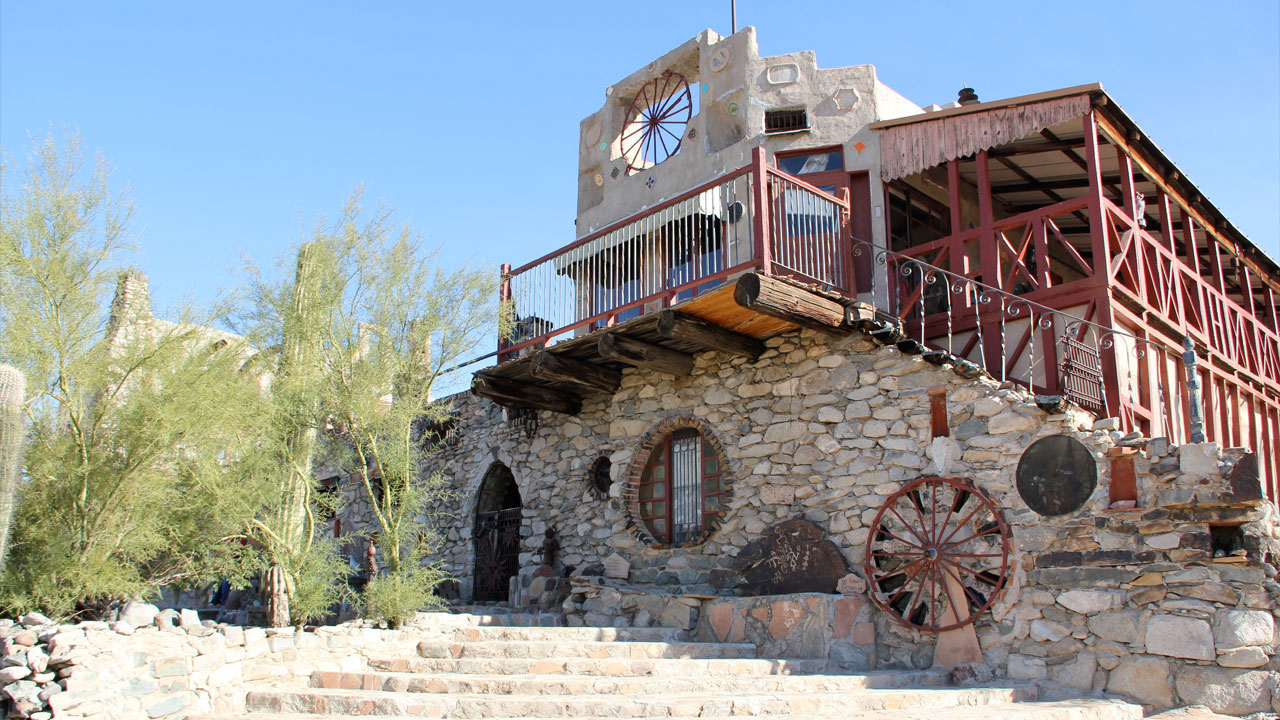
Mystery Castle in better days
Boyce Luther Gulley, who built this thing, without any notable training in construction or architecture, moved to the Valley for familiar reasons: tuberculosis, and a nasty divorce. He acquired the 7 acres at the base of the mountain in 1940 and began work on his fever-dream of a house using found materials and often his own labor. He kept at it until his death in 1952.
His daughter, Mary Lou Gulley, inherited the castle, resided in it, and opened it up as a tourist/event location, and continued like this until her death in 2010. It passed to a private foundation, the Friends of Mystery Castle, but they were not able to cope with the pandemic and vandalism and the property has been closed for several years. It was finally put up for demolition.
Best view of the Castle today
Enter the Candy Man.
I met the Candy Man at a community forum at the South Mountain Library on May 2nd.
First, he was introduced by R Brooks Jeffery, the consultant hired by Friends of Mystery Castle as a consultant to manage the vetting of new ownership for the castle. The overall goal he explained, with supporting power point slides, was to find an owner willing to transform the property into a “publicly accessible asset”.
They needed someone with a:
Plan
Track Record
Resources – meaning money.
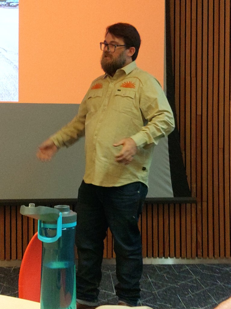
Eric Harrell explaining his vision at the forum.
The found themselves a candy man – Eric Harrell, scion of a small candy fortune, and on the side restorer of old things. He bought the property in early April. He has previously resurrected such properties as 911 Vineland in Phoenix, the Grand Theater and Gadsen Hotel in Douglass and the Butterfly Inn in Sedona because “I always love historical stuff…”
Harrell expanded, “For this to work there has to be some kind of homogeneous terra firma with the surrounding community.”
His plan:
Restore the Castle to a tourable house/museum
Convert part of it to a guest house for an artist-in-residency
9000’ sq event center/marketplace
4-6 rental cabins, 2 bedroom about 600’sq.
Parking for above.
Onsite caretaker.
Preservation measures for the existing rock art at the east end of the property.
They are in the survey phase.
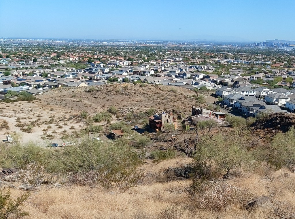
The Castle and surroundings
The Q&A that followed Harrell’s ad-hoc presentation centered mostly on the residents of the local housing developments worried about parking overflow from the Mineral Springs “trailhead”. Harrell had no answer for that other than he might open some Castle parking for that purpose.
Phoenix Vice Mayor, Kesha Hodge Washington, who also represents this area on the Council, was on hand and went to the front to provide a few non-answers for this ongoing and 100% city issue. The “trailhead” here is a different article.
It may be that Mystery Castle and it’s possible future parking provides that answer. But it doesn’t have to. That’s on a long list of questions about this property the answers to which are “we’ll have to wait and see.”
Near as I can determine, you pronounce Ma Ha Tuak just as written. It shares the name of the mountain range it partially circles, and the older Ma Ha Tuak Trail, a connector trail that goes due south up the mountain. They are both well marked. Seek the word “Perimeter”.
The Ma Ha Tuak Perimeter Trail, in its entirety, connects the 19th Ave Trailhead with the San Juan Lookout a distance of 7.8 miles. This description covers the route from the 19th Ave Trailhead, with parking, trash and a water fountain – but no restrooms to the 35th Avenue trail access point (because it would be a stretch to call it a trailhead) over just over 5 miles.
Phoenix Parks has almost no documentation on this recent addition that they clearly worked hard on. It is not on the current trail map. You will find portions of it on older trail maps as the East Laveen trail.
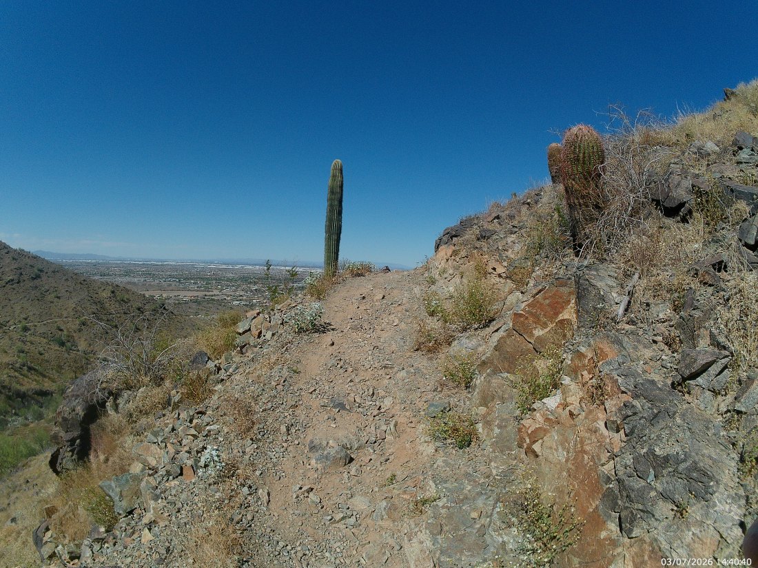
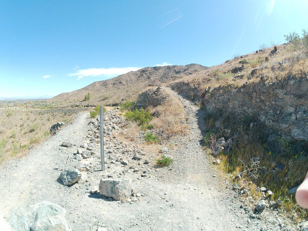
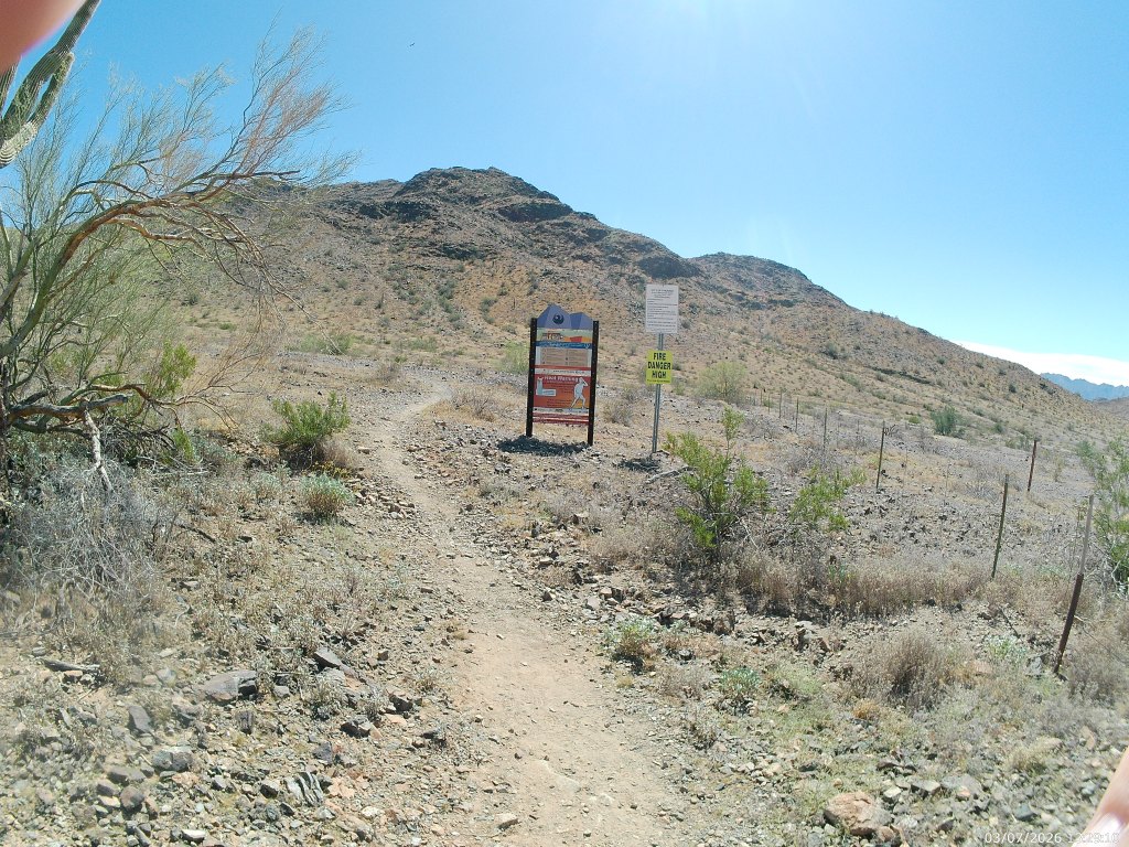
At the trailhead, find the sign with the word “Perimeter”. It will be towards the west end of the lot, and the dirt track it indicates proceeds west from there. It quickly passes a couple of old pit mines and a ruined homestead, and crosses a couple of washes until it turns south to climb a bit up on the slopes of the Ma Ha Tuak Mountains. [We wrote about the geology of these on the Alta Trail description].
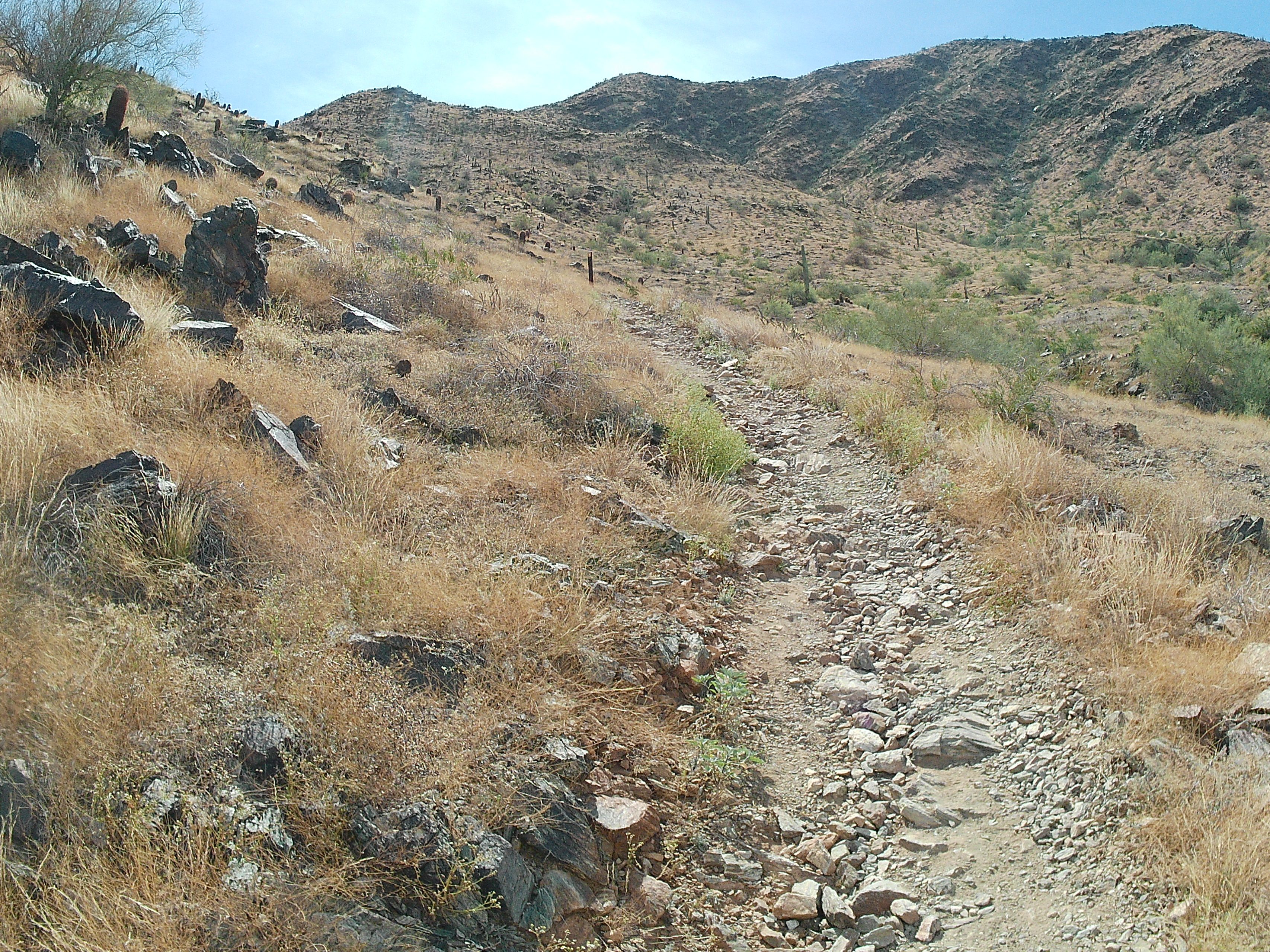
The trail will snake along the ridgeline, through creosote and barrel cacti and young saguaros, with occasion bends to go in and out of washes. Those washes, and the palo verde trees they host, are your only possible source of shade. Not long ago, this trail was one of the most remote in the system, but with the growth of Laveen, use of this trail has also grown.
The East Laveen Trail was primarily an equestrian route for the farmers and ranchers of Laveen Many storefronts, and all of the bars, in Laveen have hitching posts in front, and residents use them.
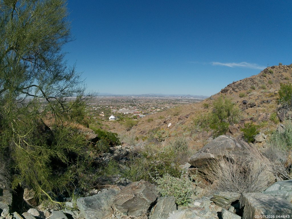
So, yes, that’s Laveen stretching out below you. Beyond the patchwork of small, weird mansions that creep up the slope to the park boundary, the once quiet farming community of Laveen is being slowly eaten alive by gated housing communities.
Laveen is generally defined as north of the mountains, east of the Gila Reservation, south of the Salt River, and west of 27th Avenue – though most locals consider their western boundary to be 19th Avenue – at least south of Dobbins. Sure. Excepting a few county islands, it’s all Phoenix now.
Phoenix grew south and west towards the sleepy village until 1960, when it directly bordered and then started to annex the village. However, up until the start of this century, you could not tell the difference. As late as 1990, only the major arteries were paved, and not paved that well. They did not have municipal water service until this century.
And now the farmland is slowly giving away to remarkably similar single family homes surrounded by walls and moats.
You’ll still see horse-shoe prints, and horse droppings on this trail, but you are more likely to encounter trail runners and mountain bikers. That said, it is still quiet compared to most of the north slope trails. [If you really want quiet, try the Bajada Trail.]
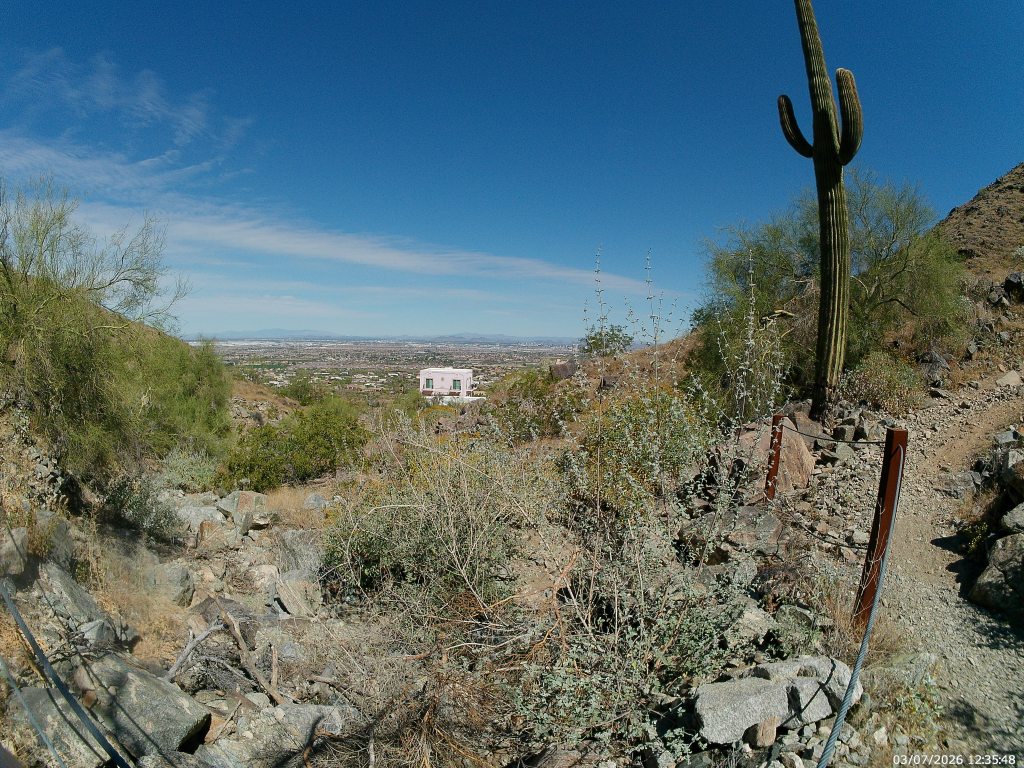
The Pink House (you won’t miss it) is about the halfway point for this portion of the hike. Someone paid extra for the privilege of having hikers stare down into their yard and coyotes go through their garbage. Even at this height you can see most of the west valley in clear weather. They can see it from their upstairs room.
This house is below what I’ve dubbed the 27th Ave Wash (that’s the road heading north into the horizon) where the Park Service has installed railings for reasons I cannot conjure. The trail bends north out of the wash until it clears this little canyon to bend back west.
Less than a mile later, the footpath will dump into a remnant road, and the trail follows that for a half mile until it splits visibly south from the old roadway. The footpath going south, and up, is the trail staying in park boundaries. The straight road west will soon end in private property, though there is clearly common access from the residential Ansell Road.
East end of the split.
A bit beyond that split you will come to the intersection with a short access trail that dumps into the southern terminus of 35th Avenue. While the trail has signed public access, the dirt lot beyond the boundary is basically someone’s extended driveway. I’d feel fine walking across it, or being dropped off here, but I couldn’t vouch for actually parking.
35th Avenue Trail Access
The Trail continues from here, winding south around the western edge of the range and then to meet the National trail near the San Juan Lookout. But here is where I realized I was halfway through my water and turned around.
The entire trail is listed as 7.5 miles in length. I feel this portion as about 5.5. It would be a moderate car shuttle, but a hard out-and -back due to the distance.
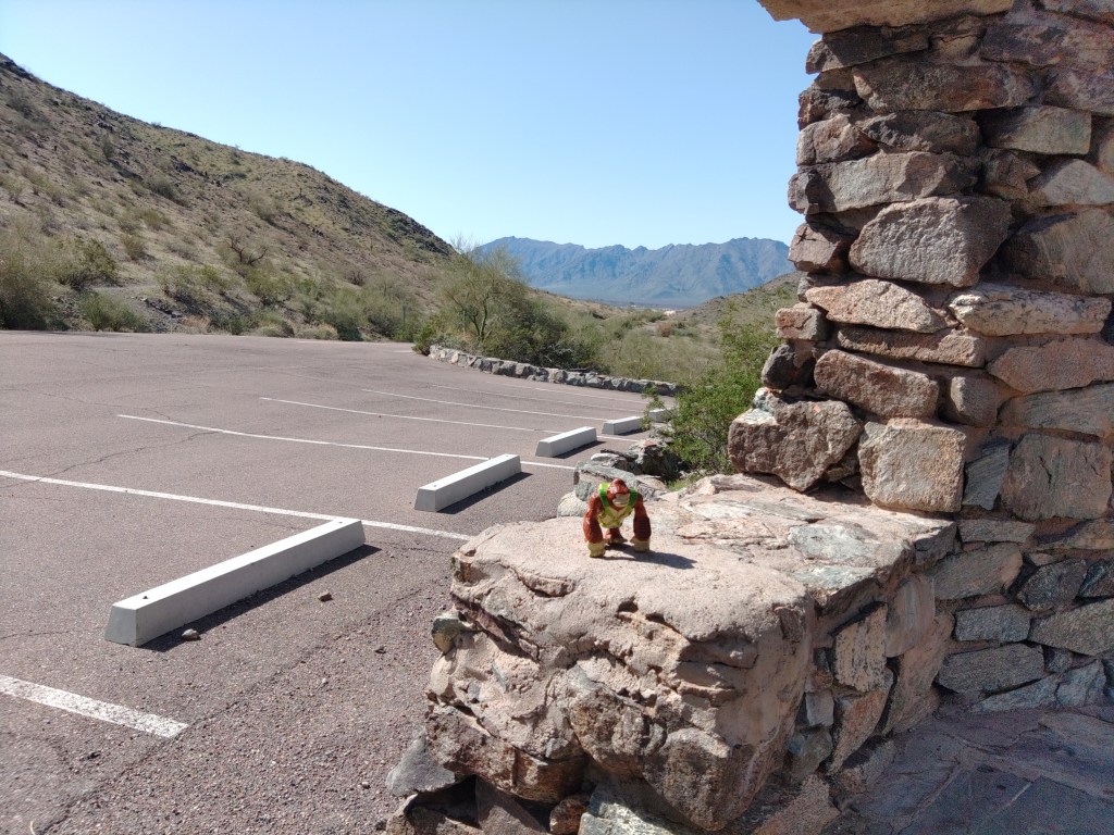
As late as 2015, this small parking lot, complete with a remnant CCC ramada, was reachable by vehicle whenever the park was open. In the day, this was primarily trailhead parking for three main trails: The National or Maricopa trail, the Bajada Trail, and the Alta Trail. To the east, you can see downtown Phoenix through the saddle, but there are honestly better views elsewhere. To the west you could see the still undeveloped farms and deserts separating the South Mountains from the Estrella range.
After sunset, that was all dark, of course, until the freeway and the casino – and still mostly dark. Anyone parked here after sundown was likely more interested in fogging up their windows than looking out of them.
The monsoon in 2015 ended that by washing out part of the access road. The city has taken that opportunity to save a bit of the ecosystem and a bit of money by keeping the road closed except for limited windows ever since.
The view to the east
The paved roadway sans cars makes it a popular destination for cyclists. It is also open to pedestrians, but the Bajada Trail goes the same place and is a nicer hike.
The Curtis Saddle Trailhead, meaning some spots you can park at the dead end of Estrella Drive, lies about a half mile west and downhill. It’s always open.
According to the Phoenix Parks:
San Juan Road: Open from 5:00 a.m. to 7:00 p.m. on the first Saturday of the month and from 10:00 a.m. to 7:00 p.m. on the first Sunday of the month.
I can’t call it the Lost Lookout, as cool as that sounds, because you can see it from the street.
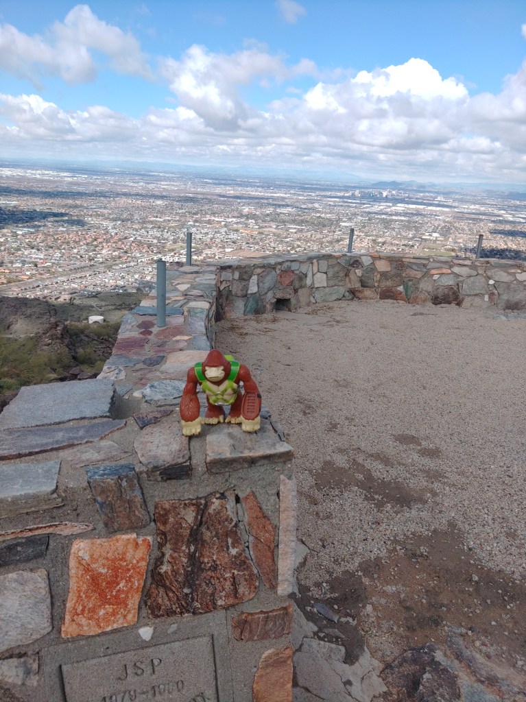
Bongo found the lookout.
As I stare at the Phoenix South Mountain Preserve, the ridgetop immediately east of Dobbins Lookout also has a stone structure upon it that I can see from my house. As a side-quest to the Holbert Trail I decided to seek it out.
To reach it, I followed the Holbert Trail south and up, past the Dobbin’s Lookout connector, and up to Buena Vista Road. I then followed the actual road east for a few hundred yards. Before you get to the junction with TV road, you will encounter a guard rail on the north side of a gentle curve across a relatively level ridgetop. This is not necessarily to keep careless drivers on the road. This is to keep curious drivers off the remnant road running north of here.
Well, I’m a pedestrian. So I went around the rail and south along what was vaguely a remnant road flanked by small palo-verde trees and young saguaros. The oldest of the saguaros guards the destination about a half-mile from the road, but you’ll see the big double-hoodoo first.
Approach from the road.
The remnant road climbs the hill, past the hoodoo to empty into what was clearly a vehicular parking/overlook with space for maybe 10 cars.
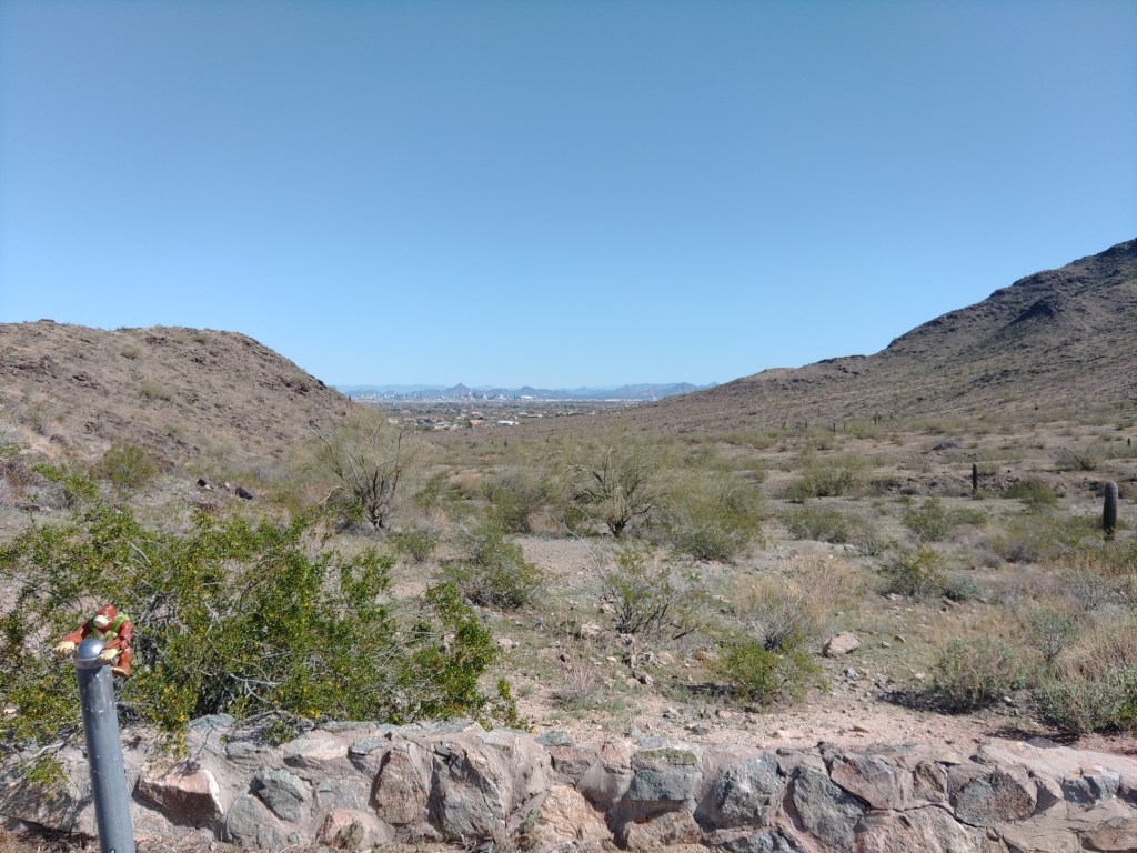
Panoramic view
The topo map has the elevation at 2246’ above sea level.
I believe, based on inferences, but not direct references, in old city planning docs, that this was called Holbert Overlook. The concrete stamp on the west side declares it was built by JSP in 1979-80 for the City of Phoenix. Its is referenced in the 1989 city master plan for the preserve.
D3 – The North Overlook area near the Summit of the Gila-Guadalupe Range. Containing Holbert and Dobbins Lookouts, with access to Buena Vista and Gila Overlooks, this sub-zone will continue to receive large numbers of visitors. Overlook sacrifice zones should be defined and edged with compatible barrier treatments.
Or abandoned and forgotten apparently. It does not appear on the 2007 trail map, or any map afterwards.
The road, though, appears on the 1952 USGS topo map.
All searches for Holbert Lookout will produce results for the trail. The lookout was abandoned before the internet was useful, so sometime in the 1990’s. I’ll update this article if I find an answer to that.
Meanwhile, I had the place nearly to myself. The other guy was also making a video, though in Spanish. He climbed the hoodoo. I did not. But I enjoyed the view until the rest of my hike called me away.
Max Delta is an entry level trail through the entrance of the preserve. It is named after the mine shaft that lies buried and officially off limits towards its southern terminus. That is another article. This is just about the trail.
From the trailhead at the entrance (across from Scorpion Gulch) the flat, wide trail winds west then south, narrowing as it climbs up the ridgeline it will follow for half its’ distance. Your first landmark is a monument and plaque commemorating the city elders who re-designated the park into a Phoenix South Mountain Preserve.
If you’re new here, Phoenix was founded by developers who eventually become old and rich philanthropic preservationists determined to protect the precious desert from the new wave of developers. Somewhere in the 1970’s, 1973 – by the plaque, the old developers city elders started designating the “park” as a “preserve”.
Litigation followed. But here it is, still more -or-less preserved.
Heading south, the trail intersects with the interpretive trail behind the old visitor’s center. This is one of the last of the original CCC buildings that still sees actual use. Looking out, you can easily see the new visitor center in the distance, and the work compound just across the street. The old administration building still has restrooms and water available to the public. The small ranger office and gift shop it once house have moved elsewhere.
The gunfire you hear from the far side of the ridge is not random. There is a gun range on the other side, both the private Phoenix Rod and Gun Club and the Phoenix Police training range. These have been here since 1948, when these slopes were still a “park”. They expanded somewhat contentiously in the 1990s, closing the trailhead on the terminus of 7th Ave at Olney.
They are not supposed to shoot hikers, even accidentally, even hikers off the trail, but the party investigating will be the one most likely to have shot you, so stay on this side of the ridge.
Climbing down from the ridge you cross low hills with patches of barrel cacti, then saguaro then teddy-bear cholla. The trail goes down into a wash and Y’s on the far side. Max Delta proceeds south, to your right. To the left, the trail crossing the road is the Derby Trail aka Los Lomitas. You can take that turn and shave a good 40% off the loop hike. But for now, we follow the Max Delta.
The dirt turns grey as the trail crosses the arroyo, finally a bit away from the road. You will cross another road, along with numerous washes, but it gives brief illusions of crossing open desert. Look for mine pits along the way.
The gates were closed at the San Juan Bike Hub, as this was not the first weekend of the month. It’s not closed to people, but certainly closed to vehicles. Even on the special weekend, it just affords closer parking to those who want to hike or bike down San Juan Road – which is another article. There are some amphitheater seats which were not shaded in the afternoon by the large metal canopy, a trash receptacle, and a good number of empty parking spaces for both bikes and cars. I was the only person there when I arrived, and took a break there, surrounded by this rust-colored monument to municipal expenditure.
Then I proceeded east down the Bajada Trail to continue on with the loop.
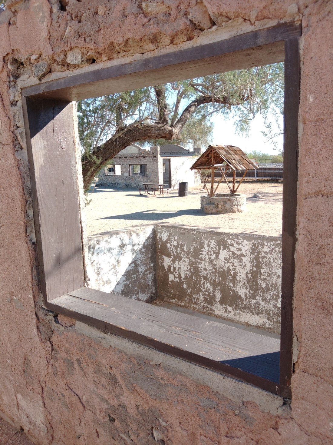
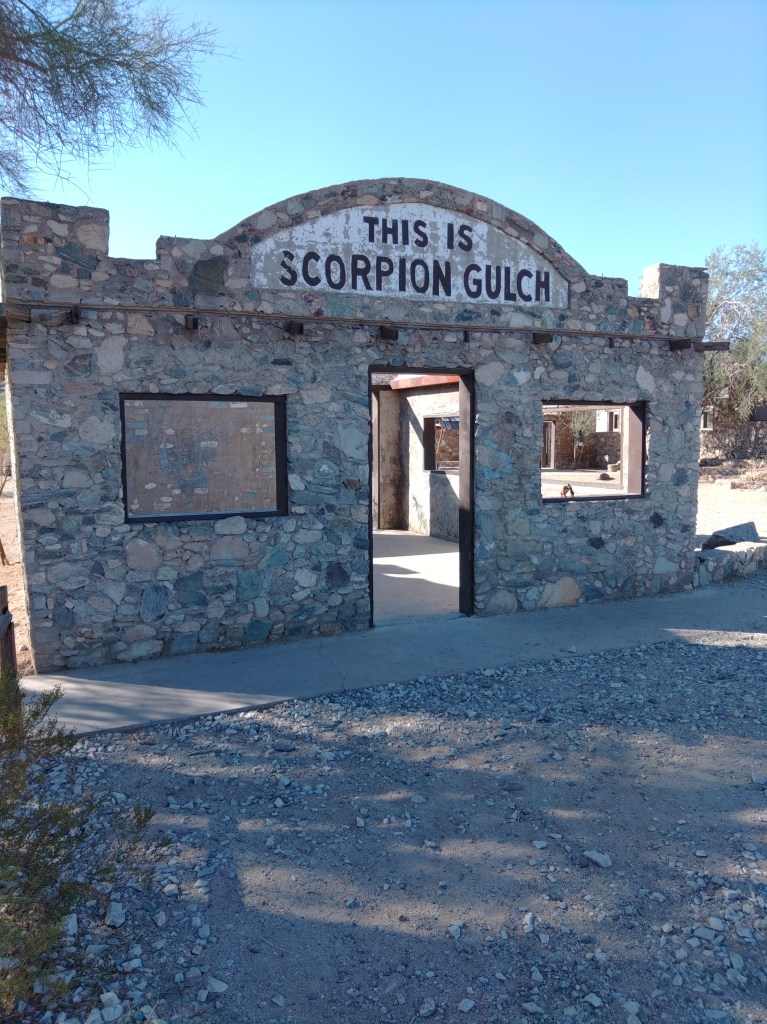
Near the main park entrance stand the stone remains of Scorpion Gulch. Visitors are free to wander in and around the two stone buildings and the dirt area between them. It is quite popular for photography, especially at sunset.
William Lundsford – Phoenix Gazette 1966
Scorpion Gulch was built as the home and the storefront of William Lundsford, who first came here with the CCC. Lundsford purchased 100 feet of frontage road in 1936 and built these structures with his own hands. For decades he ran a curio/gift/convenience store along with a cactus garden. According to an oft-quoted 1966 Phoenix Gazette article, the local kids (presumably of what was then the small town of Laveen) called him “Grandpa”.
While Lundsford claimed to have the copyright on “Scorpion Gulch” named for the prefusion of scorpions that could be found in the wash beyond, most of the early photographs show a sign saying South Mountain Trading Post. They also show it with a roof.
After Lundsford passed, the building was briefly a bar in the 1970’s, abandoned, and then became annexed into the park. The city “stabilized it” in 2012, removing what was left of the crumbling roof and adding some strategic concrete reinforcements.
After finishing day-job business early in Yuma, I realized that I did not want or need to take the [yawn] I-8 to AZ85 to I-10 back towards Phoenix.
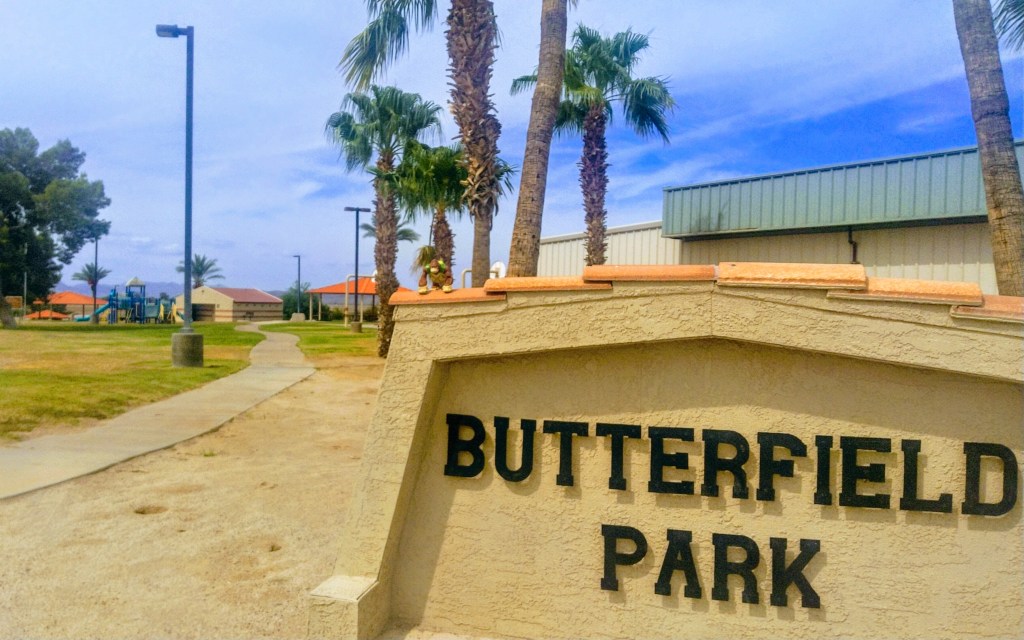
Interstate 8 replaced the old US 80 through this part of the state. US 80 replaced the Butterfield Stage Route. The actual Butterfield stage only ran a few years (1857 to 1861), but their route held onto the name. It was the wagon route from Phoenix to Yuma.
Bongo in Wellton, AZ, on old US 80.
The stage route benefitted from the work of the Mormon Battallion who beat the path from Santa Fe to San Diego, including what had long been known as the Gila Trail to Spaniards and other locals.
It’s flat desert. Follow the river as long as you can until you have to cut across to the mountain pass. Not a lot of cause for innovation.
This obvious route became part of the Dixie Overland/Lee/Bankhead/Ocean to Ocean/etc. Highway by the 1920’s, when the Feds, finally taking an interest in highway construction, decided they needed numbers. The number for this jumble of routes was initially US 80.
As Us 80 meandered across the state, if followed the old wagon route (as did the railroad line) until around what is now Gila Bend, where it bent north towards Phoenix. The original stage route bent southeast towards Tucson. Phoenix was barely a settlement in the 1850’s.
Butterfield wagon ruts are long gone, but parts of actual US 80 exist, much of it as an access road along Interstate 8. We start along there.
At Telegraph Pass, I-8 winds through the Fortuna Foothills to descend into metropolitan Yuma. These mountains are prime habitat for both Border Patrol and the Arizona Highway Patrol. Just saying. US 80, as an actual paved road you can drive, starts on the east side of this pass at the Ligurta exit.
I had lunch at some small place in Wellton where I ate my fast-food quality sandwich while trying not to listen about the Local Loud Trumpster expound on his theories to two poor women listening politely. I was happy not be included in that conversation. (I have different ideas). I was happier to leave.
Parallel to I-8, US 80 is a two lane highway with a speed limit of 65-ish. To the south, train tracks and beyond, the mighty interstate. To the north, you can see what farming in the southwest desert looked like right before the water ran out. North of that is the zombie bed of the Gila River.
We didn’t write about this little landmark, but you can read about it here.
The quest for Wellton Pond
I came across a sign saying Wellton Pond 10 mi. Had a little fishing symbol. I was ahead on time, so I took the right off of Old US 80 on Avenue 45E and headed due north for about 6 miles, crossing the Gila River bed. Following another sign, I took the right (east) on County 2nd Ave for another 5 miles until I found the pond at the junction of 2nd Street and Ave 50 East.
Wellton Pond is not on the map. Following signs as I did is about the only way to find it. It is a small hole full of water, choked by a wall of brush. I do not know who owns the property, but there were no barriers to access other than the brush. People clearly fish here. The farm field adjacent had an outhouse, for which they have my gratitude.
Once I had satisfied my curiosity with the pond (perhaps so you don’t have to) I continued east on 2nd Street until it bent south, becoming Avenue 52 E and, once back across the Gila, graded dirt until its eventual terminus with Historic US 80 just as that terminated back into Interstate 8 near the Mohawk rest area.
Bongo finds Wellton Pond so you don’t have to.
Sentinel
This is one restaurant that did not close due to COVID.
Sentinel proper is north of its exit from I-8, but the part I visited was to the south.
In truth, I wanted to see the Sentinel Plain Volcanic Field, but most of that is on the wrong side of the fence, inside the bombing range. You might be able to do this with a permit. I wasn’t that curious.
Back at the highway, though, you can see the remains of the Sentinel stage stop that once served bad food and brackish water to the brave passengers of the Butterfield Stage Line.
There is apparently more on this across the highway in Sentinel proper (which consists of like 6 buildings) but I had squandered too much time looking for a tiny pond.
US 80 north
Old US 80, as a separate highway, resumes on the east end of Gila Bend (past the Space Age Lodge), winding north along its original route west of the Gila River. Once again, you drive along the two-lane highway with the honor system as a speed limit, though pavement conditions will punish you if you try interstate speeds.
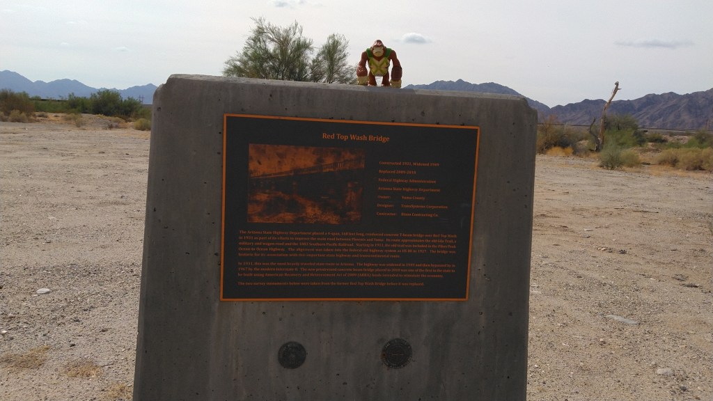
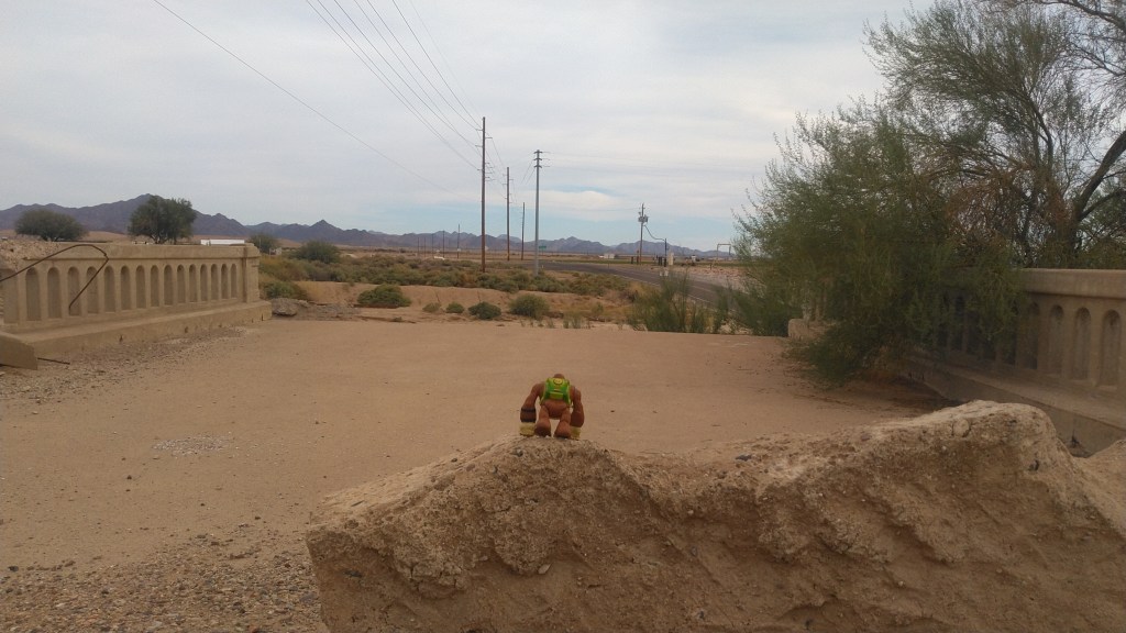
Not all the highway is original. At Rainbow Wash, I stopped to look at the bridge that once crossed the wash, back when this was a maintained coast-to-coast highway. That bridge is a hunk of concrete on one side of the wash. Beside it, the asphalt of “old” US 80 crosses the bottom of the wash, and if that’s flooded, you will have to go over to AZ 85 on the other side of the canals.
In the 1950’s, US 80 was re-routed to follow the route of what is now AZ 85, the connector highway between I-10 at Buckeye and I-8 at Gila Bend.
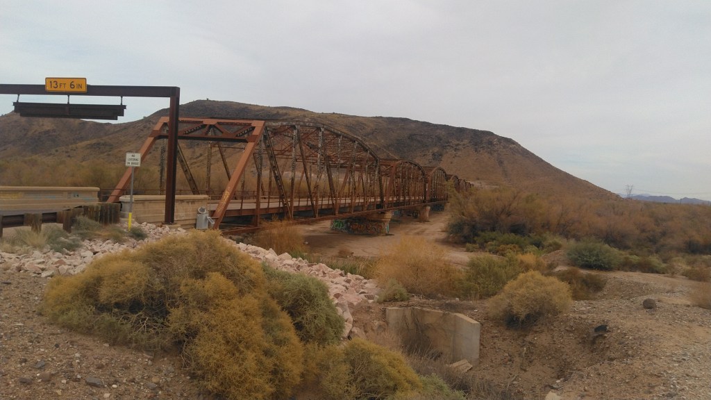
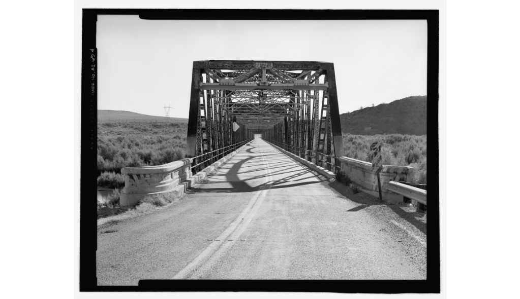
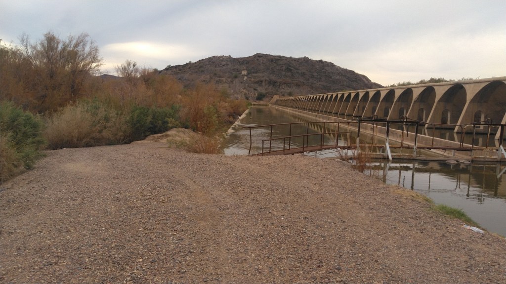
The road bends west until it crosses the Gila River (bed) at the historic Gillespie Dam Bridge.
The bridge
The Library of Congress notes:
Prior to completion of this bridge in 1927, traffic on the Pikes Peak Ocean-to-Ocean Highway at this point was often halted by flooding on the Gila River. The Gillespie Dam Bridge was this strategically important to Arizona transportation in that is finally allowed all-weather travel over this vital transcontinental route. Technologically, the bridge is noteworthy as one of the longest vehicular structures in the state. … In almost unaltered condition today, the Gillespie Dam Bridge is one of the most important examples of early bridge construction in Arizona.
To the north, as you cross, the ruins of Gillespie dam marks the spot where the Gila river, as an actual flowing river, dies. To one side, stern fencing isolated the ports where the water flows into the machinery of irrigation. No fence stopped me from exploring the partially ruined dam on foot, among the frogs and waterfowl.
The old Highway carries on, of course, hooking around to the east through various farming hamlets until it finally intersects with its replacement, AZ85, which takes you to the coast-to-coast highhway’s ultimate replacement, the mighty I-10.
West Pinto Trail #212 in the Superstition Wilderness is an easy (by Supes standards) hike into transition/riparian habitat without requiring expeditionary resources. It takes a bit to get to the trailhead, but that trip is actually (and literally) half the fun.
The eastern portion of the Superstition is the higher and more remote half. What it lacks in developed trailheads, crowds, cholla and mythology it makes up for with peace and occasional shade. I hiked this on an April Saturday, and passed some folks on the road, but met no-one on the trail.
To start with, US 60 east of Superior is one of the best drives you can take on pavement. Past Top-o-The-World (this is a town) a bridge crosses the deep canyon formed by our destination. On the far side of that bridge to left turn lane leads to FR287. The pavement here soon turns to graded dirt as it wanders through active mining country en-route to the wilderness.
The mines move big piles of rock around all the time, and then re-direct FR287 around those. This leaves maps and directions useless. Google regularly suggested I turn left, which would have been over an embankment and into a steep ravine. The mines have marked any road you are no supposed to take. Go slow, follow the signs, you’ll make it with or without maps or directions or a patient voce in your dashboard suggesting trying to get you killed.
A Y intersection at about 7 miles in marks the transition from mine country to actual Tonto National Forest. Go right, across the narrow bridge to FR287A. A sign will warn about single lane with pull-outs. Yep. Go that way.
Transition to scrub
The road benefits from a higher clearance vehicle, but you will never use 4WD even as it winds around the canyon walls. Most of the way the road will be the same color as the cliff on one side, and the ravine to the other: red, grey, greenish grey, white. You will pass the transition zone between high desert and low scrub, with saguaros growing right next to juniper trees. The switchbacks mean you are close. That flat spot at the bottom of the canyon ahead is the remains of Miles Ranch. This is where 287A effectively dead-ends.
There are two effective trailheads at Miles Tarilhead, located among the remains of the old Kennedy Ranch. The official one is poorly marked. Look for the Superstition Wilderness wood-cut sign across the road from the Miles Trailhead sign. The actual trail is just beyond, climbing the hills westward into the scrub oak. This wanders up and down the side of the hill until the junction with Bull Basin Trail.
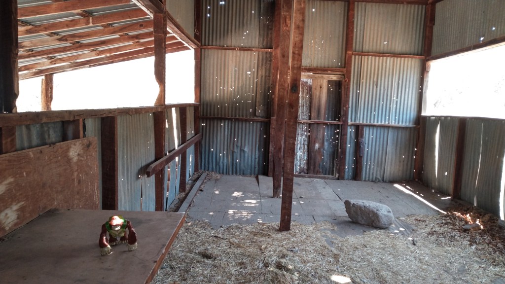
Or you can pass by the shed (empty save for vermin dropping and a scattering of hay). Nothing will stop you from seeing that for yourself. Eventually some jack-ass will burn this to the ground because their special-ass needed a fire under the roof, but right now, there it still sits. A remnant road continues westward on the far side of the gate, providing a shadeless march through the desiccated remains of the pasture. It joins the main trail within sight of the Bull Basin junction.
Bongo inthe shed that hasn’t burned down yet
The main trail is longer and has more up and down, but it also has shade.
West Pinto continues as a single-track up the canyon of its namesake. It is moderate. There were only a few places where I had to pay attention to the trail, rather than write articles in my head, and none of these lasted more than 15 yards.
Here my Tonto description remains accurate, except in 2021 there is less water. Other than isolated pools, I did not encounter water above my ankles. I was a mile in before I encountered any water at all. All the rain run-off from this spring has already sunk into the thirsty sands.
While my old warning about water level may have expired., these days you would actually worry more about fire than flooding, the poison ivy persists, so it is wise to watch your step.
In a couple of places the trail climbs abruptly up the ridge, presumably to avoid obstructions in the stream bank. I took these going in, but ignored them coming out, content to splash in and out of the stream with no undue hardships. This might not be the case if the creek ever has high water flow.
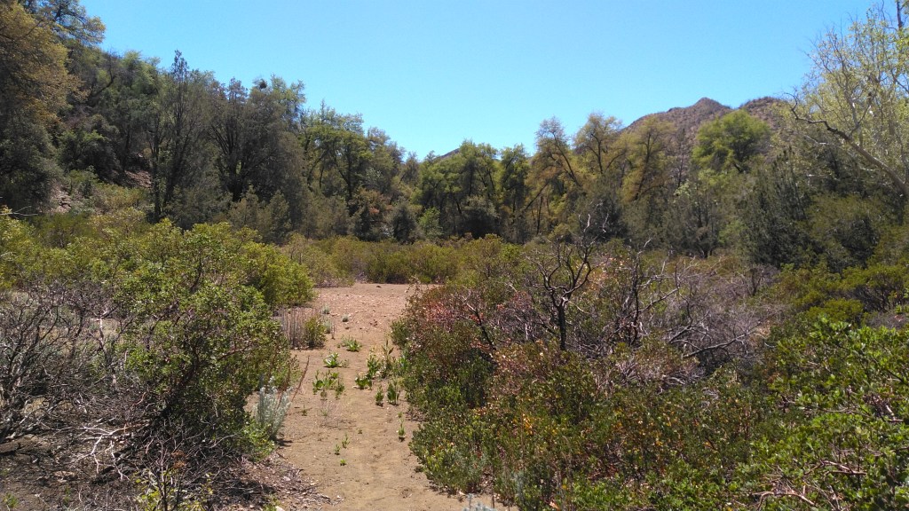
Oak Flat
At about two miles, a series of trail junctions (Cuff Button going north, then Spencer Spring going south) announce the proximity of Oak Flat, a sandy clearing filled with manzanita and surrounded by oaks. Mike book presented this as a destination, but it is really just a landmark. You can see how users of the campsite area would have to share with the large colony of red ants right near the fire pit. Across the clearing, West Pinto crosses the (dry) creek near its confluence with the (dry) Spencer Springs Creek and continues up that canyon.
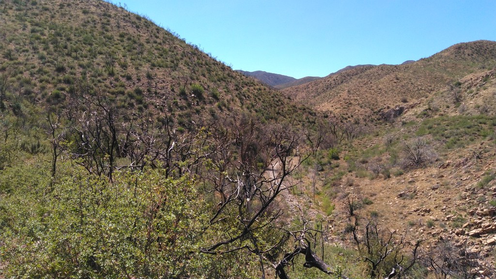
I followed for a few miles up the steep canyon side, crossing a couple of saddles until I became hungry, and realized I did not want to fight the wind to eat lunch on the shade less slopes. West Pinto continues to climb as it approaches Iron Mountain and points beyond, hitting the Reavis Trail about 9 miles from the Miles TH, but those were far beyond the distance I was prepared to hike that day. So I retreated back to Oak Flat, ate my lunch , and returned to my car.
West Pinto between Oak Flat and Iron Mountain
My total hike was 6.3 miles, which I did at a leisurely pace in just under 4 hours. My highest elevation gain was 3900 feet (the high saddle past Oak Flat) about 1100’ above the trailhead.
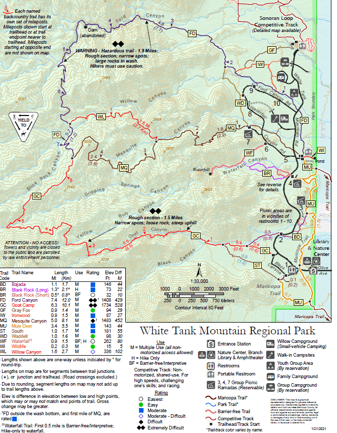
If you wonder where you are in hike conditioning, the Ford Canyon loop we are about to describe will answer that question. Also, it will take you away from the city without forcing you to take an actual road trip.
I learned that I have, comfortably, an eight mile hiking range through mountainous terrain. The route I took covered ten miles. So, even though I limped to the car, I have no regrets.
To reach White Tank Mountain Regional Park, take Olive Road (Dunlap in Phoenix) west until it basically dead-ends at the park’s guard shack. How you get to Olive Road is on you. One note: you would think that there would be an exit for Olive on Loop 303, but there is not.
Most of my information on this trail loop comes from my hike on 5 March 2021
White Tank Mountain Regional park is a Maricopa County park covering nearly 30,000 acres centered on the northern portion of the White Tank Mountains. This range rises from the 1100’ valley floor to 4000 foot peaks and separates the Salt River basin where Phoenix is centered from the Hassayampa plain to the north and west.
The park is open from 6am to 8pm, and entry at the gate is $7 per car.
Ford Canyon trail start to finish is 7.4 miles one way, but I skipped the first mile from the terminus (which is a dirt sidewalk through low desert scrub) to jump on at the sub-trailhead at Spot #9 on Ford Canyon Road. I then left the trail at its junction with Willow Canyon to head back down. That route, along with the lower portions of Mesquite Canyon Trail and towards the end Waddell Trail form the loop that led me back to my car.
I parked my car at spot #9. Like nost of the numbered spots in the park, this features a restroom and a scattering of concrete picnic tables. From the signed trailhead, the wide, packed-dirt trail quickly goes in and out of deep wash.
The lower portion of Ford Canyon Trail is a sidewalk of packed dirt across the arroyo. Besides the dirt track, signage looms plentiful and obvious. If you get lost through here, you should reconsider your form of recreation.
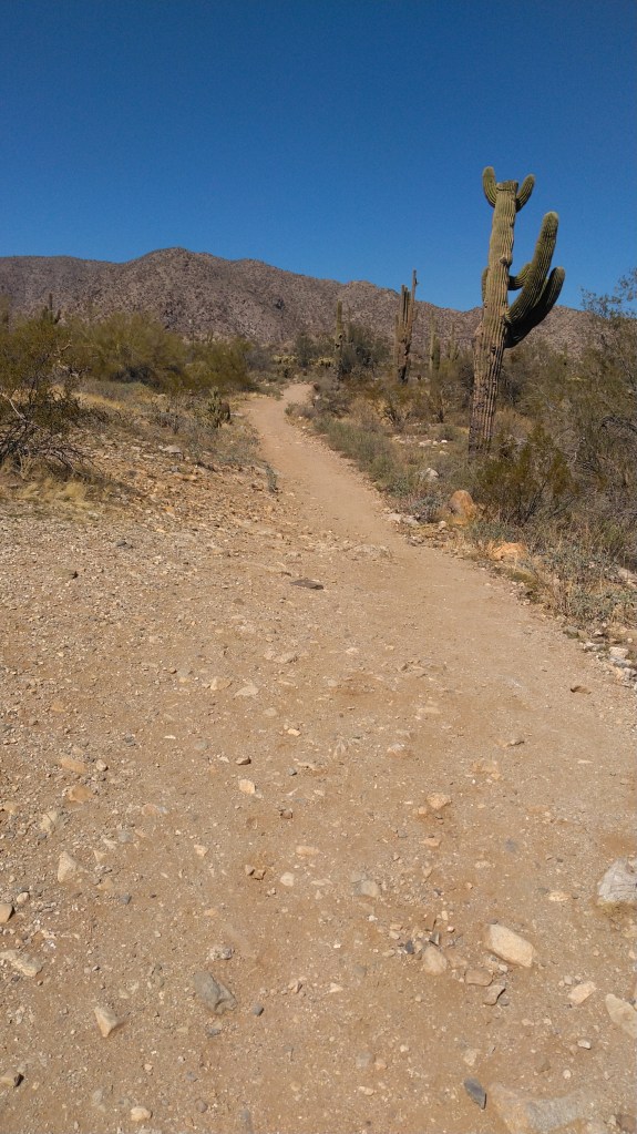
The desert welcomes you
Ford canyon early.
Memorial benches adorn every trail intersection. On my hike day, a proliferation of signage for some trail running event to be held the next day decorated the sides of the path. Teddy-bear cholla stands out as one of many spiny assailants awaiting anyone who would stray off the path as it winds over a low saddle and northwest towards Ford Canyon proper.
Just shy of 2 miles in (all distances are mine – from Spot 9) the warning sign announces that the trail from here – which narrows to a footpath immediately beyond the sign – becomes hazardous.
The sign does not lie. This section is on of the hardest trails in the metro area. Only Camelback Mountain and Goat Camp trail (in this very park) rival it – at least for these next three miles. You will end up using your hands more than once.
The sign
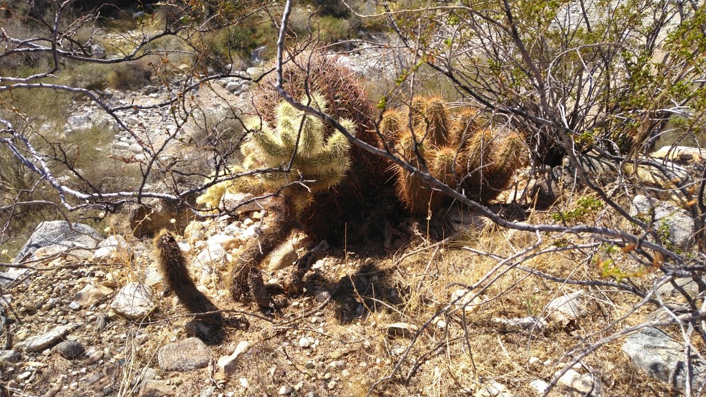
The White Tanks are known habitats for javelina and deer as well as the usual low-desert critters, but the largest vertebrate I encountered on the hike were fat and brazen squirrels.
Much of the exposed granite through here has been whitewashed by the occasional tumult of rain run-off. In early March, some pools of standing water remained. These are, in fact, some of the white tanks that give the region its name.
Towards the top, even the goat trail disappears, and you will end up hunting ribbons along the wash. The route does indeed generally follow the wash. You are a ways from any path across the shoulders.
This is the way. Really.
Lower, you might have seen signs explaining how leaving the trail will increase the erosion. It is true that much of the Sonoran Desert is held together by a layer of microbes imbedded in the soil, and our boot-stomps harm it. Do not worry about that here. This is a wash. There is nothing but granite and sand. Whatever trail ran through here before was washed away by the last rain. Whatever path your footsteps help create will be washed away by the next rain. Choose your steps according to safe, forward progress, and finding the next ribbon. Worry about nothing else.
Somewhere in here, I got my foot stuck in crevace between rocks. I got it out, but not with much grace. It buggered my boots a bit, but I thought little else of it at the time.
That left boot sock had absorbed a good bit of blood by the time I got back to the car.
The old dam is about midway through the wash passage at 3.3 miles and an elevation of 2250’.
Bongo at the abandoned Ford Canyon dam.
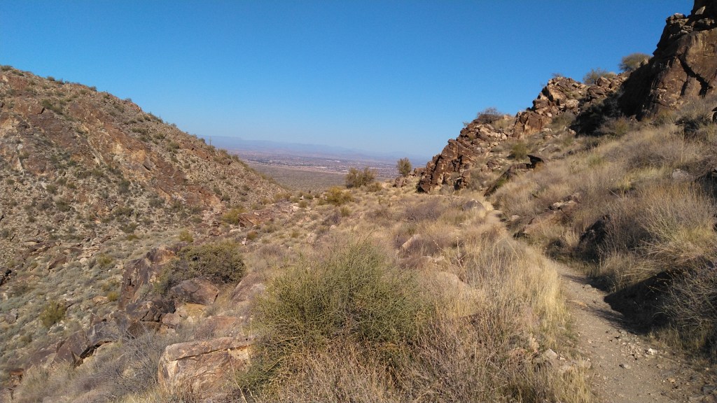
At my 4.15 mile mark, a foot path finally appeared, climbing out of the wash. You are through the worst of it, but not yet halfway. The single-track continues through the shadeless slopes as wide switchbacks up the canyon wall, across a saddle and into the next canyon.
You cannot hear the city this far up in the White Tanks. You can, if you are still for a moment, hear the buzzing of insects, the scurry of lizards and the chirping of birds.
You can also hear on occasion the roar of F-18’s flying in and out of their nest at Luke AFB.
Bongo at MM6
The saddle with the 6 mile trail sign marked about 5 miles into my hike, and the half-way point of the route. This saddle stands at 2813’ and was the highest point I recorded on the route. A half mile beyond, the Ford Trail meets the Willow Canyon trail.
Ford Canyon trail goes on another three-quarters of a mile until it Y’s out into the Goat Camp or Mesquite Canyon Trails. I took Willow Canyon instead for it was shorter, easier and more scenic.
A quarter mile past the intersection, Willow Canyon crosses the wash near an old cattle-tank sight. Past this it climbs slightly but steadily even as the canyon floor sinks steadily below you. The footpath winds across the steep slope, revealing intermittent vistas of the west valley.
Willow Canyon Trail
At 7.2 miles, Willow Canyon T’s into Mesquite Canyon, near the bottom of Mesquite Canyon.
Here the path widens a bit as it switches back down the canyon. Go left (east) to climb out of this canyon, across a ridge, to switch back down a different, unnamed canyon to the south. As you approach the bottom of the switch-backs benches appear – signaling your approach to relative civilization.
Here is also where my feet, particularly my left foot transitioned from fatigue to pain. Constant downhill always brings out the worst in foot problems. So forgive my dearth of superlative language through here. I was just trying to keep going.
By the intersection with the Waddell train, the path has become a packed-dirt sidewalk once more. Take the left (north) up the Waddell Trail.
Waddell Trail which will eventually merge back with Ford Canyon. However, a mile before you get to that point, a short spur will take you to pavement a few hundred yards from Spot #9.
Full Hike = 9.88 miles. It took me 5.5 hours, but I took notes and photos, and covered the last two miles at a -er- measured pace.
On a whim, I made a right turn off of US 93 and up Big Wash Road. Signs indicated camping and hiking areas, about which I knew nothing. With some daylight left, I went north down the wide, graded dirt road to fill in that gap in knowledge. After about five miles of flat desert, the road starts to climb Packsaddle Mountain.
Packsaddle Mountain looms over Chloride, Arizona, a not-quite-ghost mining settlement northwest of Kingman AZ. The mountain is on the southern edge of the Cerbat Mountains, just southeast of the Mount Trimble Wilderness Area.
The little post marks the wilderness boundary
The road abuts the wilderness areas for about four miles. There are no signs or formal pull-outs – you’d have to locate yourself on the map and find a place to park. But poking around wilderness areas requires that level of self-sufficiency at a minimum. Mt Trimbul Wilderness has little water and zero services, but it does have a lot of elevation change. I had a couple of hours, not a couple of days, so I stayed on the road.
Big Wash Road, from this direction, remains wide and well-graded. You will appreciate high clearance, but you could get a passenger vehicle up as far as the trailhead (see below) with caution and nerves. You’d be hard pressed to get a trailer of any size up here.
A campsite at Packsaddle CG.
At the top of the first good climb, about 8.7 miles in, I found Packsaddle Campground, which is marked by a vault toilet and an unlisted number of dispersed campsites. At 6000’ – the median elevation of the ridge that separated the “peaks” of Packsaddle – the site is a good 200 F cooler than the desert floor below. There is trash service here, but no water.
There are no facilities with water until you get to Chloride – and even then, something would have to be open.
Windy Point campsite
I kept going along the ridgetop until just past the 10 mile mark, where I found the turn-off for Windy Point Campground.
Windy Point is a BLM fee area ($8/night, on the envelope and trust system). The fee, I suppose, is justified by the addition of picnic benches and fire rings, and even more spectacular views of the surrounding countryside than the campground just yonder.
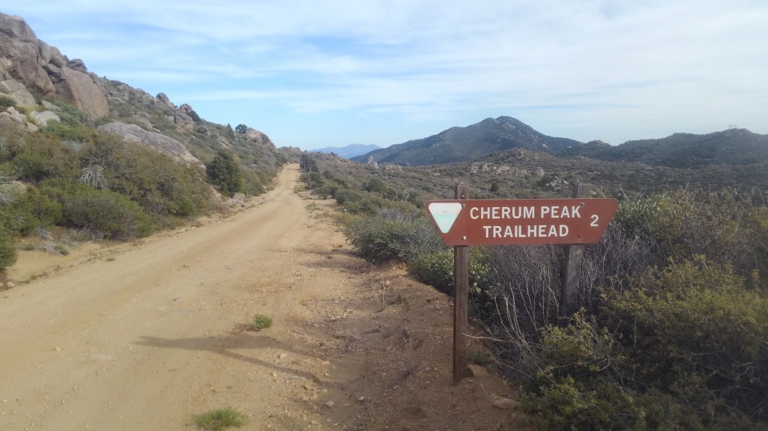
Cherum Peak trail
Big Wash plows farther, past this turn-off, towards the marked trailhead for Cherum Peak trailhead, some two miles past Windy Point. The Cherum Peak Trail is three miles one way, climbing a thousand feet to the top of the peak it is named for – the highest point in the southern Cerbat Mountains. The views are reportedly rewarding. I had an hour of sunlight left, and passed on hiking it that day.
Important: This is the turn-around if you do not have a high clearance vehicle and/or wish to have a pleasant, relaxing drive back down to pavement.
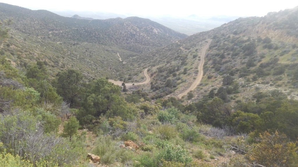
The way down…This was the nice part
I went forward – down the mountain on the eastern half of Big Wash “Road”. And while my Subaru Forester was up for it, she was just barely up for it, and this was downhill in the clear, dry afternoon. I would want no part of this in the dark or the rain. You will want a 4WD to go up from this direction.
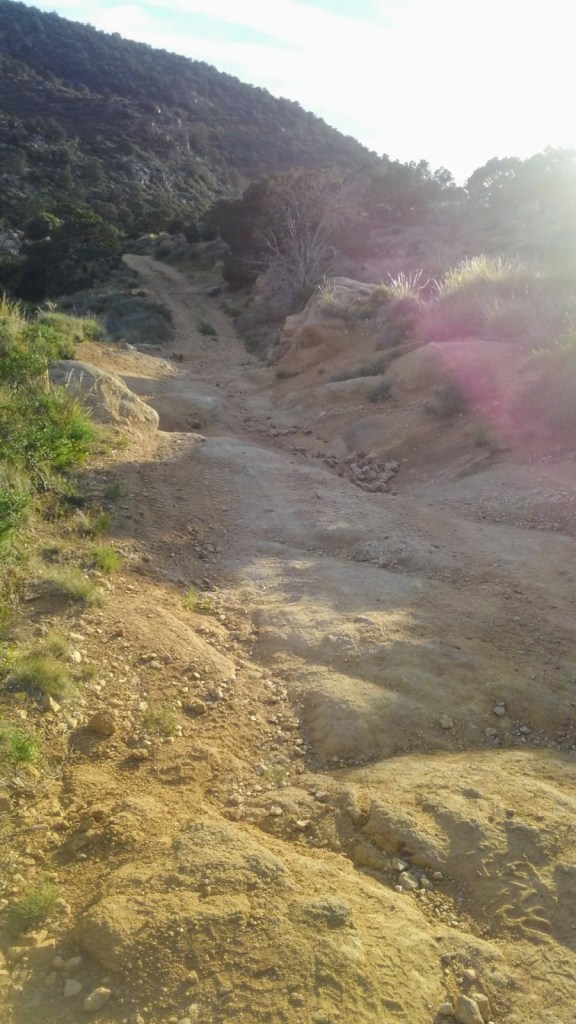
Past the trailhead, the road beyond is rough, alternating from deeply rutted to a lightly graded landslide. To weave around the rocks and the ruts Ruby (the Subaru) was often obliged to make close friends with the brush crowding the side of the now narrow jeep trail.
Friends, I took this route slow enough that bugs buzzed around my car. I spent the better part of an hour traversing a mere six miles. The gate, and the mining ruins just beyond are just past the halfway point of the ugly part. I made it through with only a couple of sickening crunches, and only one part where I seriously feared I would tip the vehicle.
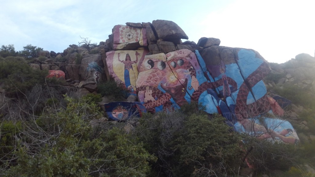
Around the 16 mile mark, the road dumps into the wider, more civilized Mural Road, so named for the murals that cover some large rocks on the side of the road.
These are the Roy Purcel Murals – and not graffitti – but Art, and the sort of roadside attraction that Route 66 was once famous for. Roy Purcell took a break from pursuing his master’s degree in fine arts to work some nearby mines. While there, circa 1966, he painted The Journey, this 2000 square foot wonder of color and imagery.
My photo suffers from the setting sun putting the rocks into shade. The website above has better ones.
While you check that out, I’ll pull Ruby over and make sure she isn’t hemorrhaging vital fluids.
She neither limped nor bled, so on I went.
Chloride was once a sprawling silver camp, and may be the oldest continuously inhabited mining settlement in the state. While it is a shell of its past, at about 350 residents, it is not a ghost town. It is not, in any way, bustling.
Mural Road dumps onto Tennessee Road – the main drag of Chloride, where I had to stop for local dogs, local people finishing their conversation in the roadway, and deer. In town limits I stopped to watch four deer cross the road.
Tennessee Road morphs into County 125, which takes you back to US 93.