Some Stupid Luck in the middle of nowhere.

I’m posting this here because the tale is too long for social media. 

On behalf of my dayjob, I journeyed deep into the Navajo Reservation (in NE Arizona) because I was “in the neighborhood”). A bit of remedial geography – no one is ever conveniently close to Dilkon Arizona, a crossroads deep in the Rez featuring a Basha’s grocery store, a gas station, and someday soonish a medical center.

There was a need for someone in our company to meet with someone working on that medical center. I was, that morning, in Flagstaff for a similar meeting that did not happen, and Those Above figured they’d never have anyone closer. So off I went in the 20 year old Dodge Dakota.

Bongo and Verity in Dilkon, AZ.

I had the Dakota (called Verity) because my Subaru Forester had a damaged suspension (likely from stunts like Packsaddle Mountain), and was in the shop that very day. 

I started and ended my day in Kingman AZ (where it was 28 F when I left my hotel room) on account of a third day-job assignment. 

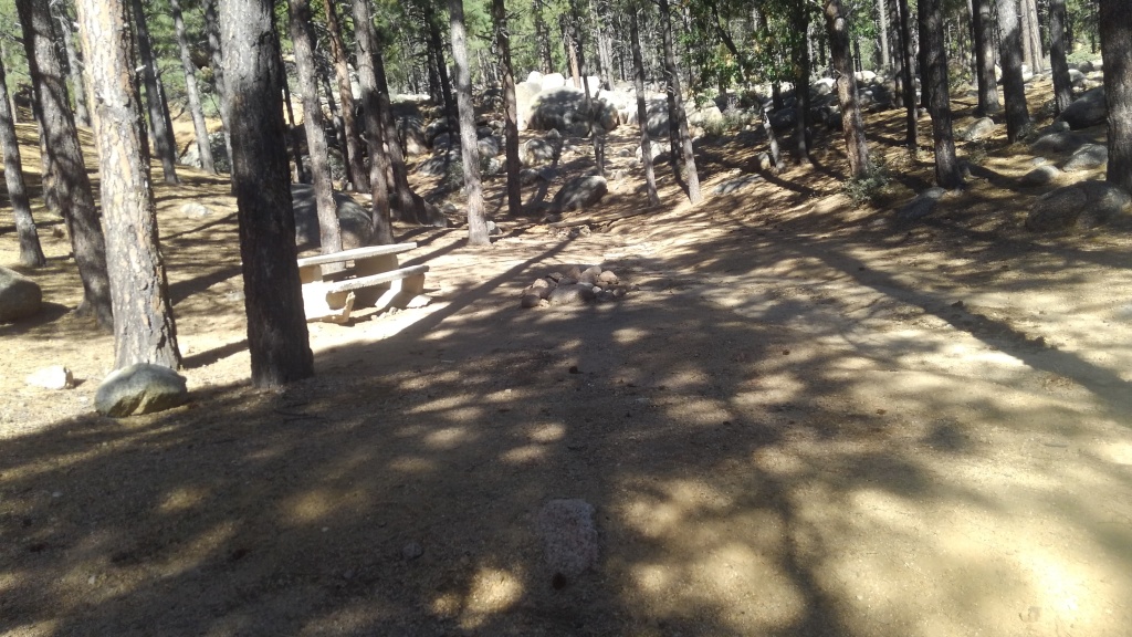
On my way back, I stopped to manage some cabin logistics, and take some Bongo pictures for Instagram, because we are trying to build a little platform here. 

This photo appeared on Instagram. It’s still there.

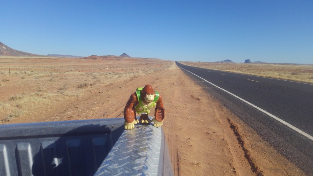
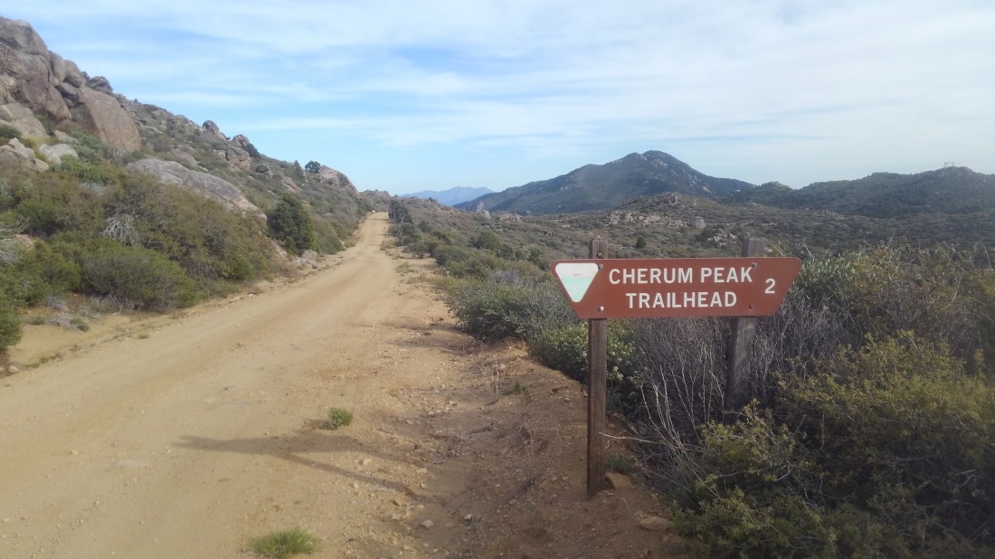
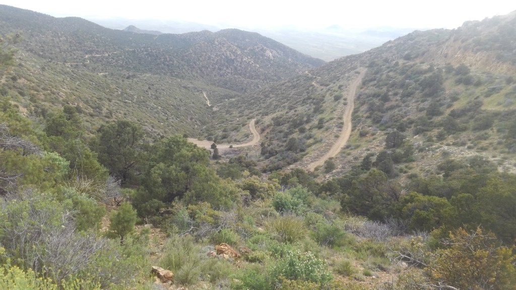
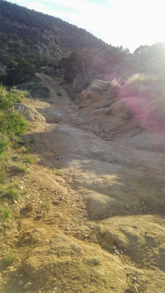
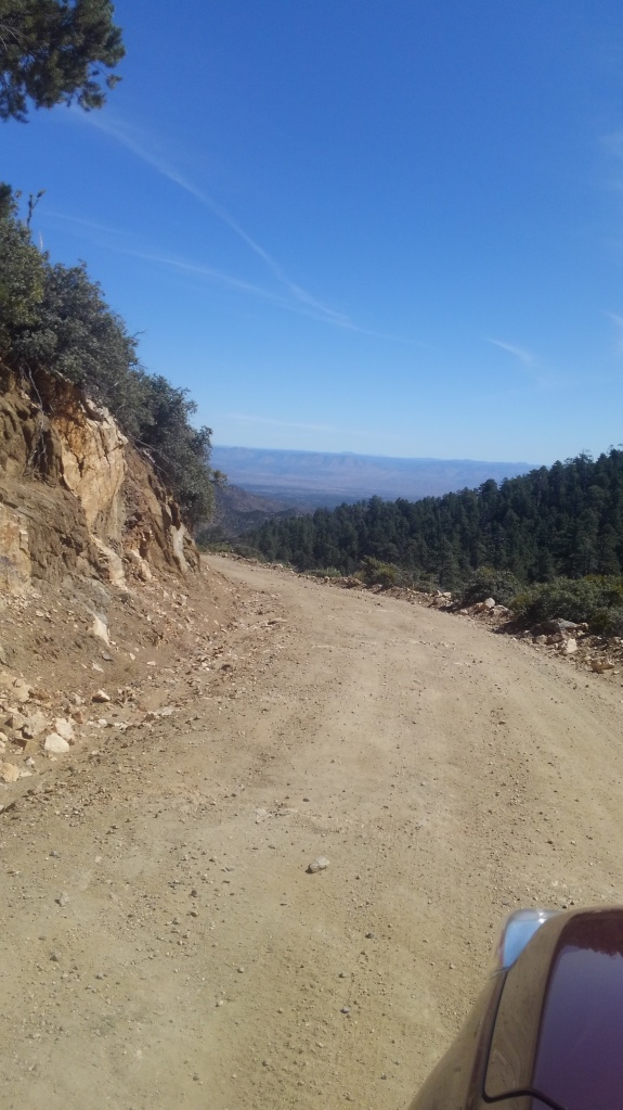
The road is Tribal 15, which looks just like that most of the way.

This is the one I meant to post, but tapped the wrong one.

Friends, that was a $40 Instagram picture, and only that cheap because I got stupid lucky.

Took the photos, got back in the truck, tried to pull away, wheels spun. 

By spun, I mean the passenger rear tire buried itself in loose sand up to the axle. 

I did not take pictures.

Verity carries a shovel, and I had it half excavated when some locals stopped by to help. As sand filled back into the hole, they explained, and probably correctly, that I wasn’t going to dig myself out.  I would need a tow.

Happily, they had the means. Once we excavated the axe from the dry quicksand (this stuff was hour-glass quality,  flowing freely in a way that was both amazing and horrifying), they produced a rope, wrapped it around my front end, and we were able to free Verity from peril on the first try. 

A had a $20 bill in my wallet, and I gave it to the lead guy. Then I dug out another $20 bill when we had to cut his rope to free it from my truck. (I hide one in my wallet for just these occasions.)

When nerves allowed, I drove on to Kingman. That’s 470 miles round trip, part of the nearly 750 miles I drove over 3 days for my job. (I get compensated for that). That took the rest of the afternoon, during which I negotiated paying the mechanic for the Subaru. (Which is why you always want to get paid for mileage, not just reimbursed for gas.)

https://www.google.com/maps/d/u/0/embed?mid=1xSa0_UJ8H2FCwT7-CJNk1rQRKIjTsiIZ

Stay on the damn road on the Rez. Now we know. 

CODA:

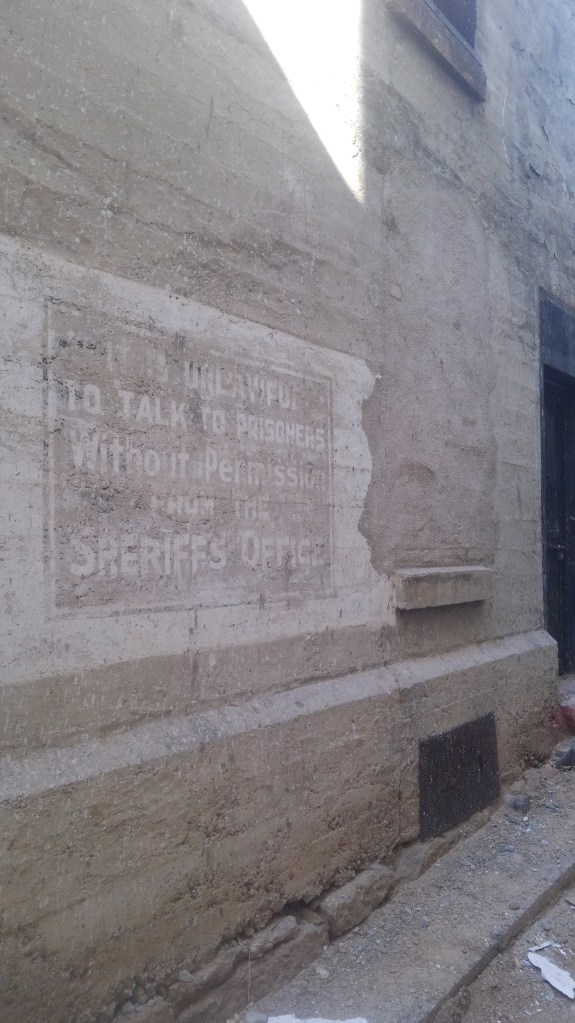
Mohave County’s original county jail is one of the oldest still standing. It’s protected, so the county can’t tear it down.  I have no idea what they use it for now, but they are building the new courthouse addition basically around this structure. 

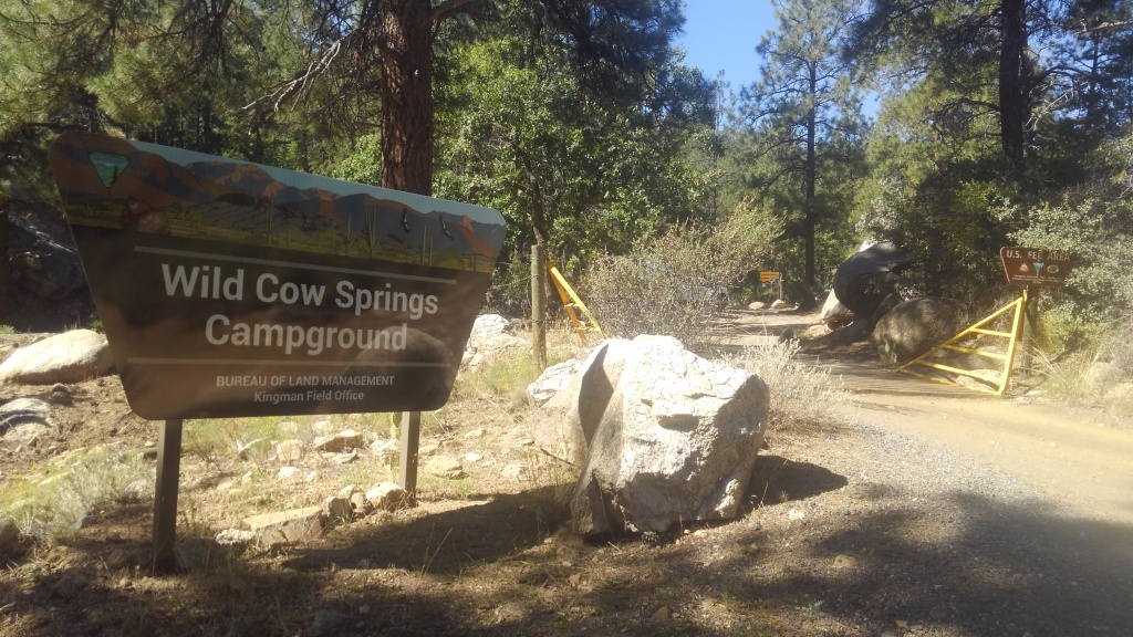
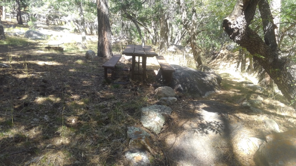
I was also in that neighborhood and have a couple of photos. 

Advertisement

Packsaddle Mountain – up the easy way and down the hard way

On a whim, I made a right turn off of US 93 and up Big Wash Road. Signs indicated camping and hiking areas, about which I knew nothing. With some daylight left, I went north down the wide, graded dirt road to fill in that gap in knowledge. After about five miles of flat desert, the road starts to climb Packsaddle Mountain.

Packsaddle Mountain looms over Chloride, Arizona, a not-quite-ghost mining settlement northwest of Kingman AZ. The mountain is on the southern edge of the Cerbat Mountains, just southeast of the Mount Trimble Wilderness Area. 

The little post marks the wilderness boundary

The road abuts the wilderness areas for about four miles. There are no signs or formal pull-outs – you’d have to locate yourself on the map and find a place to park. But poking around wilderness areas  requires that level of self-sufficiency at a minimum. Mt Trimbul Wilderness has little water and zero services, but it does have a lot of elevation change. I had a couple of hours, not a couple of days, so I stayed on the road.

Big Wash Road, from this direction, remains wide and well-graded. You will appreciate high clearance, but you could get a passenger vehicle up as far as the trailhead (see below) with caution and nerves. You’d be hard pressed to get a trailer of any size up here. 

A campsite at Packsaddle CG.

At the top of the first good climb, about 8.7 miles in, I found Packsaddle Campground, which is marked by a vault toilet and an unlisted number of dispersed campsites. At 6000’ – the median elevation of the ridge that separated the “peaks” of Packsaddle – the site is a good 20F cooler than the desert floor below.  There is trash service here, but no water. 

There are no facilities with water until you get to Chloride – and even then, something would have to be open.

Windy Point campsite

I kept going along the ridgetop until just past the 10 mile mark, where I found the turn-off for Windy Point Campground.

Windy Point is a BLM fee area ($8/night, on the envelope and trust system). The fee, I suppose, is justified by the addition of picnic benches and fire rings, and even more spectacular views of the surrounding countryside than the campground just yonder.

Cherum Peak trail

Big Wash plows farther, past this turn-off, towards the marked trailhead for Cherum Peak trailhead, some two miles past Windy Point. The Cherum Peak Trail is three miles one way, climbing a thousand feet to the top of the peak it is named for – the highest point in the southern Cerbat Mountains. The views are reportedly rewarding. I had an hour of sunlight left, and passed on hiking it that day. 

Important: This is the turn-around if you do not have a high clearance vehicle and/or wish to have a pleasant, relaxing drive back down to pavement. 

The way down…
This was the nice part

I went forward – down the mountain on the eastern half of Big Wash “Road”. And while my Subaru Forester was up for it, she was just barely up for it, and this was downhill in the clear, dry afternoon. I would want no part of this in the dark or the rain. You will want a 4WD to go up from this direction.

Past the trailhead, the road beyond is rough, alternating from deeply rutted to a lightly graded landslide. To weave around the rocks and the ruts Ruby (the Subaru) was often obliged to make close friends with the brush crowding the side of the now narrow jeep trail. 

Friends, I took this route slow enough that bugs buzzed around my car. I spent the better part of an hour traversing a mere six miles.  The gate, and the mining ruins just beyond are just past the halfway point of the ugly part. I made it through with only a couple of sickening crunches, and only one part where I seriously feared I would tip the vehicle. 

Around the 16 mile mark, the road dumps into the wider, more civilized Mural Road, so named for the murals that cover some large rocks on the side of the road.

These are the Roy Purcel Murals – and not graffitti – but Art, and the sort of roadside attraction that Route 66 was once famous for. Roy Purcell took a break from pursuing his master’s degree in fine arts to work some nearby mines. While there, circa 1966, he painted The Journey,  this 2000 square foot wonder of color and imagery. 

My photo suffers from the setting sun putting the rocks into shade. The website above has better ones.

While you check that out, I’ll pull Ruby over and make sure she isn’t hemorrhaging vital fluids.

She neither limped nor bled, so on I went. 

Chloride was once a sprawling silver camp, and may be the oldest continuously inhabited mining settlement in the state. While it is a shell of its past, at about 350 residents, it is not a ghost town. It is not, in any way, bustling.

Mural Road dumps onto Tennessee Road – the main drag of Chloride, where I had to stop for local dogs, local people finishing their conversation in the roadway, and deer. In town limits I stopped to watch four deer cross the road. 

Tennessee Road morphs into County 125, which takes you back to US 93. 

The route I took.

Camping over Kingman: Hualapai Mountain Campgrounds

Like Kingman only completely different.

For most people, Kingman, Arizona is not somewhere you go so much as a place you end up – or more likely just pass through as fast as possible. Parked in the northeast corner of the state at 3000’ elevation, Kingman is known mostly as a Route 66 stop, and the last reliable source of gas before the Nevada line on the way to Las Vegas.

(I know for a fact that I can fill my tank in Kingman, go to and drive around in Vegas for a few days, and make in back to Kingman on that same tank, thus avoiding the much higher prices in Nevada.)

As it happens, it has been a destination for me from time to time. There are a few wineries and a fine distillery, for one thing. I have also been involved in the various incarnations of the local book fair in one way or another for several years.

When in Kingman, in good weather, I prefer camping. Of course, Route 66 through Kingman is lined with a variety of mostly reasonable motels, but in the spring or fall, I’d just as soon sleep outdoors. The place to do that is 14 miles southeast and 3000 feet up from downtown Kingman.

This means that temperatures can be as much as 20 degrees cooler than Kingman or other points below.

Hualapai Mountain, with settled areas between 6000-6500’ elevation towers over the high desert that surrounds it. Most of its multiple peaks are within the Mojave County Park of the same name. Surrounding this are the cabin community of Pine Lake, and a scattering of BLM land. Both the county park ands the BLM portions host campgrounds.

Hualapai Mountain Park Campground

The county park campground winds across several ridges and valleys inside the park. The main campground is a maze of narrow but paved roads winding past tent sites, cabins, and even a small RV lot.  The top end of the maze is a trail-head for the extensive trail system that meanders up and around the peaks. We’ve written about those trails elsewhere.

If you make the sharp left turn at the ranger station, past auxiliary parking and the lower group site, you reach Pine Basin, whose unpaved and marginally graded maze of dirt roads reach some primitive tent sites. A few are flat, gravel pads on top of the ridge, but most sites are tucked inside the jumble of granite boulders that fill the basin beyond.

Pine Basin is where I am most likely to hang my hammock.

Seriously, I hang my hammock.

Most campsites have a stone table, a fire pit of some sort, and are within sight of a plastic outhouse. Not all of the stone tables are in good repair. Not all the fire pits are official.  There is no water and trash service is limited to containers near the entrance.   You can reserve cabins and even RV pads, but all tent sites are first come first serve. You pay your $20/night (cash!) and take your chances. Even so, they are not likely to fill up.

Typical site in the Pine Basin.

I chose this campground first because 1) I did not know about the BLM campground at first but 2) I had business in Kingman and the BLM campground adds 15-20 minutes to the trip – one way. But if I didn’t need to be in Kingman in the morning, I’d just as soon keep driving.

Wild Cow Springs Campground

Patience and nerve…

Let’s dispense with a myth: you can totally get to Wild Cow Springs Campground with any high clearance vehicle, in good weather. The road beyond Pine Lake is signed “Chains and 4WD only” but that is for snow-time. In the summer, the road is thin, and occasionally bumpy, but is mostly well-graded dirt. Higher clearance is helpful, but mostly you just need patience and nerve.

The road beyond Pine Lake is sharp and steep and it will take you the better part of 15 minutes to cover the four miles of up and down and around until you reach Wild Cow Springs. The road is well signed, however, so there is not much fear of getting lost. The sharp altitude difference guarantees some wide views of the desert below.

(The road continues well beyond, becoming a tangle of backroads, and you are on your own with that.)

I have seen people get small trailers into Wild Cow Springs, but it is mostly tent sites. There is a string of sites, in fact, that are a good walk from the road, following a stone-lined hiking trail across the little ravine there.

All the sites have wood and metal benches and metal fire-rings with grills. The front of the site features vault toilets. The site has some trash service, but no water supply. The fee though is $8/night.

There are, in addition, a larger RV park, and a resort (with a restaurant and a store) close to or within Pine Lake, but those are a little too civilized for this blog.

Hualapai Mountain Trail System

Hulapai trails 19

Hualapai Mountain towers over Kingman and surrounding parts,; an island of pine forest in a high desert sea.  High on the slopes, at about 6000 feet, sits Hualapai Mountain regional (county) Park, featuring campgrounds and a trail system wandering around the peaks.

There are several access points, one being right in the campground, but I started from the actual trailhead – and had the place to myself.

From the trailhead (with vault toilets tables and trash-cans) the approach trail follows the wash, past the buried remains of the Silver Bell Mine and finally across a cute little wooden bridge, and up the mountainside.

Hulapai trails 2
The only reason to take the trailhead spur

That leg took me to the campground trailhead, and honestly, unless you are hankering to see a mostly buried silver mine, you can start here and miss nothing. The meat of the hike is the Potato Patch Loop which starts in earnest a hundred feet up the dirt road from the secondary trailhead.

Now, let’s pause a moment and consider that all I had was the free trail guide they gave me at the campsite HQ. Which, so you are warned, is next to worthless. Oh, sure, it has colors and illustrations and explanatory text about the various ecosystem stratas and how regions got their name. But the scale is so small, it is useless as a means to track where you are hiking.

170525-hmp-trail-map-web-789x1024
Don’t hate me because I’m pretty. Hate me because I’m useless.

A common topic of conversation with my fellow hikers – many of whom seemed more experienced than I – was “where do you think we are?”

I went clockwise around that loop. My first stop was Staircase Lookout, named for the CCC built stone stairs that lead up to that lookout point. That would be the last landmark I could properly identify until I hit Camp Levi, which we will get to.


Hulapai trails 24


Between those two points, the trail winds around the slopes as a mostly obvious single-track affording views of the high desert vistas (mostly to my left) and cool forests and giant boulders of the mountainside (mostly to my right). The whole loop is around 10 miles, not counting spurs to summit trails. Hualapai has four summit trails, and you would be on your own with any of them.

Everyone gets lost at Camp Levi. This is a Boy Scout camp, and therefore riddled with trails that look official and well made, but really just loop back to camp for whatever reason. I would love to give you solid guidance on how I found my way out of that maze, but really I just kept trying trails in and out of the Valley of the Porta-potties there (there are like twenty spread about) until one of those trails just kept going.


The actual trail will have orange reflectors nailed to trees – though not through Camp Levi – but that’s the true sign you must seek.Then it was more wandering through shady forest around staggering boulders separated by high desert vistas.

Hulapai trails 37
The true sign of the actual trail

The hike is at serious altitude – meaning it will be blessedly a good ten degrees colder than nearby Kingman, but will also work your lungs harder. So while the trail is Medium with pockets of Hard, it will feel like a lot more Hard than it is unless you are accustomed to the lower oxygen ratios.


You can do this hike in tennis shoes. There were some families with kids chased horned toads. I hit some clots of people on a warm Sunday afternoon, but few do the whole circuit. I had the more distant slopes largely to myself.


I clocked a good thousand feet of overall elevation change across the 6 or so miles of actual hike. Most of this was accomplished via switchback.

Hulapai trails 25

Hulapai trails 36

Eventually, I came back to where I started, and followed the spur back to my car.


My tent site cost $17 a night, but a day pass to the park costs $7 per vehicle. Yes – they will check.

Hulapai trails 34