The Grim Beauty of the Granite Mountain Hotshot Memorial

Bongo at the trailhead.

A few weeks ago, taking the back way down from Prescott, I stopped at the Granite Mountain Hotshot Memorial off of AZ89. The State Memorial Park is located on the second serpentine wind down the mountain that separates Yarnell from Congress. It is most easily approached going south. AZ89 is split here, and you would have to U-turn past the site going north to come back and reach it.

There you will find parking for about a dozen cars and “restrooms”, meaning plastic outhouses.

Or you could take a map

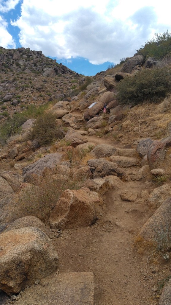
The main trail is just shy of three miles one way winding up and around the desert ridges. You can expect all the low desert hazards and all the low desert heat. The grade is gentle but constant as the packed dirt path switches back and forth across the ridge, perhaps more times than is really needed. On occasion, stone stairs will help you up or down.

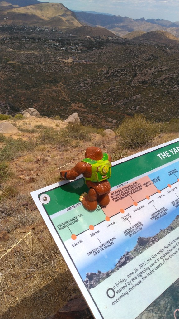
Along the way are shiny, stainless steel plaques commemorating each firefighter who died in this catastrophe, as well as plastic plaques explaining the history of desert fires in general, and the Yarnell Hill Fire in particular. There are also benches.

If you took a free map from the container at the trailhead, you can easily follow your progress up the 2.85 main trail by plaque. I’m not going to recount the well-known tale here. The park website repeats all the verbiage on the plaques.

If you need to know more right now, this article is a good over-view without being gushy local news or terse and technical fire-speak.  You could also read the actual report it references. Meanwhile, we are hiking.

View from the trail

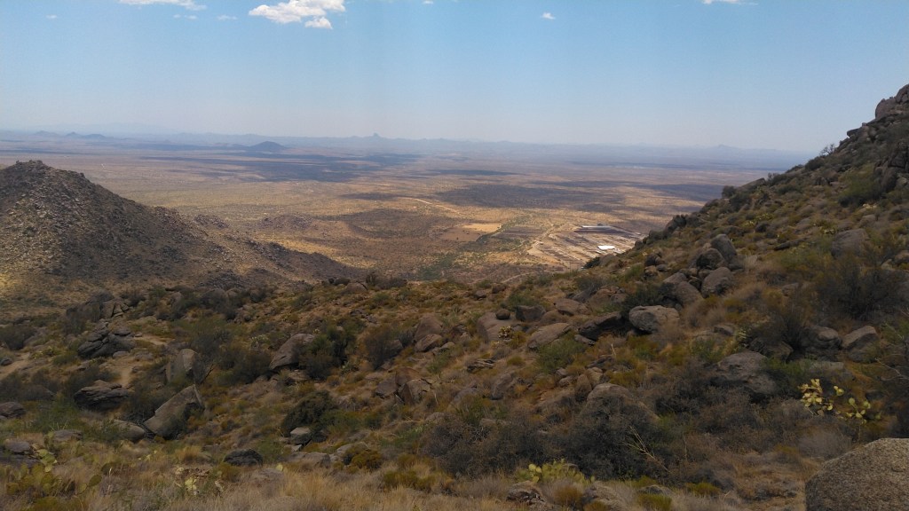
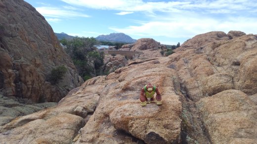
Were it not for its grim purpose, the Hotshot Trail, as it is designated, would actually be a pleasant climb through a fine collection of rocks and cacti. Climbing up the ridge reveals consecutively grander vistas of the valley below. On my trip lizards scampered away from my feet as hawks circled overhead. But then I came to a glaring plaque (the afternoon sun makes them signal mirrors) and joy yielded to grim purpose.

The Yarnell Hill Fire ended for a generation the debate as to whether Prescott (where the GM Hotshots were based) and surrounding communities should publicly fund wilderness firefighting. There had been loud talk of leaving all of it to the feds. After the fire, state and municipal money carved this fine, if sad trail up the ridgeline.

The Hotshot Trail ends at an Observation Deck overlooking the site where the 19 men actually burned to death. A large plastic plaque explains how that happened. There is a bench and shade and a tribute wall decorated with a multitude of firefighter patches along with other mementos.

The much steeper Journey Trail continues from this point, tracing the route the Hotshots took down the ridge to their doom. It drops about 500 feet in one mile to reach the actual memorial. I was out of water at that point, so I turned around at the observation deck.

A week later, hand to God, I stumbled upon the movie based upon this group and their sad end, Only the Brave. It is actually well done.

If you visit this site, go in the morning and don’t go in summer. The desert wants to kill you even when its not on fire – don’t make it easy.

Sometimes it kills even the best of us.

Advertisement

Willow Creek (whatever)

The city of Prescott has three man-made reservoirs in or about city limits, and Willow Creek is the most accessible, and arguably the most scenic. While you can float a non-powered boat on it, and fish and bird-watch, or even peer into the excavated homes of the long-gone natives if you time it right, the attraction – at least for me -is as a hiking destination.

1535579172003

There are three trailheads, and I picked the only one with a parking fee – City-run Willow Lake Park on the north side.

Let’s stop here and clarify: the body of water is called Willow Lake, Willow Creek Lake, Willow Creek Basin or Willow Creek Reservoir depending on what source you look at. It is all the same body of water.

willow_lake_loop_trail_map

The city park is the most developed site, with the boat launch and the well-guarded aboriginal ruins. They were closed when I was there, and thus we skip right past them. The park asks for a $3 fee paid by an honor-system kiosk. Or you could park at the ball-fields of adjacent Heritage Park – as I did, and hoof in for half a mile extra.

The lake, and the 6 mile trail that wanders around its perimeter can be accessed by the Jim McCasland Willow Creek Park, which has a ball-field and a dog park, on the east shore, and some undeveloped gravel parking areas on the south shore. McCasland, for your planning convenience, also has restrooms and water fountains. The south lots have only trash cans.

Back on the north shore, the city park is adjacent to a trailer park and a campground, and a number of social trails connect the two. I went clockwise, past all of these and into the portion of the Granite Dells, a large, relatively famous jumble of granite boulders and mounds that line the north and east shores of the lake.

1535579412380

Like all trails through this terrain, the path has a lot of up and down and round and round and is often a scramble over granite marked only by spots of white paint.

In the NE corner, some side trails loop further into the Dells, but I skipped these, to budget time and energy. Originally, I was just going to go to the dam, and then turn back. Past the junction with the loop trails, heading south through the boulders, you can look for the red bridge, though if you take the offshore leg of the loop you could miss it, before you wind down into the valley behind the dam.

I have been through this valley both wet and dry. Dry is far more likely, but trails exist which will get you across when the water is spilling out from the concrete barrier.

On the south wall of this valley are the stairs, rail-road tie stairs, which will march up 200’ in elevation to the last leg of the journey south through the Dells.

Here I reasoned, correctly I still believe, that retracing the just under two-mile journey from the city park to the top of the stairs would consumed as much energy as continuing along the remaining four miles ahead of me, and I decided to press forward around the lake.

Another half mile of big boulders, including a close encounter with the edge of the lake, that required a bit of rock hopping, separated the stairs from more open terrain. You can avoid the edge of the lake via a loop I did not take.

1535579517054

Both will dump you into the shadeless, swamp-grass covered expanse of the south-eat edge of the lake, The map claims this part of the trail could be submerged, but this is rare. When I traveled it, it was a dry dirt track through the tall grass and swarms of insects that live there. This turns west and rises into the hard-pack of the southern shore. Power lines and an intermittent fence-line separate the trail from Willow Road to the south. Past the gravel parking areas, and across a wooden bridge, the trail wanders away from the road, and skirts some low granite formations before turning north along the east shore.


forklift stunts
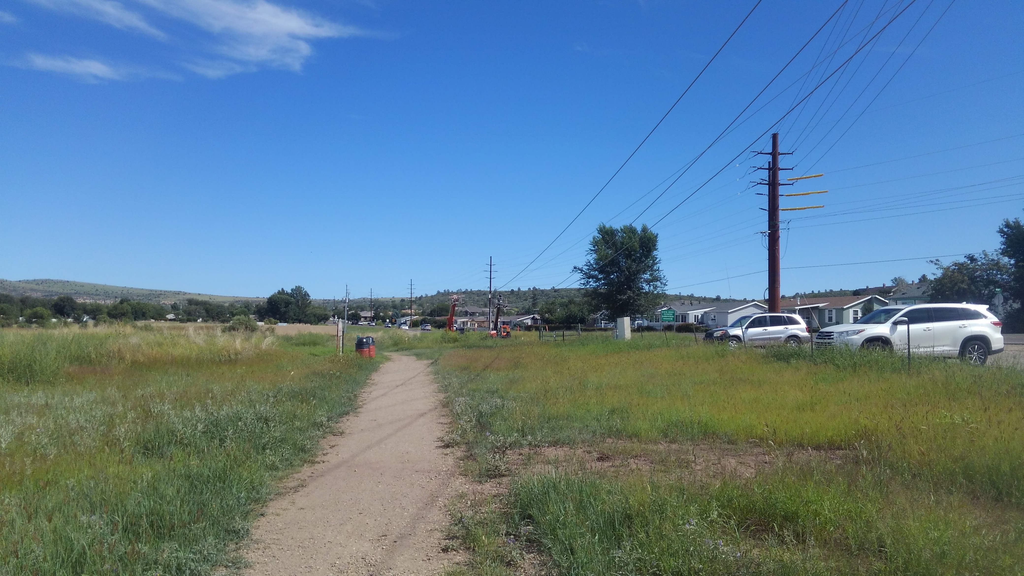
It will dip in and around some wooded washes before reaching McCasland Park, where I found the water and restrooms nearly life-saving. Past there the trail wanders through scrub along the shore, passing Embry-Riddle University on the far side of the road, and finally back to the city park sprawling along the north shoreline.

I did the trail in about three hours. The Dells are Hard, the rest of the trail is easy, but the Dells are the worthwhile portion in my opinion. These Dells would be a premier destination for burning off the energy of junior high boys. Even as an adult, this hike remains a good way to kill a few hours if you happen to be in Prescott, in good weather, with time on your hands, and reasonably sturdy shoes.