Hualapai Mountain towers over Kingman and surrounding parts,; an island of pine forest in a high desert sea. High on the slopes, at about 6000 feet, sits Hualapai Mountain regional (county) Park, featuring campgrounds and a trail system wandering around the peaks.
There are several access points, one being right in the campground, but I started from the actual trailhead – and had the place to myself.
From the trailhead (with vault toilets tables and trash-cans) the approach trail follows the wash, past the buried remains of the Silver Bell Mine and finally across a cute little wooden bridge, and up the mountainside.

That leg took me to the campground trailhead, and honestly, unless you are hankering to see a mostly buried silver mine, you can start here and miss nothing. The meat of the hike is the Potato Patch Loop which starts in earnest a hundred feet up the dirt road from the secondary trailhead.
Now, let’s pause a moment and consider that all I had was the free trail guide they gave me at the campsite HQ. Which, so you are warned, is next to worthless. Oh, sure, it has colors and illustrations and explanatory text about the various ecosystem stratas and how regions got their name. But the scale is so small, it is useless as a means to track where you are hiking.

A common topic of conversation with my fellow hikers – many of whom seemed more experienced than I – was “where do you think we are?”
I went clockwise around that loop. My first stop was Staircase Lookout, named for the CCC built stone stairs that lead up to that lookout point. That would be the last landmark I could properly identify until I hit Camp Levi, which we will get to.

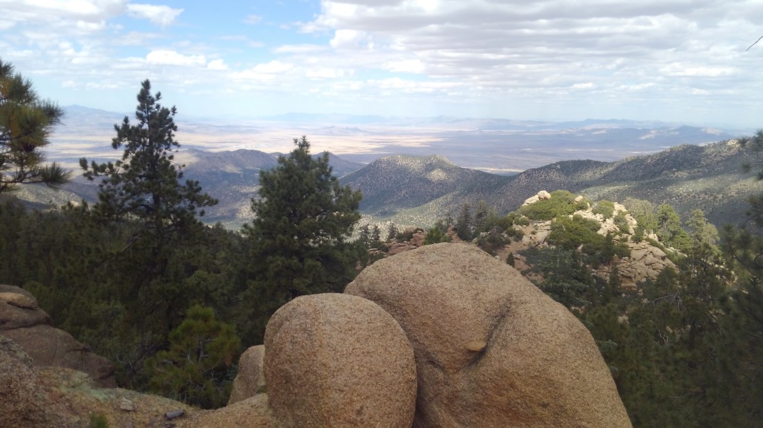
Between those two points, the trail winds around the slopes as a mostly obvious single-track affording views of the high desert vistas (mostly to my left) and cool forests and giant boulders of the mountainside (mostly to my right). The whole loop is around 10 miles, not counting spurs to summit trails. Hualapai has four summit trails, and you would be on your own with any of them.
Everyone gets lost at Camp Levi. This is a Boy Scout camp, and therefore riddled with trails that look official and well made, but really just loop back to camp for whatever reason. I would love to give you solid guidance on how I found my way out of that maze, but really I just kept trying trails in and out of the Valley of the Porta-potties there (there are like twenty spread about) until one of those trails just kept going.
The actual trail will have orange reflectors nailed to trees – though not through Camp Levi – but that’s the true sign you must seek.Then it was more wandering through shady forest around staggering boulders separated by high desert vistas.

The hike is at serious altitude – meaning it will be blessedly a good ten degrees colder than nearby Kingman, but will also work your lungs harder. So while the trail is Medium with pockets of Hard, it will feel like a lot more Hard than it is unless you are accustomed to the lower oxygen ratios.
You can do this hike in tennis shoes. There were some families with kids chased horned toads. I hit some clots of people on a warm Sunday afternoon, but few do the whole circuit. I had the more distant slopes largely to myself.
I clocked a good thousand feet of overall elevation change across the 6 or so miles of actual hike. Most of this was accomplished via switchback.


Eventually, I came back to where I started, and followed the spur back to my car.
My tent site cost $17 a night, but a day pass to the park costs $7 per vehicle. Yes – they will check.