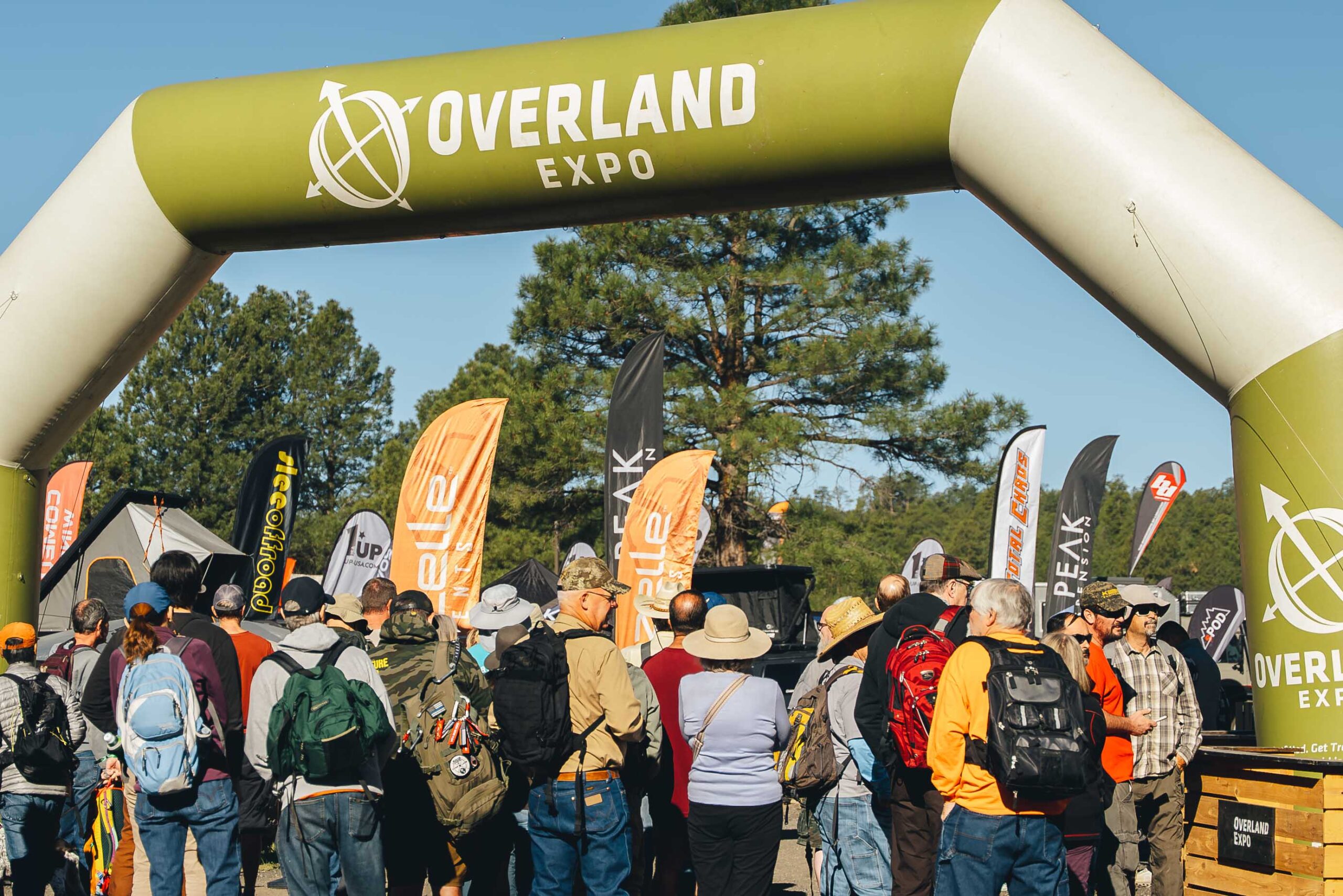
Full disclosure: I am not actually an Overlander guy and I doubt I would become one even if I had the money. It just doesn’t take that much to get off of the beaten path. However, many others see it differently, and the market that emerged from this worldview created the Overland Expo which was recently encamped in Flagstaff.
My wife and I went, and while we paid to shop, essentially, we had a discount through some means I do not recall.
Amateur but veteran tip: we parked at NAU and took the bus in, and this was little trouble. Especially compared to a previous year where we spent so long hiking in from our found parking space that we essentially missed the event.
This is not a detailed review of what is a giant outdoor mall for people who want to see the great outdoors from the window of their expensive vehicles. We found a few cool things, and I record them here for my reference, but I share also with you.
More or less smallest to largest:
The Transcool portable evaporative cooler. A lunch-boxed sized evap cooler you can run from your car battery of other portable power. Or a wall outlet, I suppose. Couldn’t vouch for its performance in the humidity but the demo was blowing cold on a dry Flagstaff afternoon. https://transcoolusa.com/
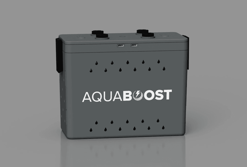
The Aquaboost power station turns salt water to electricity, perhaps to power your Transcool for up to 12 hours, per their literature. https://www.aquaboostpower.com/
Your state parks and local tribes are trying to save history – and they gave me a sticker, so I give them a plug. https://savehistory.org/
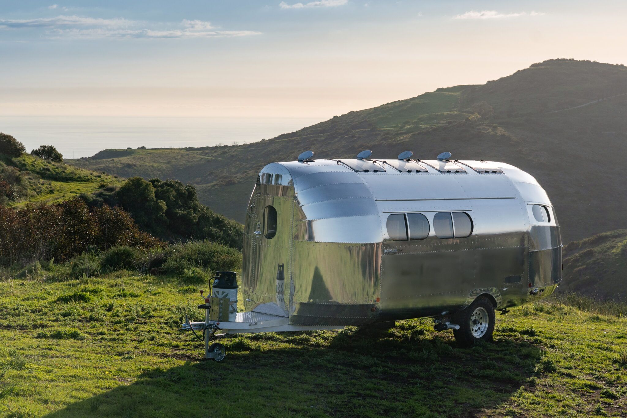
Finally, if money were no object, this would be the trailer I tow:
The Bowlus Rivet is an airplane fuselage disguised as a trailer. Our European host made us take off our shoes to walk inside the thing. Once inside we learned that while it has actually fewer amenities than trailers in its $150k price category ( you read that right) it is stupid lightweight for its size. That’s what you’re actually paying for. Sure the shower is clever, the other features are spare but well laid out, and thing outside is mirror-shiny, but what makes it worth it is the #2800 base weight. You can tow it with an SUV.
We would tow it with a cargo van – money being no object – for UnObtanium events. But we are not anywhere close to that kind of money.
Even so, it was fun to get out of the heat and daydream.
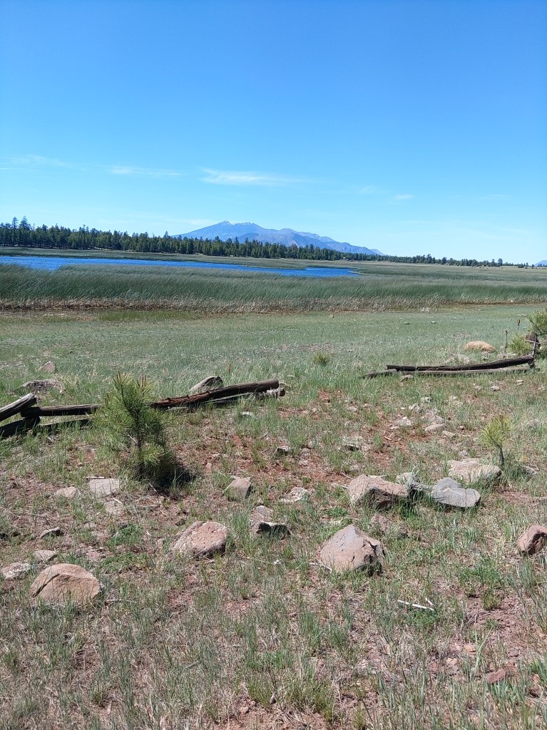
Marshall Lake is a small, marshy pond, really, just south of Flagstaff. Its’ reedy shores are full of birds, and the forested hills around it are full of dispersed campers.
Arizona does not have many natural lakes, but Marshall Lake is one of them. It’s really only a lake at its rare high water mark. At normal levels it is a series of connected ponds. There are times when it is completely dry.
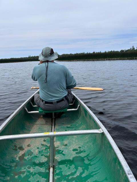
On my last visit, my son and I were able to paddle a canoe through breaks in the reeds and go from pond to pond to see the birds and hear the frogs and waver to the scattered fisherfolk. At high levels, AZ Game and Fish will stock some trout in here. Folks have also caught channel catfish, northern pike, crappie and the occasional largemouth bass.
More numerous than fisherfolk are the ducks and coots. The Coconino National Forest slipped a good line past the fedbots:
“Marshall Lake is a small marshy body of water that’s generally full of coots and other waterfowl splashing, flapping, and cooting around. It is such valuable wildlife habitat that it is managed in partnership by Ducks Unlimited and the Arizona Game and Fish Department.”
Signs and portents by the lake.
You can also see osprey and even eagles around the lake. The hills around are popular for elk and are grazing allotments for cattle.
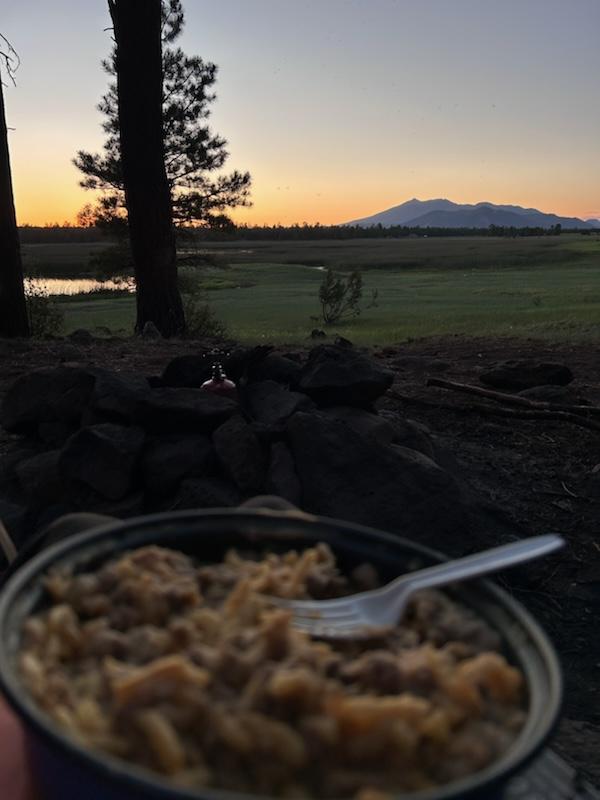
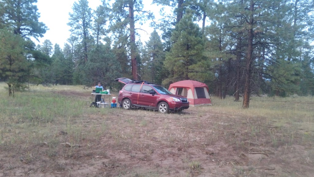
Dispersed camping means no services: no tables, no trash, no outhouses, no water. When we were there in late June, we were under a fire restriction, which covers all of these sites. Even so, the area is popular. If you aren’t up there by mid-morning Saturday on a weekend with good weather, you are likely camping somewhere else. A lot of your neighbors are clearly going to use all 14 days of the stay limit.
Photo by Ben Padegimas
Marshall Lake is seasonal, approximately May-October. Outside that window, the roads might close indefinitely due to snow.
The lake is located about 12 miles south of Flagstaff, off of lake Mary Road (aka FR3). Take that road south past the Lake Mary recreation sites to FR 128 which switchbacks up the hill before becoming graded dirt. Follow the signs.
There are no fees. There is a small parking lot next to the “boat launch”.
The observatory on the top of Anderson Mesa is not open to the public. The nearby trailhead is, and I have written about that in my book: 5 Star Hikes Sedona and Flagstaff.
There is a plan to improve the wetland conditions here, somehow. More information can be found here:
Current Status: The wetland is a perched clay basin with limited inflow from rain and snowmelt. As a result, Marshall Lake is sensitive to drought and is dry in many years. AGFD is conducting a water balance and feasibility assessment for habitat improvements in the Marshall Lake watershed. A restoration plan will be developed in coordination with the Coconino National Forest in 2015.
Before I get into this article about the ruined houses of native Americans, let me confess, for context, that I have long been bored with the subject. As a native (meaning born in Phoenix – not Native) and thereby a product of Arizona public education through the 1970’s, I joined my classmates as we were herded by busloads through the various ruins scattered around a two hour drive from metro Phoenix.
These are not hard as day trips go, and low-hanging fruit for educators: here are their mud and stone structures or pit houses – and they all used to live here and did things – some of which we know, the rest we guess about – and then they all disappeared – before white man arrived (they always add that) – and now we can look at their old houses from a respectful distance.
Just like the last ones we visited, only they are over here, and look like this. If the nerds in class are bored with this (and I was a poster-quality nerd), all of the kids are bored with this.
Consequently, as an adult, I swore off Native American ruins as a destination.
This lasted until I had kids and started dabbling in travel writing.
Another thing these places have in common is visitor centers with maps and bathrooms.
Bongo at the Homolovi AZ state park visitor center
I arrived at the visitor center at Homolovi State Park at 4pm – an hour before they closed their gates. The ranger their took my $7 entry fee, and said I probably had time to see the main ruins: Homolovi II at the end of a road winding through the dry prairie for about two miles north of the visitor’s center.
Of the five known sites, only two are open to visitors. Homlovi II is the larger of the two. Homolovi I is close to the campground – yes people camp here – all year. It’s $20/night for most spots. The campground has restrooms, and even showers, but, like the rest of this ecozone, zero shade.
I saw RV’s scattered across it in early February. I don’t know why.
The state park is a joint effort with the Hopi Tribe, whose reservation lies about 60 miles north of here, in the middle of the sprawling Navajo reservation. Neither tribe thought this was a good idea, and the Feds didn’t care. Thick books have been written on how this happened and why its stupid. I don’t have time to get into that here – but this guy took the time, if you care.
The Hopi people of today still consider Homolovi, as well as other precolumbian sites in the southwest, to be part of their homeland. They continue to make pilgrimages to these sites, renewing the ties of the people with the land. The Hopi tell us that the broken pottery and stones are now part of the land and are the trail the Bahana will follow when he returns. Therefore, these are mute reminders that the Hopi continue to follow the true Hopi way and the instructions of Masau’u.
The website does not go on to explain who or what the Bahana is, and while we can guess by context, it does not expand on the concept of Masau’u. None of which is surprising.
The Hopi Tribe is notoriously insular. They allow visitors to their reservation, but only in the approved hotel, and you cannot wander around, and not only is photograph prohibited, but note-taking is prohibited.
I think in 7th grade a public school teacher told us that every year evangelical Christians would send Christmas gifts to the Hopi reservation, and every year the Hopis would, “toss them over the cliff”. I don’t know if that still happens, or for a fact if that ever happened, but it sounds plausible that it happened at least once. I’m pretty confident, though, that you can replace the cliff part with a dumpster of some sort.
So those guys – those guys – partnered with white man (then Governor Bruce Babbit in particular) to preserve the dwindling remains of these sites, as pot hunters were starting to come in with construction equipment.
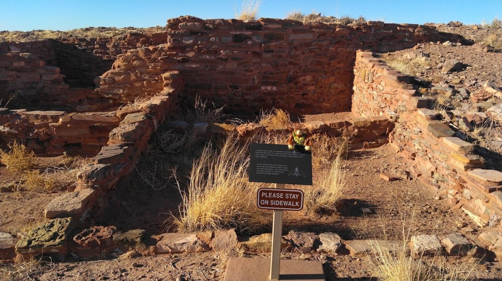
And having driven that road and walked along the couple hundred yards of sidewalk to and around Homolovi II I can report that those ruins are – unimpressive. A couple of small dwellings and one large ceremonial structure have been excavated so you can take pictures (that was part of the deal) and learn that they – favored rectangles.
Rectangles!
Full disclosure: I did not have the time to go through the interpretation displays in the visitor center – which take up slightly more space than the gift shop portion, nor did I download or otherwise listen to the interpretive audio feature.
As much as I claim disinterest, I did do some reading.
Somewhere in the 1200’s flooding along the Little Colorado (which marks, roughly, the western boundary of the park) deposited big piles of driftwood. Ancestral Hopi (I’m using a consensus term that is also easiest to spell) migrated out from the Mesas and used that driftwood for building and burning, establishing several villages along the river. They grew cotton and other crops in the alluvial soil until sustained drought in the 1300’s drove them back to the Mesas.
That same drought did in a lot of cultures around the southwest. I learned that in the 70’s.
Ancestral Hopi took the trouble to destroy their homes, particularly ceremonial sites, as they abandoned them. Vandals and looters also did their share of damage. Unlike the towering ruins at say Wupatki or Walnut Canyon, all the average eye will see is a pile of rubble of what was once a sizeable complex of structures. Except for the small portion the state park excavated so I could pose my plastic gorilla in front of them and take pictures.
The sidewalk to peace and quiet
I do not have Hopi ancestors to commune with. In fact, I have very little spiritual awareness – I don’t feel Vortexes around Sedona or any of that. I believe the spirit world is like the New Jersey mob: not a player, not a target. This buddhist has enough complications in his life.
I did feel the abiding peace that comes with those barren, rust-colored hilltops – near silent save for the wind. That may be typical of the whole region, but I paid my $7 – so I could feel this without trespassing.
Micah Loma’ovaya, an archeology student working on the site wrote this in Southwest Archeology in the Fall 2000 issue:
“Going home on the weekends allowed me to recount for my grandparents and other relatives our weekly discoveries. Many parallels between Homol’ovi and Hopi were found, and my learning expanded, not only in archaeology, but in my own culture as well. It seems that as Hopi have progressed along our cultural continuum, we have tended to lose focus of the true meanings behind our behavior. […]
“In Hopi culture, we understand that ancestral places were marked with footprints (ruins, artifacts, and burials), monuments to our prehistoric occupation, that would be attributed to us one day. Now we must participate in retracing those steps leading to Hopi society and be willing to acknowledge the fact that we have a history to share.”
Micah Loma’ovaya Archeology Southwest, Fall 2000 pg 10.
I’ll leave on that, before the ranger closes the gate.
[Micah Loma’ovaya has gone on to become an archeologist and apparently a realtor. His Linked-in bio.]
Homolovi State Park is located just north of I-40 and Winslow on AZ 87.
My go-to spot for undesignated camping in the high country (in AZ that means higher than 5000’) is the north rim of Sycamore Canyon. The Sycamore rim marks the southern boundary of the Williams district of the Kaibab National Forest. It lies essentially 30-50 miles south by southeast of Williams AZ, which is about 30 miles due east of Flagstaff along I-40.
The rim itself does not offer spectacular scenery. It offers a consistent expanse of rock-studded plateau topped with pine and oak stands separated by occasional prairies. It is plenty pretty to be sure. The tall green grasses and flowers, towering fragrant pinon and ponderosa pines and gnarled oaks offer habitat for everything from turkey to elk. But this is what most of the Coconino plateau looks like when it hasn’t been paved over or grazed down to high desert.
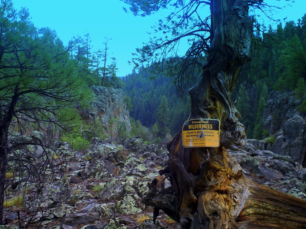
The only noteworthy vistas are views into and across Sycamore Canyon itself.
One of many vistas of Sycamore Canyon
Sycamore Canyon proper is a wilderness area (mostly within the Coconino NF) where Sycamore Creek and its immediate tributaries have cut steep slots into the plateau. The canyon often rivals Oak creek Canyon (to the southeast) for scenery, but is not nearly as accessible. Getting into the canyon is best approached as a backpacking expedition, and well beyond the scope of this article.
Ruby and company
(Although I wrote about those trails, and others I will reference shortly in 5 Star Trails: Flagstaff and Sedona, which I plug here to avoid a lot of repetition.)
What I like about it is the relative privacy. You will consistently pass the tribal compound of RV boondockers on the main roads just south of Williams. But go further south, on the thinner forest roads, and you can spend days at a time on your own part of the prairie, seeing no other people until you have to go back into town for more ice. I have accomplished this feat more than once.
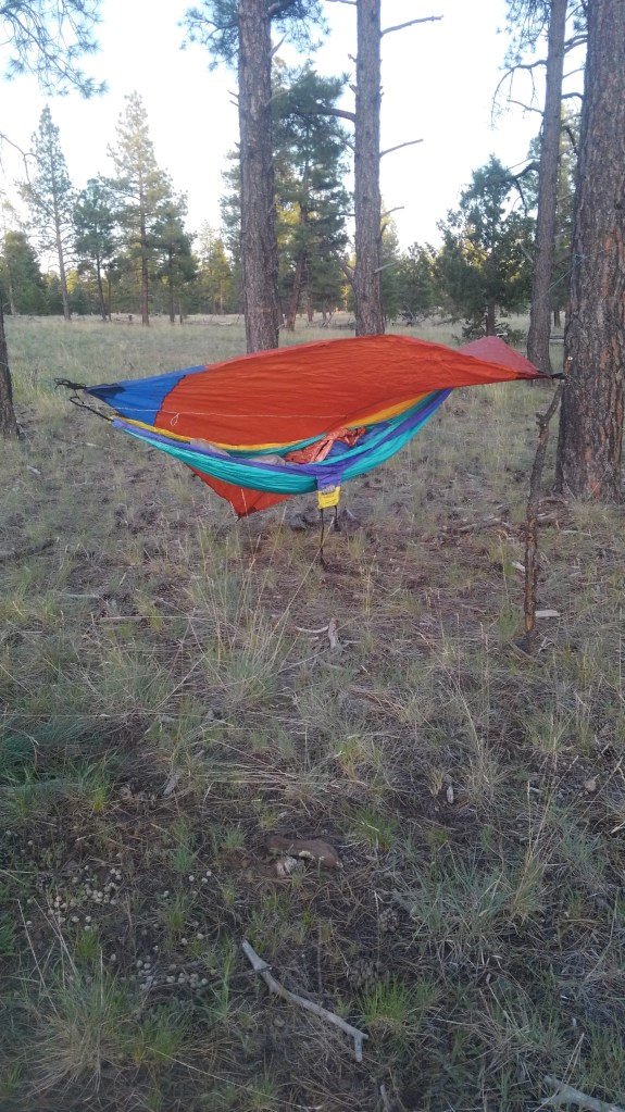
And when it’s just me…
To get real privacy, I had to bounce down some roads with long number designations until I was out of sight of the road that is actually on the map. This is undesignated camping, meaning you make your own campsite and provide your own services. If you need a toilet and a trashcan, you are better going to Whitehorse Lake Campground, which we will also get to.
I have camped on the northwest rim (off of FR 110) on the north center rim (off of FR56) and the northeast rim in the Coconino NF somewhere off of FR 231. The experience was all the same. Though, in full disclosure, I haven’t been on the northeast portion since I wrote the hiking guide.
All were about 6500’, hard-dirt prairie where I only had to wear pants if I wanted to. And bees – I had plenty of bees at all three sites.
Whitehorse Lake Campground
Credit – Kaibab NF
White Horse Lake campground is the big campground on the actual rim. It features a mix of tent and RV sites (94 total) about half of which are reservable. Most are at least within sight of the 35 acre lake. You can’t swim in the lake, but you can putter about in non-motorized boats (some rentable on site – in non Covid years) and do a bit of fishing. The lake is also popular with frogs.
The campground is a hosted fee area. (Fees vary – check the website). I visited the place on a Wednesday in August of 2020, and it was about ⅓ occupied. You would still want a reservation or an early arrival for a weekend spot.
Also nearby, of course, are the Sycamore Rim and Overland Trail hikes (also in my book). I had assumed I blogged about these on the old site, but it seems I did not. So that comes next time.