Los Lomitas Trail

Los Lomitas Trail in South Mountain Preserve is the connector trail between the middle of the developed picnic lands and the giant parking lot that separates the conference center from the group picnic grounds. It is the third and final leg of my South Mountain Infrastructure Loop.

For all that, this trail is worth doing on its own. Because this is part of the loop, we start in the middle of the park, and head towards the great lot where you likely left your car.

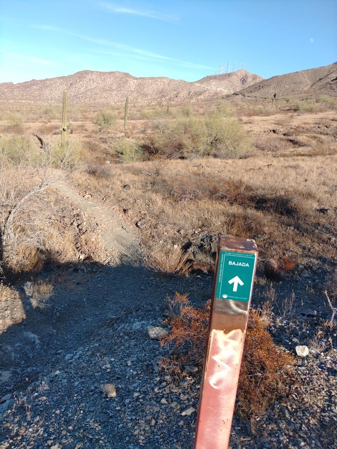
We start at the four-way junction: The Bajada Trail goes south, up the slope. The Ranger trail continues north, towards the Five Tables Trailhead. The Derby Trail, which is oft signed as part of Los Lomitas, goes west to eventually join the Max Delta Trail, but the part we want, the main portion of Los Lomitas, heads east, before bending north.

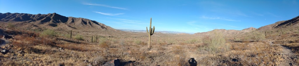
East now, from the junction, Los Lomitas goes over low hill and shallow wash a few times before crossing some flat desert. On the far side of that, you reach Los Lomitas Cabanas, which were fenced off when I was there, but the restroom was open. By open, I mean unlocked. The gate door is closed and latched, presumably to keep the critters out of the garbage. Latch it back up behind you.

The trail follows ridgeline NE to the Kiwanis TH (and another RR), then parallels the road a spell before dropping into a large wash near the ramada compound of the Piedras Grandes picnic grounds.

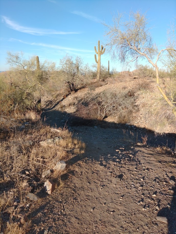
Here, you trudge through sand, as opposed to the packed dirt of the trail that came before. In mid-day, the high walls of this wash present your only hope for shade. Los Lomitas climbs out of this wash   to merge with Box Canyon Trail, a horse trench bending more north now.  Soon, Box Canyon/Los Lomitas parallels the Judith Tunell accessible trail as it gradually bends from north to northeast before reaching the parking lot.

Where exactly in the parking lot depends upon where they are in the endless construction. This flat expanse of asphalt hides few secrets, and rarely more than a dozen cars. You’ll be fine.

The Bajada Trail

This is the east section (about a third) of the trail, from its junction with the Los Lomitas Trail to the San Juan Bicycle Center and Sometime Parking Lot. Except I actually hiked it and describe it in the opposite direction.

This is part of my South Mountain Infrastructure Loop.

The San Juan bike lot marks about a third of this trail’s overall length. For the rest of this trail and its’ journey west see the main trail description.

Bajada Trail main

The Max Delta Trail  T’s with the Bajada trail near the San Juan Bike Center. To the right, Bajada proceeds roughly southwest to the Alta trailhead deeper in the park. To the left, the section I wanted went roughly northeast, toward my car.

Most of this portion of the trail follows the mountainside just below Dobbins Lookout Road, so this is not a wilderness experience at all. But oh my – lookit the city out there to the north. The trail picks it way across the slope for about three-quarters of a mile before turning north and downwards. Soon, it will merge with the Ranger Trail. By this point, has widened into a service road.

The building you are heading for is the Valley of the Sun Quarter Midget Association Race Track where they race small vehicles for reasons.

Immediately to the west of that facility, Bajada will end at a four-way junction. The Ranger Trail continues straight/down/south towards the Five tables trailhead. The Derby Loop continues left/west until its junction with the middle portion of the Max Delta Trail.

Los Lomitas Trail goes to the right/east towards the Big Parking Lot. That is the way if you are following the Infrastructure Loop.

Otherwise, you are just at the end of this trail.

The South Mountain Infrastructure Vista Loop

This is a half-day hike within the Phoenix South Mountain Preserve. This is a sub-hub for that overall hub page.

This half-day hike combines three established trails and a bit of mild bushwhacking  to make a circuit of the south-central portion of the park, where most of the development is located. As described, the circuit takes the Max Delta Trail south and west to its junction with the Bajada Trail. Taking the Bajada east we turn north to it terminus with the Ranger Trail, then shortly its junction with the  Los Lomitas Trail. We take the Los Lomitas east and then north again, where it merges with Box Canyon Trail, to dump into the parking lot, completing the circui

I parked in the expansive Environmental Center/Ranger Station /Event parking lot and then bushwhacked roughly north, across the big wash to Scorpion Gulch, then across the street to the Max Delta trailhead proper.  It is not hard. Many have done this before you, but it is not an official route.

Panoramic view from the Bajada Trail

All three of these hikes are moderate and easy to access. Moderate means you can do these in tennis shoes, but not sandals. They are not, as the name suggests, quality wilderness experiences. It is more of a walking tour of the municipal portion of the park.  You can take non-hiker-hikers on it, and see some desert, and never be more than an hour from rescue and two hours from some sort of toilet.

Max Delta across 2.2 miles, will take you along the entrance road, past the old park HQ, then south across a short stretch of open desert to the San Juan Bike Center.

Bajada Trail, at least this mile of it, heads east, following the mountainside below Telegraph Pass Road before turning south to connect with the Ranger trail, and then the junction with Los Lomitas.

Las Lomitas, over the roughly 2.5 miles, winds through the various ramada compounds before merging with Box Canyon trail and dumping out alongside the accessible trail to the parking lot.

That’s just under six miles total. I did it in four hours hike time, while taking notes and pictures.

Hike date: 23 November 2023