This is the toughest trail in the Phoenix South Mountain Preserve. It is also one of the more lightly used one, as, aside from the difficulty, none of its access points are from parking lots. Originally built by CCC and convict labor in the 1930’s , it is one of the oldest existing trails in the park. And one of the best – if you’re up for it.
You can do it as a loop with the Bajada or even the National trail, and that will take all day. If you do it as a car-shuttle, no one will judge you. Either way, it is worth doing – at least once.
This article is part of an ongoing series about hikes in the South Mountain Preserve.

We (my son joined me) parked one car at the Curtis Saddle “Trailhead”. We only call it a trailhead because it is so marked upon a map. At the eastern dead-end of Estrella Drive, just east of 43rd Ave, where it turns to dirt, you can find several places to park along the barbed wire fence lining the south side of the road. There are no services.
The elevation here is about 1140 feet.
A short connector trail (called Dead Man’s trail in some sources) charges up the rock slopes, bisecting the Ma Ha Tauk Perimeter Trail (aka the East Laveen Trail) before winding south through the actual Curtis Saddle and down to the San Juan Lookout.
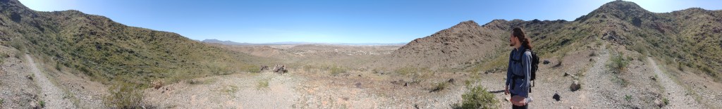
San Juan Lookout is one of several parking lots in the park where you are no longer allowed to realistically park. That’s another article. To our purpose it is a trail hub granting access to the National or Maricopa trail, which crosse the entire park east-west, the Bajada Trail which goes across the gentle slopes of the San Juan Valley to the east, and the Alta Trail, which also heads east – but straight up the slopes of the Ma Ha Tauk mountains.

It has always been my preference to go up the hard way – while your feet are fresh, and then down the easy way, which is why we describe this hike west to east. The western climb has some switch-backs, but it has just as many places where you are going to be obliged to use your hands or maybe your knees to get up the rock-surface portion of the trail.
There is one particularly daunting spot, where a straight climb up scree leads you to a trail marker, taunting you. This is a trap. Look behind you. The trail actually switches sharply back to climb the slope in a more rational manner.
This old trail winds up the oldest of the two ranges that form the park. This range and the western portion of the Gila range (due south) are composed of Precambrian gneiss pushing up granite 1.7 billion years ago. It has been slowly eroding ever since. You’re helping.

There are a couple false summits where you can pant and take pictures but the literal high point is also approximately the half-way point, around 2.5 miles, when you reach the ridge crest and can see both the north and south sides of the range. This is 2400 feet, depending upon which rock you sit on. That’s why you’re tired.
The highest point of the range, at just under 2500′ is called Maricopa peak – on some maps.


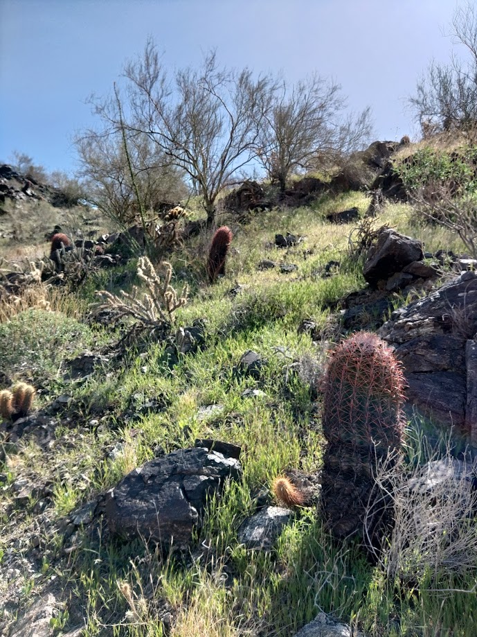
From here, the trail winds up and down the high slopes on the north side for a mile or so before cresting again. On the way, you can see the farming village of Laveen and the gated communities that increasing surround it. You can also absolutely win a game of desert cactus bingo along its slopes, passing stately saguaros, whispey ocotillos, stunted palo -verde trees, angry cholla and in the right season delicate wildflowers. If you’re lucky you’ll see some hawks. If you’re less lucky – jet planes.

The last mile and a half winds down the southeast slopes in lunatic switchbacks – a hallmark of CCC trail engineering. Towards the bottom, you might find where the original course was abandoned for a straighter line along the wash.


You will cross that wash, and the trail flattens as it approaches the San Juan Bicycle Center, where you can find the Bajada Trail and the Max Delta. The San Juan Bicycle Center is another not-really-open parking lot that we made fun of described in the Max Delta trail description. It has trashcans and places to sit, but no other services. There are other normally open parking lots just down the road.
We reached the Bicycle Center from Curtis Saddle in just over 4 hours – but I hike slow and take notes and pictures. My son could have easily shaved an hour off of that were he not waiting on me.

4 thoughts on “The Alta Trail”