Scorpion Gulch

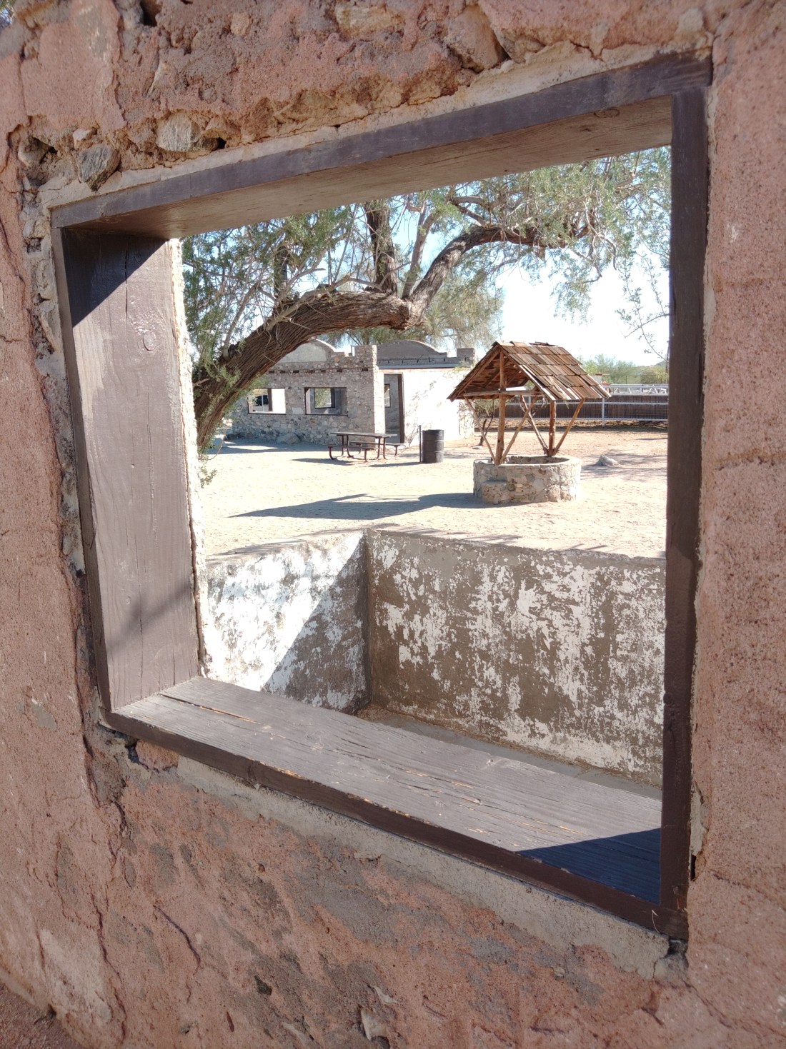
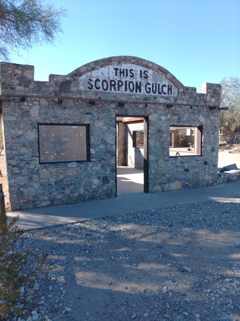
Near the main park entrance stand the stone remains of Scorpion Gulch. Visitors are free to wander in and around the two stone buildings and the dirt area between them. It is quite popular for photography, especially at sunset.

William Lundsford – Phoenix Gazette 1966

Scorpion Gulch was built as the home and the storefront of William Lundsford, who first came here with the CCC. Lundsford purchased 100 feet of frontage road in 1936 and built these structures with his own hands. For decades he ran a curio/gift/convenience store along with a cactus garden.  According to an oft-quoted 1966 Phoenix Gazette article, the local kids (presumably of what was then the small town of Laveen) called him “Grandpa”.

While Lundsford claimed to have the copyright on “Scorpion Gulch” named for the prefusion of scorpions that could be found in the wash beyond, most of the early photographs show a sign saying South Mountain Trading Post. They also show it with a roof.

After Lundsford passed, the building was briefly a bar in the 1970’s, abandoned, and then became annexed into the park. The city “stabilized it” in 2012, removing what was left of the crumbling roof and adding some strategic concrete reinforcements.

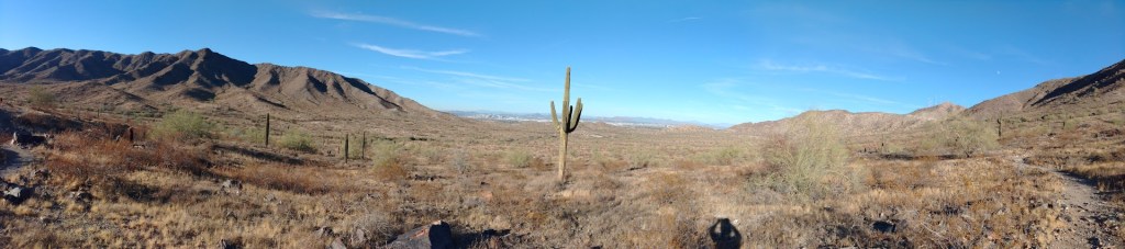
Across the road is the trailhead for the Max Delta Trail.

Scorpion Gulch circa 2009

This post is part of my ongoing Phoenix South Mountain series.

The South Mountain Infrastructure Vista Loop

This is a half-day hike within the Phoenix South Mountain Preserve. This is a sub-hub for that overall hub page.

This half-day hike combines three established trails and a bit of mild bushwhacking  to make a circuit of the south-central portion of the park, where most of the development is located. As described, the circuit takes the Max Delta Trail south and west to its junction with the Bajada Trail. Taking the Bajada east we turn north to it terminus with the Ranger Trail, then shortly its junction with the  Los Lomitas Trail. We take the Los Lomitas east and then north again, where it merges with Box Canyon Trail, to dump into the parking lot, completing the circui

I parked in the expansive Environmental Center/Ranger Station /Event parking lot and then bushwhacked roughly north, across the big wash to Scorpion Gulch, then across the street to the Max Delta trailhead proper.  It is not hard. Many have done this before you, but it is not an official route.

Panoramic view from the Bajada Trail

All three of these hikes are moderate and easy to access. Moderate means you can do these in tennis shoes, but not sandals. They are not, as the name suggests, quality wilderness experiences. It is more of a walking tour of the municipal portion of the park.  You can take non-hiker-hikers on it, and see some desert, and never be more than an hour from rescue and two hours from some sort of toilet.

Max Delta across 2.2 miles, will take you along the entrance road, past the old park HQ, then south across a short stretch of open desert to the San Juan Bike Center.

Bajada Trail, at least this mile of it, heads east, following the mountainside below Telegraph Pass Road before turning south to connect with the Ranger trail, and then the junction with Los Lomitas.

Las Lomitas, over the roughly 2.5 miles, winds through the various ramada compounds before merging with Box Canyon trail and dumping out alongside the accessible trail to the parking lot.

That’s just under six miles total. I did it in four hours hike time, while taking notes and pictures.

Hike date: 23 November 2023