Let’s just get it out on the table: part of my fascination with the Phoenix South Mountain Preserve is that I can see it from my office window. I really can’t see much else. We live right on the north slopes of what are technically the Salt River Mountains, though only geography nerds will call them that.

To everyone else in Phoenix, the row of peaks collectively is South Mountain and has been since the 1920’s when the park was first established.
At 16,000 acres, South Mountain was the largest municipal park in the nation. (It recently lost out to Scottsdale, of all places.) It has 50 miles of trails for hiking, biking and horse-back riding and public roads that go to three popular lookout spots near the summit.
We are going to get to as much of that as we can in this blog over the next few winters (only desperate fools brave these slopes in the summer. It is, in fact, illegal after a certain temperature.)
We will also get into history, geology, the desert and the things that live in and how they all want to kill you. Some very basic info on this page, and then links to the blog entries as they pile up.

South Mountain began its public life as a sale of land from the feds in 1924. Phoenix had realized that it was going to be a city, and that they didn’t want what was becoming their favorite picnic spot to turn into a mine pit surrounded by private ranchland. So, they purchased the original 14000 acres from the Wilson Administration. They have added around the edges since.
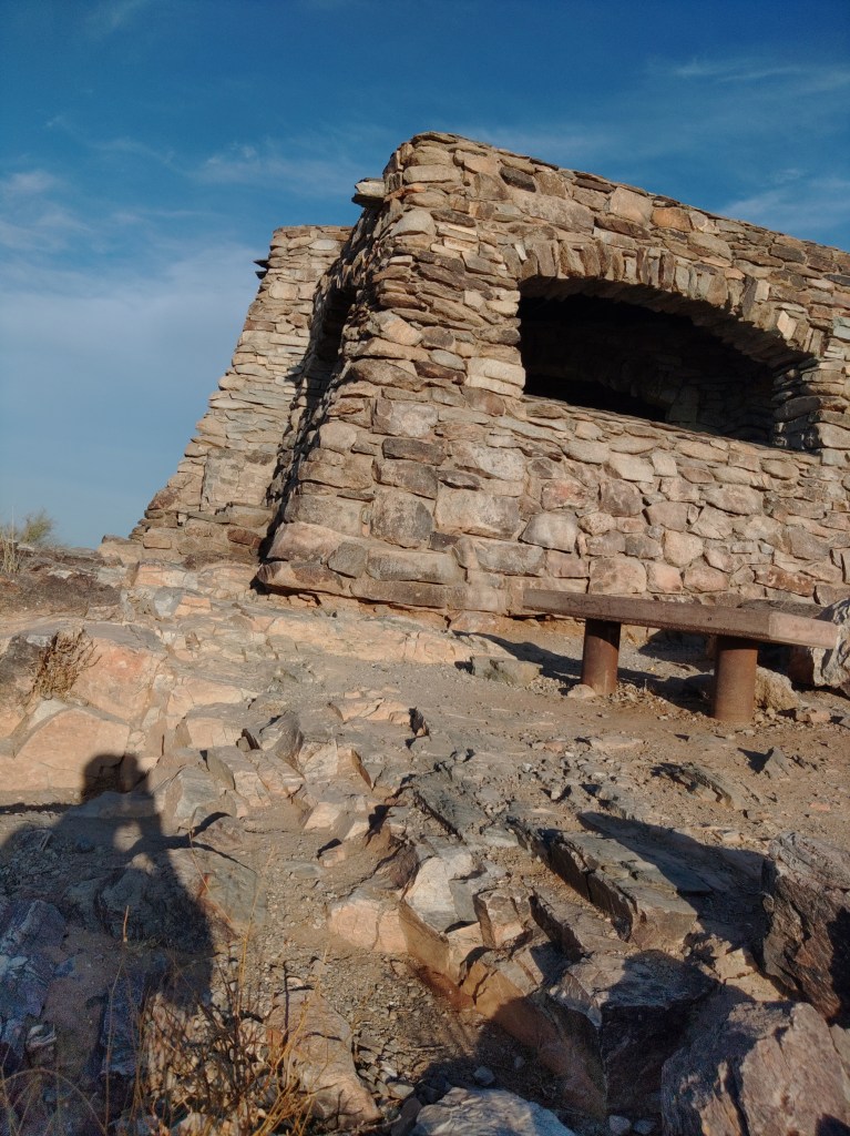
Most of the infrastructure you see in the park was built by the CCC or over work the CCC started in the late 30’s, early 40’s. The highlight of this is the old administration building near the main entrance to the park, in the middle of the north slopes of the mountain range.
South Mountain Park is the southern terminus of Central Avenue from Phoenix. Once inside the park, you drive past the ruins of Scorpion Gulch, past the new visitor center, and then past the old admin center, and then, if you follow the signs for Dobbins Lookout, nearly all the way up the mountain.
From that vantage, 90% of Phoenix, and 70% of the rest of the valley stretch out before you. This is where all those photos come from. This is where you take relations from out of town to see the city.
The road up to Dobbins, or up to anywhere in the park, is real mountain driving: winding, two lane roads that the locals tend to take faster than advised. I’ve never taken a group of people up there without at least one person getting spooked.
The stone building at the top was built by the CCC. If you stand in front of it and look down, you can see my house.

And I can see you.
The lower map is my copy of the city’s map with my info added on top. Any imbedded descriptions on the their trail layers are the city’s I only added links to my article.
Bajada Trail [east]
Dobbins Lookout
Kiwanis Trail
