
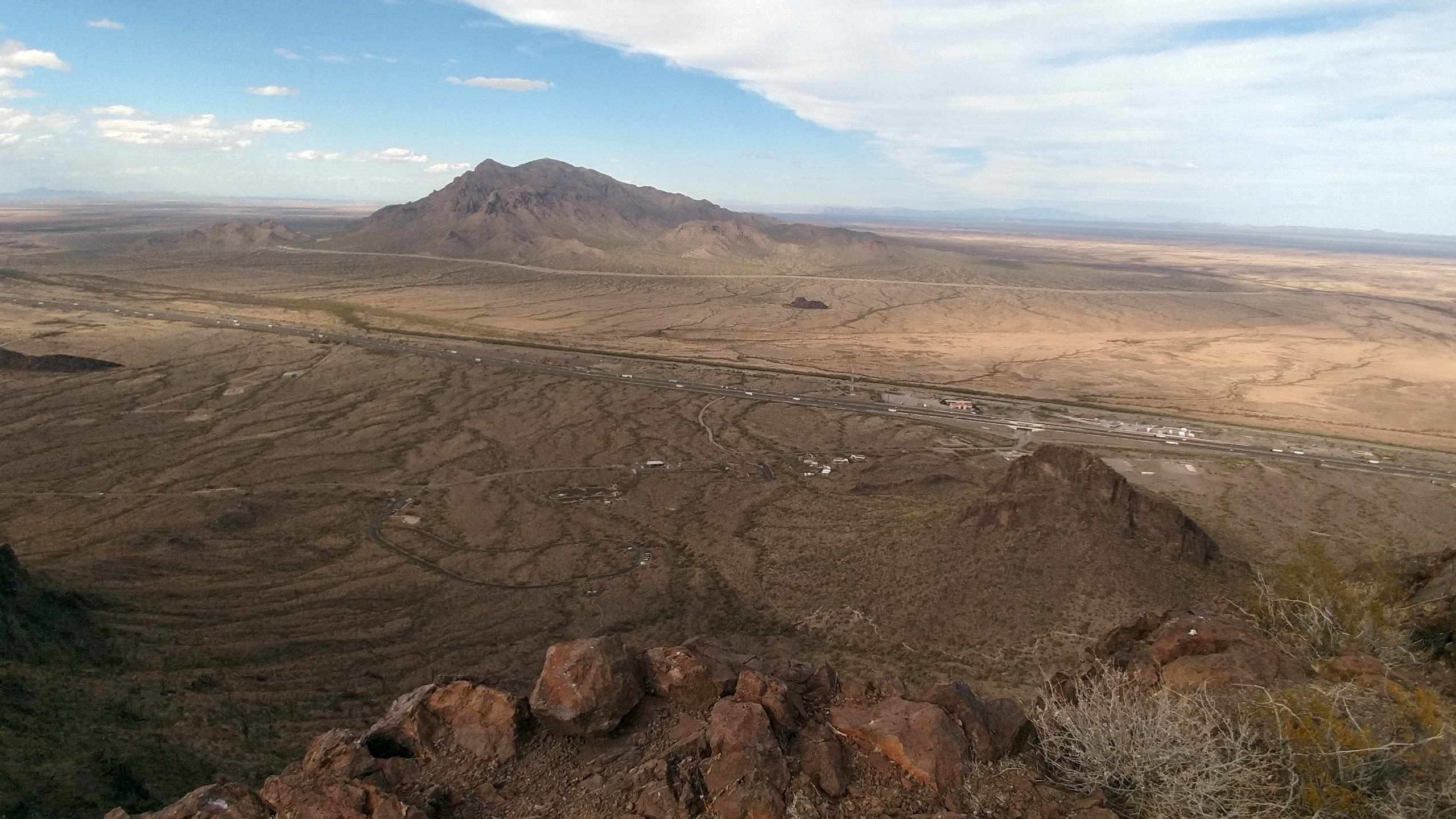
The saddle-shaped Picacho Peak marks a long used pass now underneath Interstate 10 between Phoenix and Tucson. It has been a state park since 1965, and you can climb it.
But you have to really, really want to.
The peak is a mere 1500 feet above highway grade, but the way is steep and only gets steeper. My route went up the north side, down the south, and then around the whole mountain to the west all on established trails. This can be done in a half-day, but it will use all of that half day. I started at 2pm on a March afternoon and reached my car just past sunset.

From the Barret Loop parking area, Hunter Trail charges straight up the north slope of the peaks at stairstep grade through the creosote and saguaro and ocotillo. After about a half mile, it evens out for a hundred yards or so, and then it gets even steeper, and stays that way all the way up.
The trail proved surprisingly crowded for a hike so notoriously difficult. The difficulty is balanced perhaps by the shortness of the hike, 2.2 miles one way, and that it is located right off the interstate.
On this slope, you’ll encounter your first bit of wire rope. The signs recommend gloves (and I wore them because I had them). The wire, however, is tightly spun and in good shape. You have more to worry about from heat than splinters. Up the north slope they are a convenience. Further up they become a necessity.
Despite its shape, the peak is not a dormant volcano. It is a remnant lava flow which has eroded unevenly over the past 22 million years or so.
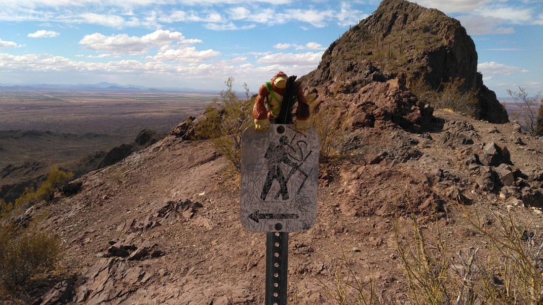
At just shy of a mile, and just shy of a 100’ elevation gain from the parking lot, Hunter reaches the saddle between the two main peaks. There is a sign and a bench. I made the saddle at 3:50. This is the turn-around for the moderate hike. Past here it is as much a climb as a hike.
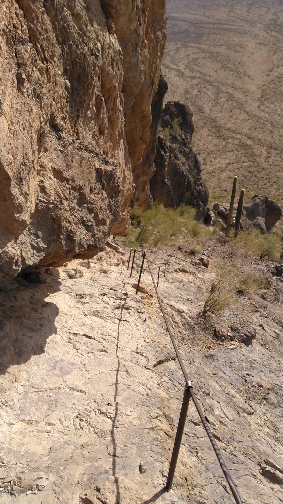
You’ll hug the bottom of the cliff as you wind east towards the summit approach. Past the intersection with Sunset (which we’ll get to) you will find two “ladders”: straight-up vertical climbs with wire rope on either side, and footholds slickened by thousands of boots before yours.

You are not actually near the summit until you cross the plank. You’ll see what I mean.
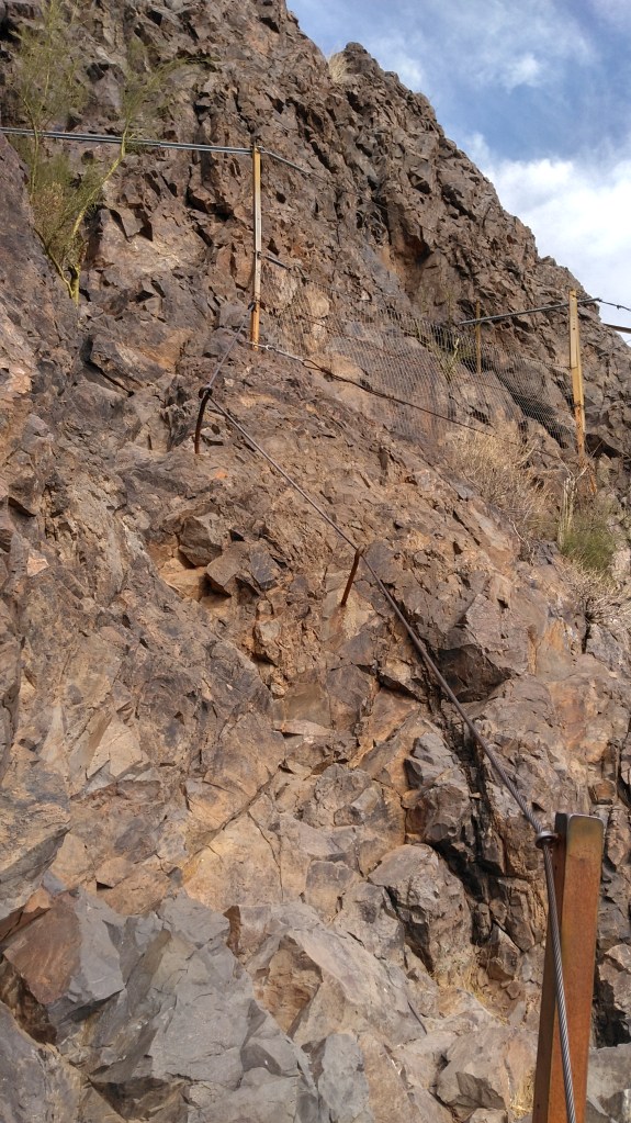
We can thank the Civilian Conservation Corp for the summit approach route. They used it to build and service a 40-foot light beacon that was installed at the top of the peak for air traffic control in 1932.
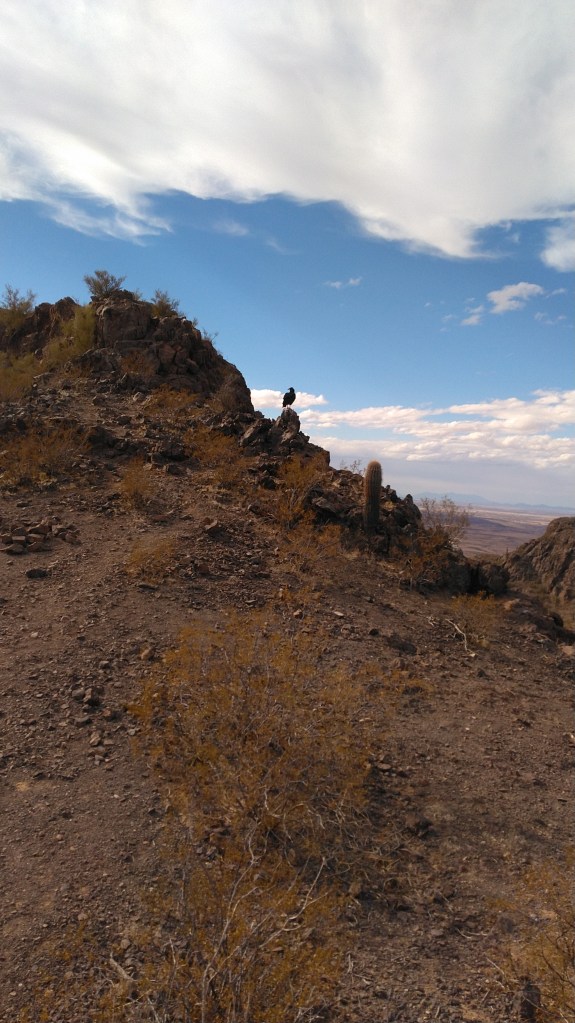
At the top saddle, I did not climb the taller east peak because of other hikers. This was the tail end of Covid times, and there is only the one path. But I crossed the ridge to towards the west peak. I did not climb that all the way either because the turkey vultures, who, judging from the slicks of white slime decorating the cliff, spend a lot of time there. The top saddle would have to do.


As I admired the vista in both directions, I also noted how low the sun had sank. So down we go.
Going up, the wire ropes were really more of a convenience. Coming down, which I often had to do facing the cliff, they were a necessity. I cannot say I would have attempted this without those ropes in place.
Imagine for a moment the guys who built these.

The hardest ladder of the journey was heading down Sunset Trail, which basically slows your tumble down the cliff. (Again, courtesy of the CCC). Once off the rocks, Sunset continues as a series of tight, rubble-filled, joyless switchbacks for another half mile.
Sunset levels out as it bends west to wander across the ridges and washes draining the southwest slopes of the peak. It goes through private property through much of this passage, so stay on the trail.
Learn from my mistake: a liter of frozen water will not melt fast enough in March to keep you hydrated. I coaxed enough liquid out of it to stay out of real trouble, but not enough to be comfortable.
Cholla displaces ocotillo and crowds the trail in places with their spiky pods of ouch. The sun was low enough by now that small palo-verde trees were shading my passage on the trail.
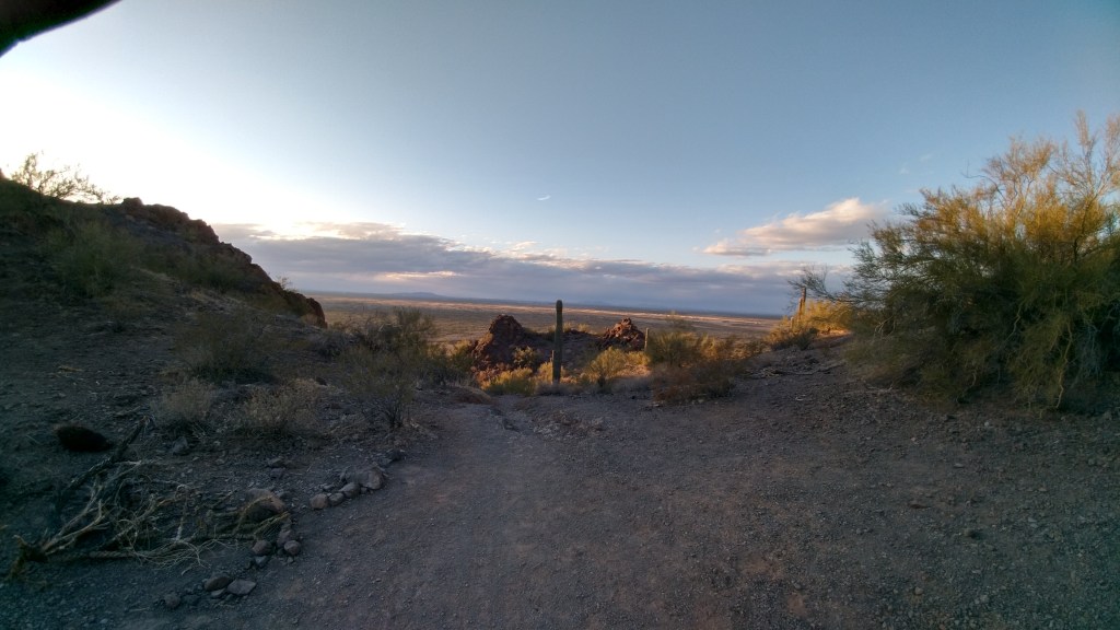
I reached Sunset trailhead at 6:20pm. I found a welcome restroom at nearby day-use. I then marched through the twilight along the road, past the campground and eventually the (now closed) visitor center and back to my car.
The park gates are open from 5am to 10pm. Trails are open sunrise to sunset. It cost me $7 to drive into the park in my car. The visitor center promises exhibits but is really just a gift shop.
