A few notes from the Overland Expo

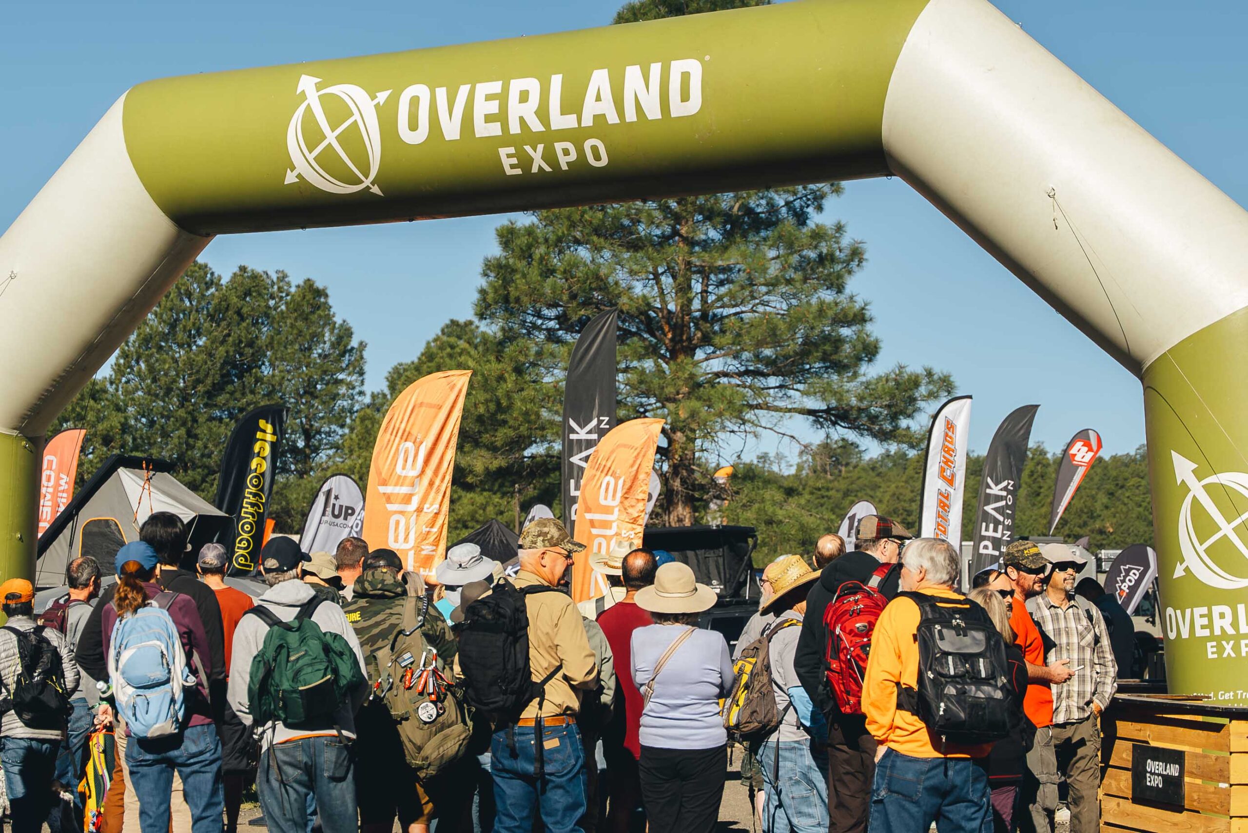
Full disclosure: I am not actually an Overlander guy and I doubt I would become one even if I had the money. It just doesn’t take that much to get off of the beaten path. However, many others see it differently, and the market that emerged from this worldview created the Overland Expo which was recently encamped in Flagstaff.

https://www.overlandexpo.com/photo-gallery/overland-expo-west-2025-friday-photos/

My wife and I went, and while we paid to shop, essentially, we had a discount through some means I do not recall.

Amateur but veteran tip: we parked at NAU and took the bus in, and this was little trouble. Especially compared to a previous year where we spent so long hiking in from our found parking space that we essentially missed the event.

This is not a detailed review of what is a giant outdoor mall for people who want to see the great outdoors from the window of their expensive vehicles. We found a few cool things, and I record them here for my reference, but I share also with you.

More or less smallest to largest:

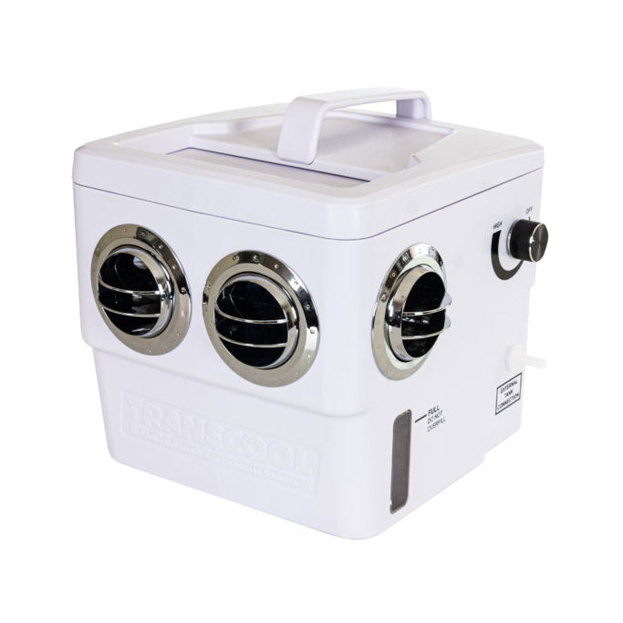
The Transcool portable evaporative cooler. A lunch-boxed sized evap cooler you can run from your car battery of other portable power. Or a wall outlet, I suppose. Couldn’t vouch for its performance in the humidity but the demo was blowing cold on a dry Flagstaff afternoon. https://transcoolusa.com/

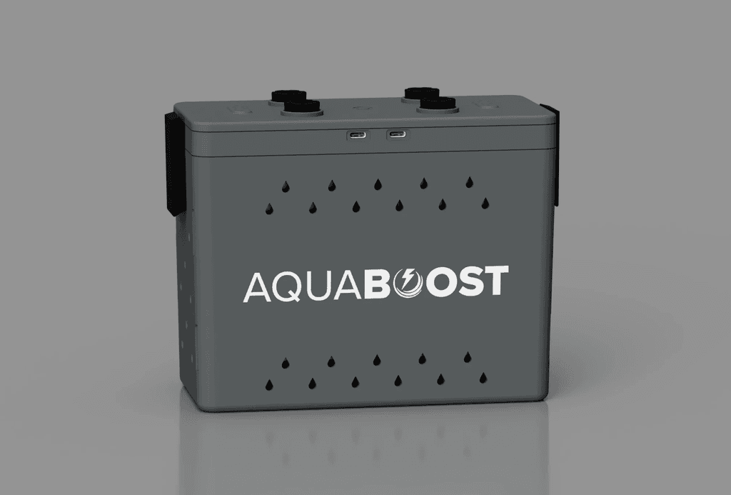
The Aquaboost power station turns salt water to electricity, perhaps to power your Transcool for up to 12 hours, per their literature.  https://www.aquaboostpower.com/

Your state parks and local tribes are trying to save history – and they gave me a sticker, so I give them a plug. https://savehistory.org/

This is tangential to a previous post.

Finally, if money were no object, this would be the trailer I tow:

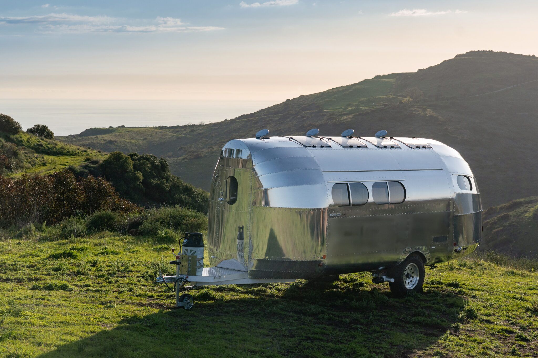
The Bowlus Rivet is an airplane fuselage disguised as a trailer. Our European host made us take off our shoes to walk inside the thing. Once inside we learned that while it has actually fewer amenities than trailers in its $150k price category ( you read that right) it is stupid lightweight for its size. That’s what you’re actually paying for. Sure the shower is clever, the other features are spare but well laid out, and thing outside is mirror-shiny, but what makes it worth it is the #2800 base weight. You can tow it with an SUV.

We would tow it with a cargo van – money being no object – for UnObtanium events. But we are not anywhere close to that kind of money.

Even so, it was fun to get out of the heat and daydream.

The Bajada Trail – main

A bajada is the mound of run-off sediment skirting the edge of the mountain. It is not quite Spanish for “Alluvial Fan”, but they are functionally the same thing.

The Bajada Trail winds up and across its namesake across the San Juan Valley in the Phoenix South Mountain preserve. Or, rather, the main western portion des this. The eastern third of the trail is basically a connector trail we have written about elsewhere.

The portion we write about here connects the San Juan Bicycle Center with the San Juan Lookout, running from its junction with the Max Delta Trail (at the lot) to its’ junction with the National Trail on the west end of the park. You then follow the National Trail northwest to the lookout.

This is often done as a loop hike with the Alta Trail. If so, regardless of direction, do Alta is the harder of the two, and I always recommend doing the hard part first. If you do it as a loop, take a lunch.

I did this as a car shuttle. My plan was to park at the bike lot, and then have a friend drive me to the Curtis Saddle Trailhead. However, we lucked into one of those Brigadoon-like morning when the vehicle road to San Juan Lookout was actually open to actual vehicles. So, he dropped me off there instead.

The route is National Trail of Bajada Trail to the bike center – a route that is about 4.3 miles one way. Most people can do it in a couple of hours.

National Trail heading out from the lookout is what you picture single-track trail through the low desert to look like: Packed dirt wide enough for one pedestrian, winding through the cactus. There are not a lot of landmarks. Sure, to the west, AZ 202 crosses in front of the casino, but the trail itself has few features. The junction with the Maw Ha Tuak Perimeter Trail. A stand of teddy-bear cholla. A stand of chain fruit cholla. A stand with both of them together. A geologic marker. You cross three small washes, then a big one, and then East San Juan Road. On the far (south) side of that you come to the junction with the western terminus of the Bajada Trail. 

The National Trail, also called the Maricopa Trail heads off further southwest until it turns east and charges up the main Gila Range to the top ridge. It will continue east across that ridge to the other end of the park.

I took the Bajada Trail, of course. It promptly crossed the grey-gravel expanse of the main San Juan wash, and then began a lesser climb up the mountain, turning east kinda-sorta along the top of the bajada.

When the road is closed, and you get some distance from the freeway, this is one of the quietest sections in the park.

The trail will go up the berm and down the wash and up the berm for most of its remaining length (either direction). It is in excellent shape, a little rocky in places, blue and black basalt with a little gypsum for color, but you can do this in tennis shoes.  The entire length is a shadeless march through stunted palo-verde trees, bone dry creosote and a scattering of cacti.

The terrain is not your problem. Like all hikes in this park, or this area, do not attempt this in summer unless you start marching in the predawn gloom. The entire hike I noted two places (both washes) with enough shade that a grown human could sit down within.

Below you (north) East San Juan Road follows the wash through the relatively quiet canyon. Towards the end, after one of the few sustained climbs, the trail with turn north and descend towards the road. Before you get there, as you start to enter the main wash, you will reach the junction with Alta Trail.

You are a half-mile from the trailhead. You can guzzle some water now.

Don’t cross the wash. Stay on Bajada as it turns east again, though and then out of the wash. Then across the desert floor a little farther to pavement.

If you look up the hill during this passage you will see mine trailings, and perhaps some social trails going up towards same. There is at least one open mine shaft still existing on those slopes, but you are on your own with that. When crawling about in mine-shafts, you are betting your life on the engineering acumen and diligence of whatever miner dug this 100+ years ago, and I cannot recommend that.

The bike lot has trashcans, but no other services. The San Juan Lookout has nothing but an old ramada and signage.

The Holbert Trail

When you have friends or relations in from out-of-town and they say that they want to hike up South Mountain – and you are satisfied that they understand what “hike” and “up” really mean in this context – you want Holbert Trail.

It is also worth doing on its own merits.

This hike is part of my Phoenix South Mountain Preserve Collection.

One of several park things named for Charles M Holbert, the first custodian of South Mountain Preserve from 1929 to 1939. It is said that there was no place in the preserve that he had not visited.

The official trailhead of Holbert is now in the giant parking lot near the Central Avenue entrance. Where exactly, in the giant lot depends on where they are in reconstructing the group picnic site.

The two and half miles of Holbert Trail can be roughly divided into four sections. The first section starts in the giant parking lot, wandering east across the north base of the mountains, skirting a couple of retention basins. You can find some petroglyphs in the early going. This is where you take out-of-towners who clearly do not grasp “hike” or “up” in this context, and you do not want to hear them whine. Meaning this portion is super-easy, and totally skippable.

The second part can be easily reached by the 7th Street or Mineral Road trailhead. This is no longer an official trailhead on city maps, but the dead-end of Mineral Road heading east from the southern terminus of 7th Street is very much used as a trailhead. Both the footpath on the west side and the access road on the east side will lead you to signed junctions with Holbert Trail.

This is also the entrance for Mystery Castle – should that attraction ever manage to open its gates again.

Past the second water tank, Holbert starts its second section, a sustained, winding climb up and across two ridges and then up a narrowing canyon lined with blackened basalt. Every time you can bring your gaze up from the constant rock-stairs on the trail you will see the desert slopes of the mountains spreading before you. Stop and turn around and you will witness the whole of the Phoenix metro stretching off into the horizon.

So, this hike is best done on a clear day. Otherwise, you will see the bowl of haze you hiked out of, realize that you actually live in that, and struggle with sadness.  But on a clear day, this is awesome.

Poor place to plan a felony…

As this popular trail winds up the canyon, the voices of other hikers in the distance will echo around the steep walls. This is a poor place to plan a felony with your friends.

Just past what would be a waterfall, for the seven hours a year this canyon has running water, you will encounter the junction with the Dobbins Lookout Access Trail. At this point you’ve climbed 500 feet up in just over a half mile – which is why you’re feeling it.

Most locals with out-of-towners in tow take the access road to Dobbins Lookout. Yeah – don’t tell them. Hearing your friends exclaim “We could have driven up here?” is a long and traditional source of great joy.

There are also vault toilets here – one of the few available outside of the developed picnic areas.

When I did this hike for photos, I cheated. I had a friend drop me off at Dobbins, then I went up Holbert, off to a side-quest, and then down.

Upper Holbert continues past the Dobbins junction, climbing the rest of the way out of the canyon before crossing Buena Vista Road. It keeps climbing over and then on top of the actual mountain. This portion is quieter, less crowded, slightly easier and more scenic than the portions that came before, and totally worth doing. In less than a half mile from Buena Vista Road, you will reach TV Road.  Across that road – which goes to the antenna farm on the summit and the Gila Valley Lookout – is the terminus of the Holbert Trail as it T’s with the Maricopa or National Tail. You are at the 2.5 or 3 mile mark, depending on whether you went up to Dobbins, and have climbed at least 1200 feet from the trailhead to stand at 2400 feet above sea level. 

The proximity of either Dobbins or Gila Valley lookouts make this a super-easy car shuttle. You could also take the National Trail west to the Kiwanis Trail and then Los Lomitas Trail to make a full loop of it. The loop would add a couple of hours.

The up and back described could be done in four hours, five if you dawdle. I mean – I suppose. I actually cheated.

Max Delta Trail

Max Delta is an entry level trail through the entrance of the preserve. It is named after the mine shaft that lies buried and officially off limits towards its southern terminus. That is another article. This is just about the trail.

This trail is part of the Infrastructure Vista Loop Hike.

From the trailhead at the entrance (across from Scorpion Gulch) the flat, wide trail winds west then south, narrowing as it climbs up the ridgeline it will follow for half its’ distance.  Your first landmark is a monument and plaque commemorating the city elders who re-designated the park into a Phoenix South Mountain Preserve.

If you’re new here, Phoenix was founded by developers who eventually become old and rich philanthropic preservationists determined to protect the precious desert from the new wave of developers. Somewhere in the 1970’s, 1973 – by the plaque, the old developers city elders started designating the “park” as a “preserve”.

Litigation followed. But here it is, still more -or-less preserved.

Heading south, the trail intersects with the interpretive trail behind the old visitor’s center. This is one of the last of the original CCC buildings that still sees actual use.  Looking out, you can easily see the new visitor center in the distance, and the work compound just across the street. The old administration building still has restrooms and water available to the public. The small ranger office and gift shop it once house have moved elsewhere.

The gunfire you hear from the far side of the ridge is not random. There is a gun range on the other side, both the private Phoenix Rod and Gun Club and the Phoenix Police training range.  These have been here since 1948, when these slopes were still a “park”. They expanded somewhat contentiously in the 1990s, closing the trailhead on the terminus of 7th Ave at Olney.

They are not supposed to shoot hikers, even accidentally, even hikers off the trail, but the party investigating will be the one most likely to have shot you, so stay on this side of the ridge.

Climbing down from the ridge you cross low hills with patches of barrel cacti, then saguaro then teddy-bear cholla. The trail goes down into a wash and Y’s on the far side. Max Delta proceeds south, to your right. To the left, the trail crossing the road is the Derby Trail aka Los Lomitas. You can take that turn and shave a good 40% off the loop hike. But for now, we follow the Max Delta.

The dirt turns grey as the trail crosses the arroyo, finally a bit away from the road.  You will cross another road, along with numerous washes, but it gives brief illusions of crossing open desert. Look for mine pits along the way.

The gates were closed at the San Juan Bike Hub, as this was not the first weekend of the month. It’s not closed to people, but certainly closed to vehicles. Even on the special weekend, it just affords closer parking to those who want to hike or bike down San Juan Road – which is another article.  There are some amphitheater seats which were not shaded in the afternoon by the large metal canopy, a trash receptacle, and a good number of empty parking spaces for both bikes and cars. I was the only person there when I arrived, and took a break there, surrounded by this rust-colored monument to municipal expenditure.

Then I proceeded east down the Bajada Trail to continue on with the loop.