
If you wonder where you are in hike conditioning, the Ford Canyon loop we are about to describe will answer that question. Also, it will take you away from the city without forcing you to take an actual road trip.
I learned that I have, comfortably, an eight mile hiking range through mountainous terrain. The route I took covered ten miles. So, even though I limped to the car, I have no regrets.
To reach White Tank Mountain Regional Park, take Olive Road (Dunlap in Phoenix) west until it basically dead-ends at the park’s guard shack. How you get to Olive Road is on you. One note: you would think that there would be an exit for Olive on Loop 303, but there is not.
Most of my information on this trail loop comes from my hike on 5 March 2021
White Tank Mountain Regional park is a Maricopa County park covering nearly 30,000 acres centered on the northern portion of the White Tank Mountains. This range rises from the 1100’ valley floor to 4000 foot peaks and separates the Salt River basin where Phoenix is centered from the Hassayampa plain to the north and west.
The park is open from 6am to 8pm, and entry at the gate is $7 per car.
Ford Canyon trail start to finish is 7.4 miles one way, but I skipped the first mile from the terminus (which is a dirt sidewalk through low desert scrub) to jump on at the sub-trailhead at Spot #9 on Ford Canyon Road. I then left the trail at its junction with Willow Canyon to head back down. That route, along with the lower portions of Mesquite Canyon Trail and towards the end Waddell Trail form the loop that led me back to my car.
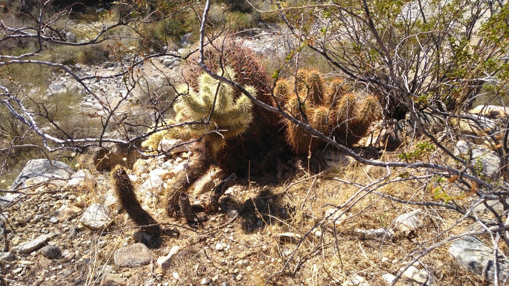
I parked my car at spot #9. Like nost of the numbered spots in the park, this features a restroom and a scattering of concrete picnic tables. From the signed trailhead, the wide, packed-dirt trail quickly goes in and out of deep wash.
The lower portion of Ford Canyon Trail is a sidewalk of packed dirt across the arroyo. Besides the dirt track, signage looms plentiful and obvious. If you get lost through here, you should reconsider your form of recreation.
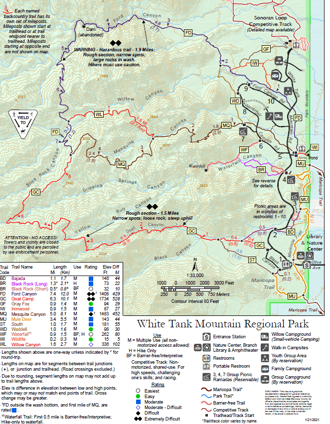
Memorial benches adorn every trail intersection. On my hike day, a proliferation of signage for some trail running event to be held the next day decorated the sides of the path. Teddy-bear cholla stands out as one of many spiny assailants awaiting anyone who would stray off the path as it winds over a low saddle and northwest towards Ford Canyon proper.
Just shy of 2 miles in (all distances are mine – from Spot 9) the warning sign announces that the trail from here – which narrows to a footpath immediately beyond the sign – becomes hazardous.
The sign does not lie. This section is on of the hardest trails in the metro area. Only Camelback Mountain and Goat Camp trail (in this very park) rival it – at least for these next three miles. You will end up using your hands more than once.

The White Tanks are known habitats for javelina and deer as well as the usual low-desert critters, but the largest vertebrate I encountered on the hike were fat and brazen squirrels.
Much of the exposed granite through here has been whitewashed by the occasional tumult of rain run-off. In early March, some pools of standing water remained. These are, in fact, some of the white tanks that give the region its name.
Towards the top, even the goat trail disappears, and you will end up hunting ribbons along the wash. The route does indeed generally follow the wash. You are a ways from any path across the shoulders.

Lower, you might have seen signs explaining how leaving the trail will increase the erosion. It is true that much of the Sonoran Desert is held together by a layer of microbes imbedded in the soil, and our boot-stomps harm it. Do not worry about that here. This is a wash. There is nothing but granite and sand. Whatever trail ran through here before was washed away by the last rain. Whatever path your footsteps help create will be washed away by the next rain. Choose your steps according to safe, forward progress, and finding the next ribbon. Worry about nothing else.

Somewhere in here, I got my foot stuck in crevace between rocks. I got it out, but not with much grace. It buggered my boots a bit, but I thought little else of it at the time.
That left boot sock had absorbed a good bit of blood by the time I got back to the car.
The old dam is about midway through the wash passage at 3.3 miles and an elevation of 2250’.

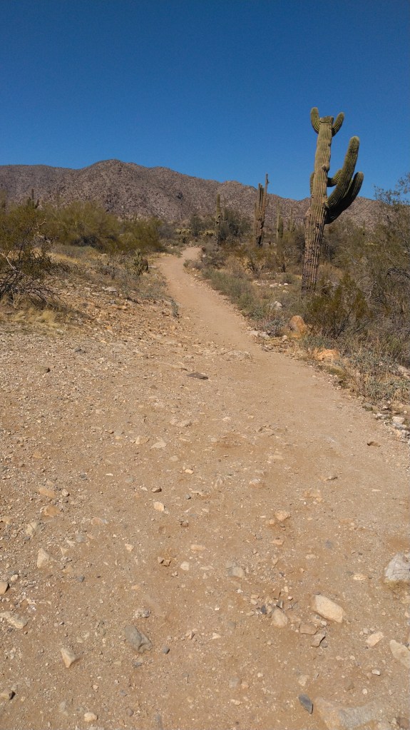
At my 4.15 mile mark, a foot path finally appeared, climbing out of the wash. You are through the worst of it, but not yet halfway. The single-track continues through the shadeless slopes as wide switchbacks up the canyon wall, across a saddle and into the next canyon.
You cannot hear the city this far up in the White Tanks. You can, if you are still for a moment, hear the buzzing of insects, the scurry of lizards and the chirping of birds.
You can also hear on occasion the roar of F-18’s flying in and out of their nest at Luke AFB.

The saddle with the 6 mile trail sign marked about 5 miles into my hike, and the half-way point of the route. This saddle stands at 2813’ and was the highest point I recorded on the route. A half mile beyond, the Ford Trail meets the Willow Canyon trail.
Ford Canyon trail goes on another three-quarters of a mile until it Y’s out into the Goat Camp or Mesquite Canyon Trails. I took Willow Canyon instead for it was shorter, easier and more scenic.
A quarter mile past the intersection, Willow Canyon crosses the wash near an old cattle-tank sight. Past this it climbs slightly but steadily even as the canyon floor sinks steadily below you. The footpath winds across the steep slope, revealing intermittent vistas of the west valley.
At 7.2 miles, Willow Canyon T’s into Mesquite Canyon, near the bottom of Mesquite Canyon.
Here the path widens a bit as it switches back down the canyon. Go left (east) to climb out of this canyon, across a ridge, to switch back down a different, unnamed canyon to the south. As you approach the bottom of the switch-backs benches appear – signaling your approach to relative civilization.
Here is also where my feet, particularly my left foot transitioned from fatigue to pain. Constant downhill always brings out the worst in foot problems. So forgive my dearth of superlative language through here. I was just trying to keep going.
By the intersection with the Waddell train, the path has become a packed-dirt sidewalk once more. Take the left (north) up the Waddell Trail.
Waddell Trail which will eventually merge back with Ford Canyon. However, a mile before you get to that point, a short spur will take you to pavement a few hundred yards from Spot #9.
Full Hike = 9.88 miles. It took me 5.5 hours, but I took notes and photos, and covered the last two miles at a -er- measured pace.
I’d still do it again.

One thought on “Ford Canyon is a good test without becoming a major expedition.”