
West Pinto Trail #212 in the Superstition Wilderness is an easy (by Supes standards) hike into transition/riparian habitat without requiring expeditionary resources. It takes a bit to get to the trailhead, but that trip is actually (and literally) half the fun.
I included this trail in my book Day and Overnight Hikes in the Tonto National Forest, but that was over 10 years ago.
The eastern portion of the Superstition is the higher and more remote half. What it lacks in developed trailheads, crowds, cholla and mythology it makes up for with peace and occasional shade. I hiked this on an April Saturday, and passed some folks on the road, but met no-one on the trail.
To start with, US 60 east of Superior is one of the best drives you can take on pavement. Past Top-o-The-World (this is a town) a bridge crosses the deep canyon formed by our destination. On the far side of that bridge to left turn lane leads to FR287. The pavement here soon turns to graded dirt as it wanders through active mining country en-route to the wilderness.

The mines move big piles of rock around all the time, and then re-direct FR287 around those. This leaves maps and directions useless. Google regularly suggested I turn left, which would have been over an embankment and into a steep ravine. The mines have marked any road you are no supposed to take. Go slow, follow the signs, you’ll make it with or without maps or directions or a patient voce in your dashboard suggesting trying to get you killed.
A Y intersection at about 7 miles in marks the transition from mine country to actual Tonto National Forest. Go right, across the narrow bridge to FR287A. A sign will warn about single lane with pull-outs. Yep. Go that way.

The road benefits from a higher clearance vehicle, but you will never use 4WD even as it winds around the canyon walls. Most of the way the road will be the same color as the cliff on one side, and the ravine to the other: red, grey, greenish grey, white. You will pass the transition zone between high desert and low scrub, with saguaros growing right next to juniper trees. The switchbacks mean you are close. That flat spot at the bottom of the canyon ahead is the remains of Miles Ranch. This is where 287A effectively dead-ends.
There are two effective trailheads at Miles Tarilhead, located among the remains of the old Kennedy Ranch. The official one is poorly marked. Look for the Superstition Wilderness wood-cut sign across the road from the Miles Trailhead sign. The actual trail is just beyond, climbing the hills westward into the scrub oak. This wanders up and down the side of the hill until the junction with Bull Basin Trail.
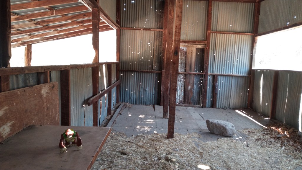
Or you can pass by the shed (empty save for vermin dropping and a scattering of hay). Nothing will stop you from seeing that for yourself. Eventually some jack-ass will burn this to the ground because their special-ass needed a fire under the roof, but right now, there it still sits. A remnant road continues westward on the far side of the gate, providing a shadeless march through the desiccated remains of the pasture. It joins the main trail within sight of the Bull Basin junction.
The main trail is longer and has more up and down, but it also has shade.

West Pinto continues as a single-track up the canyon of its namesake. It is moderate. There were only a few places where I had to pay attention to the trail, rather than write articles in my head, and none of these lasted more than 15 yards.

Here my Tonto description remains accurate, except in 2021 there is less water. Other than isolated pools, I did not encounter water above my ankles. I was a mile in before I encountered any water at all. All the rain run-off from this spring has already sunk into the thirsty sands.
While my old warning about water level may have expired., these days you would actually worry more about fire than flooding, the poison ivy persists, so it is wise to watch your step.
In a couple of places the trail climbs abruptly up the ridge, presumably to avoid obstructions in the stream bank. I took these going in, but ignored them coming out, content to splash in and out of the stream with no undue hardships. This might not be the case if the creek ever has high water flow.
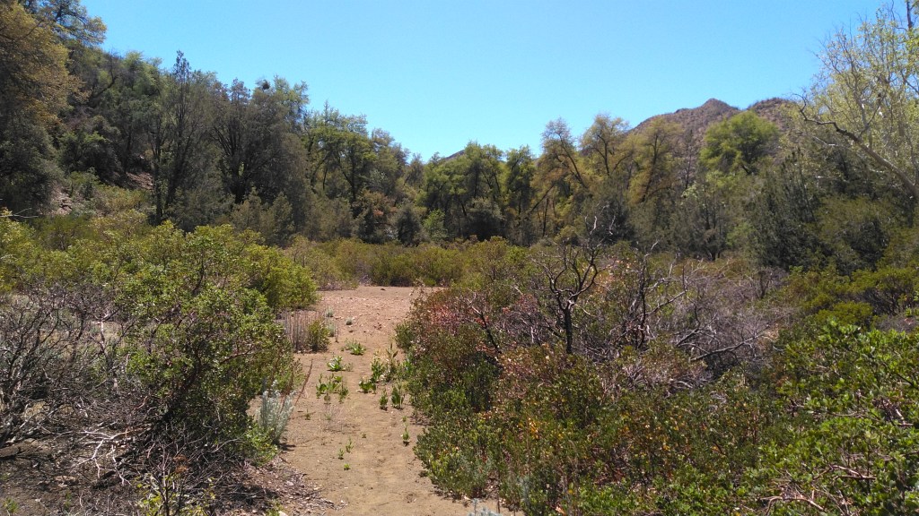
At about two miles, a series of trail junctions (Cuff Button going north, then Spencer Spring going south) announce the proximity of Oak Flat, a sandy clearing filled with manzanita and surrounded by oaks. Mike book presented this as a destination, but it is really just a landmark. You can see how users of the campsite area would have to share with the large colony of red ants right near the fire pit. Across the clearing, West Pinto crosses the (dry) creek near its confluence with the (dry) Spencer Springs Creek and continues up that canyon.
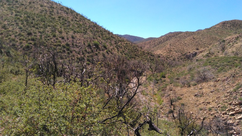
I followed for a few miles up the steep canyon side, crossing a couple of saddles until I became hungry, and realized I did not want to fight the wind to eat lunch on the shade less slopes. West Pinto continues to climb as it approaches Iron Mountain and points beyond, hitting the Reavis Trail about 9 miles from the Miles TH, but those were far beyond the distance I was prepared to hike that day. So I retreated back to Oak Flat, ate my lunch , and returned to my car.
My total hike was 6.3 miles, which I did at a leisurely pace in just under 4 hours. My highest elevation gain was 3900 feet (the high saddle past Oak Flat) about 1100’ above the trailhead.

One thought on “West Pinto Creek – a journey without a particular destination.”