Tres Rios Wetlands Environmental Restoration Project is the outflow from the city of Phoenix water treatment facility that they have made into a public park. No – the water’s fine. It’s already treated before you can get anywhere near it. They won’t let you swim in it, but they will let you walk around (with a free permit) and fish (with a paid permit).

One path through here is a segment of both the Sun Circle Trail, a bike route that runs around most of the cities in the metro area and the Maricopa trail, which circumnavigates the entire metro area. [They have an interactive map!} Also, it is a local hike, and the day (30 Jan 2022) was great for local hiking.
My route would start at Tres Rios, then follow the trail past it, westwards along the Salt Riverbed to its confluence with the Gila river, near the Base and Meridian Wildlife Area. I would return the way I came.
Tres Rios has a gravel parking area, a single plastic outhouse, interpretive signage and large trashcans. There are no other services. The large trashcans represent a futile attempt to keep fisherfolk from leaving their fishing garbage all over their fishing place.
The city says this of the project:
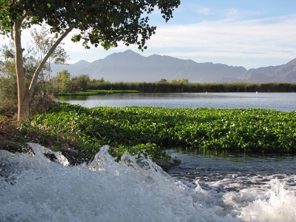
The lush and scenic Tres Rios is now home to more than 150 different species of birds and animals like muskrats, raccoons, skunks, coyotes, bobcats, and beavers. The beautiful cottonwood groves, willows, mesquites, and other desert shrubs around the reed-lined ponds and along the trail attract many migratory and wintering songbirds. By bringing the Salt River back to the condition it was in during the early 1800s, this project is repairing a natural habitat.
The reclaimed water from the wastewater treatment plant is pumped over to the wetlands, and the plants and animals take what they need before it is discharged back into the river.


From the parking lot, three trails (wide graded dirt roads really) proceed westward in parallel. The center one, with the signs, if the official course of the Maricopa Trail. It also seemed the most crowded in the late morning, but also had the better of what scenery there was. To the north are the lagoons, and to the left, after the first half mile, is the mesquite bosque. The trail also passes the “waterfall” where the lagoons discharge into the Salt Riverbed.
The north track has those same lagoons to its south, and open farm fields to its north.
The south track had brush to the north and the normally dry portion of the Salt River to the south. It also features zero shade.
I had dutifully applied for my permit, and had it ready to show on my phone, but there was no evidence that anyone enforces that. All the numerous “No Trespassing” signs about the place – that means people without permits. Or visiting after dark- park hours are dusk/dawn.
Several concrete causeways separate the various lagoons, and these can be crossed on foot. I’m not sure if you are supposed to, but fisherfolk clearly do this all the time. But beware, At least two spillways on each causeway guarantee a water hazard.
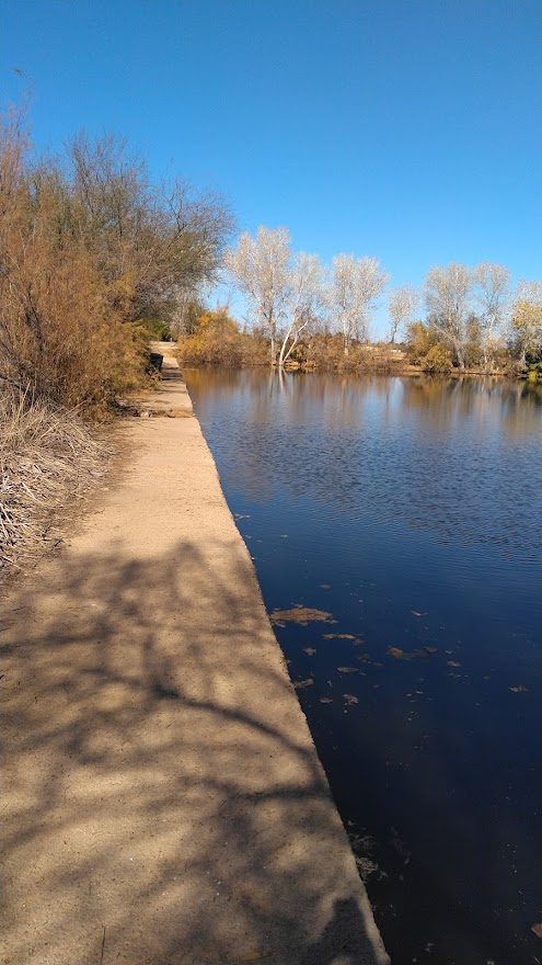
Past the lagoons, the north and center roads converge, ending in a turn-around marked by giant concrete pipes. To the north of these pipes, the Maricopa trail continues, intermittently following the remnant rod, or making its way as a dedicated footpath.
I dutifully followed the marked trail on my way in as it hugged the great wall of caged rock that marks the northern edge of the Salt’s flood-zone. I followed a series of dirt roads on my way back and found that I did not miss the trail at all.

The trail closes in on the riverbank just as you reach the boundaries of Base and Meridian Wildlife Area. B&M is primarily a fishing spot. It shares parking with the Phoenix International Raceway. From that parking lot, a bridge crosses a wash to land onto a paved road bisecting the riverbed. From this road all manner of dirt roads and trails fan out to various fishing spots.
Due south of the parking lot is monument hill, where the geo-marker forming the basis for the state’s survey lines is located. Alas, it is also possible to glimpse into the raceway from that height, so the hill is now fenced off. It’s not much of a fence, but you would be on your own with that. I tossed the garbage I had collected on the trail into the trashcans provided at the trailhead and turned back.
I found the actual confluence, where the Gila, maybe ten feet across at that point, burbles into the Salt, fattened to hundreds of yards across by the Tres Rios discharge.

One of the dirt roads bisects an island in the middle of what would not be the Gila River, and I was able to sit quietly on the bank and listen to one fisherfolks Tejano music battle with another’s rap music battle with oldie-rock being covered by whatever band was playing whatever even went on at the raceway.

Remember that you are, at either trailhead, walking distance from a convenience store. This will not be a wilderness experience.
Even so, I did find some measure of peace and quiet. On my return, following the dirt roads closer to the river, I encountered nobody for the better part of a mile, and was able to even sit by the river in peaceful reflection, doctoring a blister. That moment alone kinda made the trip worth it.
I did not bother to GPS this, but ten miles round trip feels right. You could probably do it in eight miles if you did not wander. I was on the trail about five hours.

One thought on “The water works of Tres Rios”